Floure
show This article may be expanded with text translated from the corresponding article in French. (December 2008) Click [show] for important translation instructions. |
Floure | |
|---|---|
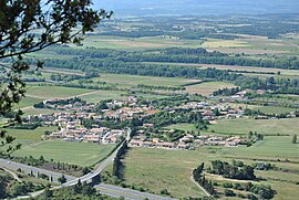 A general view of Floure | |
 Coat of arms | |
show Location of Floure | |
 Floure | |
| Coordinates: 43°11′02″N 2°29′27″E / 43.1839°N 2.4908°ECoordinates: 43°11′02″N 2°29′27″E / 43.1839°N 2.4908°E | |
| Country | France |
| Region | Occitanie |
| Department | Aude |
| Arrondissement | Carcassonne |
| Canton | La Montagne d'Alaric |
| Intercommunality | Carcassonne Agglo |
| Government | |
| • Mayor (2008–2014) | Philippe Phalip |
| Area 1 | 4.25 km2 (1.64 sq mi) |
| Population (Jan. 2018)[1] | 407 |
| • Density | 96/km2 (250/sq mi) |
| Time zone | UTC+01:00 (CET) |
| • Summer (DST) | UTC+02:00 (CEST) |
| INSEE/Postal code | 11146 /11800 |
| Elevation | 69–384 m (226–1,260 ft) (avg. 77 m or 253 ft) |
| 1 French Land Register data, which excludes lakes, ponds, glaciers > 1 km2 (0.386 sq mi or 247 acres) and river estuaries. | |


Floure is a commune in the Aude department in southern France. The journalist and writer Gaston Bonheur (1913–1980) is buried in Floure where he owned the castle.
Population[]
| Year | Pop. | ±% |
|---|---|---|
| 1962 | 98 | — |
| 1968 | 138 | +40.8% |
| 1975 | 137 | −0.7% |
| 1982 | 260 | +89.8% |
| 1990 | 255 | −1.9% |
| 1999 | 318 | +24.7% |
| 2008 | 361 | +13.5% |
See also[]
- Corbières AOC
- Communes of the Aude department
References[]
- ^ "Populations légales 2018". INSEE. 28 December 2020.
| Wikimedia Commons has media related to Floure. |
| show Communes of the Aude department |
|---|
This Aude geographical article is a stub. You can help Wikipedia by . |
Categories:
- Communes of Aude
- Aude geography stubs