Fongen
| Fongen (Norwegian) Lopmesvaerie (Southern Sami) | |
|---|---|
 Fongen seen from north-west in the sunset in winter. | |
| Highest point | |
| Elevation | 1,441 m (4,728 ft) |
| Prominence | 651 m (2,136 ft)[1] |
| Isolation | 31 to 31.2 km (19.3 to 19.4 mi) |
| Coordinates | 63°10′51″N 11°37′50″E / 63.1808°N 11.6306°ECoordinates: 63°10′51″N 11°37′50″E / 63.1808°N 11.6306°E[2] |
| Geography | |
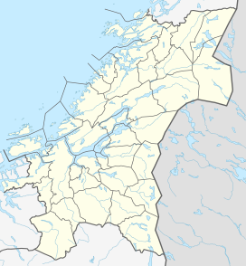 Fongen Location of the mountain | |
| Location | Trøndelag, Norway |
| Topo map | 1721 III Tydal |


Fongen (Norwegian) or Lopmesvaerie (Southern Sami) is a mountain in Trøndelag county, Norway. The mountain sits along the border of the municipalities of Selbu, Tydal, and Meråker. The 1,441-metre (4,728 ft) summit is located inside the Skarvan and Roltdalen National Park. The nearest villages are Mebonden in Selbu, about 25 kilometres (16 mi) to the southwest, Ås in Tydal, about 32 kilometres (20 mi) to the southeast, and the village of Midtbygda in Meråker. The closest Norwegian Trekking Association cabin is , several kilometers to the east of the summit.[3]
Name[]
The name is probably the finite form of fong which means "pole" (used in roundpole fence). It is common in Norway to compare the form of high and steep mountains with staffs, sticks, and poles.
References[]
- ^ "Fongen 1441 moh - fakta". Toppomania. Retrieved 2011-03-01.
- ^ "Fongen, Selbu (Trøndelag)" (in Norwegian). yr.no. Retrieved 2017-03-23.
- ^ Rosvold, Knut A., ed. (2011-12-16). "Fongen". Store norske leksikon (in Norwegian). Kunnskapsforlaget. Retrieved 2018-03-10.
This Trøndelag location article is a stub. You can help Wikipedia by . |
- Mountains of Trøndelag
- Meråker
- Tydal
- Selbu
- Trøndelag geography stubs