Forshaga Municipality
Forshaga Municipality
Forshaga kommun | |
|---|---|
 Slottet villa (1880s) | |
 Coat of arms | |
 | |
| Coordinates: 59°32′N 13°28′E / 59.533°N 13.467°ECoordinates: 59°32′N 13°28′E / 59.533°N 13.467°E | |
| Country | Sweden |
| County | Värmland County |
| Seat | Forshaga |
| Area | |
| • Total | 397.29 km2 (153.39 sq mi) |
| • Land | 348.18 km2 (134.43 sq mi) |
| • Water | 49.11 km2 (18.96 sq mi) |
| Area as of 1 January 2014. | |
| Population (31 December 2019)[2] | |
| • Total | 11,499 |
| • Density | 29/km2 (75/sq mi) |
| Time zone | UTC+1 (CET) |
| • Summer (DST) | UTC+2 (CEST) |
| ISO 3166 code | SE |
| Province | Värmland |
| Municipal code | 1763 |
| Website | www.forshaga.se |

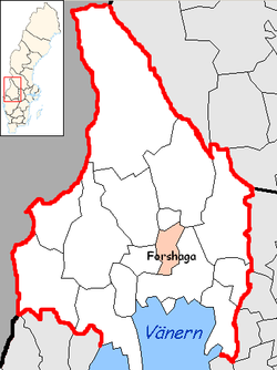
Forshaga Municipality (Forshaga kommun) is a municipality in Värmland County in west central Sweden. Its seat is located in the town of Forshaga.
The first municipality named Forshaga was a market town (köping) which was detached from Grava in 1944. The local government reform of the 1970s made Forshaga a unitary municipality in 1971 and in 1974 Ullerud was added to it.
Forshaga was known in the 14th century as a location for salmon fishing in the river Klarälven. Salmon was used both locally and transported to monasteries in southern Sweden. Forshaga is still known for its rich fishing waters, which attract hobby sport fishers from all over the country.
Localities[]
References[]
- ^ "Statistiska centralbyrån, Kommunarealer den 1 januari 2014" (in Swedish). Statistics Sweden. 2014-01-01. Archived from the original (Microsoft Excel) on 2016-09-27. Retrieved 2014-04-18.
- ^ "Folkmängd i riket, län och kommuner 31 december 2019" (in Swedish). Statistics Sweden. February 20, 2020. Retrieved February 20, 2020.
External links[]
 Media related to Forshaga Municipality at Wikimedia Commons
- Forshaga Municipality - Official site
Municipalities and seats of Värmland County | ||
|---|---|---|
| Municipalities | ||
| Municipal seats | ||
| Authority control |
|
|---|
Categories:
- Municipalities of Värmland County