Fort Hamilton Parkway
| Fort Hamilton Avenue | |||
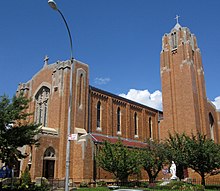 Immaculate Heart of Mary Church along Fort Hamilton Parkway | |||
 | |||
| Type | Parkway | ||
|---|---|---|---|
| Maintained by | NYSDOT and NYCDOT | ||
| Length | 4.1 mi[1] (6.6 km) | ||
| Restrictions | No commercial vehicles | ||
| Location | Brooklyn, New York | ||
| Southwest end | 4th Avenue | ||
| Northeast end | Coney Island Avenue | ||
| Other | |||
| Status | Parkway | ||

Fort Hamilton Parkway is a parkway in Brooklyn, New York. It runs for 4.1 miles from the neighborhood of Windsor Terrace to Bay Ridge, its southern end at the entrance to its namesake military base at Fort Hamilton.
History[]
Originally known as Fort Hamilton Avenue, it was renamed by the state legislature as a parkway in 1892, along with Bay Ridge Parkway, and Bay Parkway, placing the road under the jurisdiction of the Brooklyn Parks Department.[2] The renaming was intended to boost the desirability of real estate along its route. The renaming was approved by the governor on May 17, 1892.[3] In contrast to Ocean Parkway and Eastern Parkway, while Fort Hamilton Parkway was paved in late 1896,[4] it was never given the widths or separated lanes of these two better-known Brooklyn parkways. In 1915, responsibility for this road was transferred from Parks to the Brooklyn Borough President.[5] Fort Hamilton Parkway is presently maintained by the New York City Department of Transportation, which maintains all streets in New York City.[6]
Parks along the route[]
As Fort Hamilton Parkway cuts diagonally through the local street grid, triangular intersections that are too small to be developed were designated as parks, including Bocchino-Dente Memorial Plaza and Lt. William E. Coffey Square. Other parks along its route include Greenwood Playground,[7] Leif Ericson Park,[8] McKinley Park,[9] Kathy Reilly Triangle,[10] Dan Ross Playground,[11] and John J. Carty Park.[12] Fort Hamilton Parkway is also the southeastern border of Green-Wood Cemetery, whose Fort Hamilton gate contains a landmarked cottage building.[13]
Transportation[]
Along its route, it shares its name with three stations of the New York City Subway: Fort Hamilton Parkway on the F and G trains; Fort Hamilton Parkway on the D train; and Fort Hamilton Parkway on the N, Q, and W trains.[14] Until 1975, there was another station also called Fort Hamilton Parkway on the now-demolished section of the BMT Culver Line.[15] The B16 bus route follows Fort Hamilton Parkway between 86th and 56th Streets, while the B70 bus follows it between Seventh Avenue and 92nd Street in Bay Ridge.[16]
References[]
- ^ Google (January 9, 2017). "Fort Hamilton Parkway" (Map). Google Maps. Google. Retrieved January 9, 2017.
- ^ "At the State Capital". Brooklyn Daily Eagle. March 27, 1892. p. 7. Retrieved March 13, 2017.
- ^ "Three More Local Laws". Brooklyn Daily Eagle. May 18, 1892. p. 1. Retrieved March 13, 2017.
- ^ "Park Extension". Brooklyn Daily Eagle. January 4, 1897. p. 2. Retrieved March 13, 2017.
- ^ "Fort Hamilton Parkway". The New York Times. January 24, 1915. Retrieved March 13, 2017.
- ^ "About DOT". nyc.gov. New York City Department of Transportation. December 31, 2013. Retrieved March 13, 2017.
- ^ "Greenwood Playground". New York City Department of Parks and Recreation. Retrieved March 13, 2017.
- ^ "Leif Ericson Park". New York City Department of Parks and Recreation. Retrieved March 13, 2017.
- ^ "McKinley Park". New York City Department of Parks and Recreation. Retrieved March 13, 2017.
- ^ "Kathy Reilly Triangle". New York City Department of Parks and Recreation. Retrieved March 13, 2017.
- ^ "Dan Ross Playground". New York City Department of Parks and Recreation. Retrieved March 13, 2017.
- ^ "John J Carty Park". New York City Department of Parks and Recreation. Retrieved March 13, 2017.
- ^ Richman, Jeff (March 24, 2014). "We Have A Winner!". Green-Wood. Retrieved March 13, 2017.
- ^ "Subway Map" (PDF). Metropolitan Transportation Authority. September 2021. Retrieved September 17, 2021.
- ^ Fowler, Glenn (April 27, 1975). "For Culver Shuttle It's the 11th Hour". The New York Times. Retrieved September 5, 2016.
• Hanley, Robert (May 12, 1975). "Brooklyn's Culver Shuttle Makes Festive Final Run". The New York Times. Retrieved September 5, 2016. - ^ "Brooklyn Bus Map" (PDF). Metropolitan Transportation Authority. October 2020. Retrieved December 1, 2020.
External links[]
- Walsh, Kevin (April 17, 2010). "A Quick Walk on Fort Hamilton Parkway". Forgotten-NY. Retrieved March 13, 2017.
- Streets in Brooklyn