Fourth Avenue (Brooklyn)
This article needs additional citations for verification. (November 2013) |
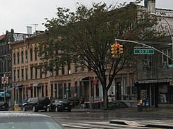
 Looking south at Fourth Street in 2008 | |||
 | |||
| Owner | City of New York | ||
|---|---|---|---|
| Maintained by | NYCDOT | ||
| Length | 5.9 mi[1] (9.5 km) | ||
| Location | Brooklyn, New York City | ||
| South end |
| ||
| Major junctions |
| ||
| North end | Flatbush Avenue / Atlantic Avenue in Downtown Brooklyn | ||
| East | Fifth Avenue | ||
| West | Third Avenue | ||

Fourth Avenue is a major thoroughfare in the New York City borough of Brooklyn. It stretches for 6 miles (9.7 km) south from Times Plaza, which is the triangle intersection created by Atlantic and Flatbush Avenues in Downtown Brooklyn, to Shore Road and the Belt Parkway in Bay Ridge.
While southwestern Brooklyn is well served by expressways, Fourth Avenue provides an alternate for local traffic as it directly links the neighborhoods of Park Slope, Sunset Park and Bay Ridge with Downtown Brooklyn. Traffic signals along the avenue are coordinated for green wave in the peak direction.
Description[]
Fourth Avenue begins at Times Plaza, the triangle intersection it forms with Flatbush and Atlantic Avenues at the foot of the Williamsburgh Savings Bank Tower and Atlantic Terminal in Downtown Brooklyn. The avenue extends south with three traffic lanes in each direction and a one-lane-wide concrete divider that provides a left-turn lane. The concrete divider is actually part of the ventilation system for the BMT Fourth Avenue Line, which lies directly underneath. While six lanes are provided, only four lanes get full use, since the outer two are used by double-parked vehicles and as a right-turn lane.[2]
On its course through Park Slope, Fourth Avenue is home to several condominiums and homes but is dominated by service stations and automotive repair centers.
Upon entering Sunset Park, Fourth Avenue passes under the Prospect Expressway (NY 27) and offers indirect access to it through local side streets. The avenue continues to serve the automotive trade as far as the street numbered in the low 40s, where it becomes flanked by large wall-to-wall apartment buildings.[2]
After crossing under the Gowanus Expressway viaduct into Bay Ridge, the arterial boulevard gives way to a four-lane street bordered by four- to five- story apartment buildings until it reaches Shore Road and the Belt Parkway under the Verrazano Narrows Bridge.[2]
History[]
The avenue was paved in the 1890s as a grand parkway resembling Manhattan's Fourth Avenue, which was later rebuilt and renamed to Park Avenue. The Fourth Avenue in Brooklyn was rebuilt after 1910 to accommodate more traffic.[3]
On October 25, 1962, Mayor Robert F. Wagner Jr. requested that the New York City Board of Estimate approve an expenditure of $724,572 for the reconstruction of subway structures and entrances along the Fourth Avenue subway line in order to accommodate the widening of Fourth Avenue between 60th Street and Atlantic Avenue, which was to be accomplished by narrowing the street's sidewalks. At the time of the request, 80% of the work on the project was completed. Work had started on the project, which cost $1 million, several months earlier. The contract that the Mayor had requested approval for would have relocated vault lights, gratings, entrances and exits at 56th Street and 49th Street, and at the 45th Street, 53rd Street and 59th Street stations.[4]
Protected bike lanes, separated from vehicular traffic by a lane of parking, were proposed for Fourth Avenue in 2017 in an attempt to improve cycling infrastructure in New York City. The first bike lanes were added between 60th and 64th Streets within Sunset Park in 2018, followed by the section between 1st and 15th Streets in Park Slope in early 2019.[5] Due to ongoing reconstruction work on the Fourth Avenue subway tunnel, the section between 60th and 38th Streets could not receive bike lanes until the reconstruction was completed.[6] In August 2019, following several cyclist deaths citywide, the NYCDOT announced that the remainder of Fourth Avenue between 38th and 60th Streets would receive protected bike lanes by late 2020.[7][8]
Churches[]

The borough has a thoroughfare named Church Avenue (named for an 18th-century church), which, contrary to its name, does not rival the large number of later churches located along Fourth Avenue. At Fourth Avenue's intersection with 54th Street in Sunset Park, there are four houses of worship either directly at the corner of the intersection or within a building of it. Two of the churches stand side by side.[9]
Public transportation[]
The BMT Fourth Avenue Line (D, N, Q, R, and W trains) of the New York City Subway runs the length of Fourth Avenue. Stations are located at Atlantic Avenue, Union Street, Ninth Street, Prospect Avenue, 25th Street, 36th Street, 45th Street, 53rd Street, 59th Street, Bay Ridge Avenue, 77th Street, 86th Street, and 95th Street, with express stations at Atlantic Avenue, 36th Street, and 59th Street.[10]
MTA Regional Bus Operations operates several routes, none of which serve the avenue significantly. The B103 Limited route has the longest stretch, traveling southbound on 4th Avenue from Atlantic Avenue to Prospect Expressway. The B4, B9, B11 and B70 also use the avenue for short stretches. The B1, B8, B16, B37, B63, S53, S79 SBS and S93 also stop at the south end of the avenue.[11]
References[]
| Wikimedia Commons has media related to 4th Avenue (Brooklyn). |
- ^ Google (May 23, 2019). "Fourth Avenue" (Map). Google Maps. Google. Retrieved May 23, 2019.
- ^ a b c Cartography from Google Maps
- ^ "From Grand Parkway to Canyon of Mediocrity, the Story of Brooklyn's Fourth Avenue". Curbed NY. 28 August 2015. Retrieved 2015-10-30.
- ^ "For Release PM Papers Thursday, October 25, 1962" (PDF). New York City Office of the Mayor. October 25, 1962. Retrieved August 28, 2019.
- ^ "Work Begins On 4th Avenue Bike Lane In Park Slope - BKLYNER". bklyner.com. May 2019. Retrieved 2019-08-28.
- ^ "Drivers, Cyclists Say Incomplete Bike Lane In Brooklyn Is Turning Into Safety Hazard". 2019-02-21. Retrieved 2019-08-28.
- ^ Ricciulli, Valeria (2019-08-07). "Amid spike in cyclist deaths, DOT accelerates Fourth Avenue bike lane plans". Curbed NY. Retrieved 2019-08-28.
- ^ "Fourth Ave. bike lane completion fast-tracked for Sunset Park". am New York. Retrieved 2019-08-28.
- ^ "Going Fourth, Forgotten NY". forgotten-ny.com. Retrieved 12 January 2018.
- ^ "Subway Map" (PDF). Metropolitan Transportation Authority. September 2021. Retrieved September 17, 2021.
- ^ "Brooklyn Bus Map" (PDF). Metropolitan Transportation Authority. October 2020. Retrieved December 1, 2020.
Coordinates: 40°39′00″N 74°00′32″W / 40.65000°N 74.00889°W

- Streets in Brooklyn