Frazer, Montana
Parts of this article (those related to Demographics) need to be updated. (January 2016) |
Frazer, Montana | |
|---|---|
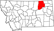
 Location of Frazer, Montana | |
| Coordinates: 48°3′31″N 106°2′28″W / 48.05861°N 106.04111°WCoordinates: 48°3′31″N 106°2′28″W / 48.05861°N 106.04111°W | |
| Country | United States |
| State | Montana |
| County | Valley |
| Area | |
| • Total | 1.6 sq mi (4.3 km2) |
| • Land | 1.6 sq mi (4.2 km2) |
| • Water | 0.0 sq mi (0.1 km2) |
| Elevation | 2,060 ft (628 m) |
| Population | |
| • Total | 362 |
| • Density | 223.0/sq mi (86.1/km2) |
| Time zone | UTC-7 (Mountain (MST)) |
| • Summer (DST) | UTC-6 (MDT) |
| ZIP code | 59225 |
| Area code(s) | 406 |
| FIPS code | 30-29275 |
| GNIS feature ID | 0771614 |
Frazer is a census-designated place (CDP) in Valley County, Montana, United States, located within the Fort Peck Indian Reservation, about 80 miles from the Canadian border.[2] The population was 362 at the 2010 census.[1]
The St. Paul, Minneapolis & Manitoba Railway established Frazer as a station in 1888.[3] A post office opened in 1907.[3]
Geography[]
Frazer is located at 48°02′56″N 106°02′55″W / 48.048907°N 106.048572°W (48.048907, -106.048572).[1]
According to the United States Census Bureau, the CDP has a total area of 1.7 square miles (4.4 km2), of which 1.7 square miles (4.4 km2) is land and 0.04 square miles (0.10 km2) (1.75%) is water.
Demographics[]
At the 2000 census[4] there were 452 people, 115 households and 96 families residing in the CDP. The population density was 269.3 per square mile (103.9/km2). There were 122 housing units at an average density of 72.7 per square mile (28.0/km2). The racial makeup of the CDP was 7.08% White, 92.48% Native American, 0.22% from other races, and 0.22% from two or more races. Hispanic or Latino of any race were 0.44% of the population.
There were 115 households, of which 49.6% had children under the age of 18 living with them, 38.3% were married couples living together, 33.9% had a female householder with no husband present and 16.5% were non-families. 14.8% of all households were made up of individuals, and 2.6% had someone living alone who was 65 years of age or older. The average household size was 3.93 and the average family size was 4.21.
41.6% of the population were under the age of 18, 10.0% from 18 to 24, 31.0% from 25 to 44, 12.4% from 45 to 64, and 5.1% who were 65 years of age or older. The median age was 24 years. For every 100 females, there were 110.2 males. For every 100 females age 18 and over, there were 91.3 males.
The median household income was $19,500 and the median family income was $16,458. Males had a median income of $24,500 females $18,438. The per capita income for the CDP was $6,435. About 47.3% of families and 47.1% of the population were below the poverty line, including 44.7% of those under age 18 and 50.0% of those age 65 or over.
Education[]
Frazer School educates students from kindergarten through 12th grade.[5] 's team name is the Bearcubs.[6]
References[]
- ^ a b c "US Gazetteer files: 2010, 2000, and 1990". United States Census Bureau. 2011-02-12. Retrieved 2011-04-23.
- ^ Doughtery, Jesse (January 3, 2018). "Reservation basketball stars rarely make it to Division I. But Mya Fourstar has a dream". Washington Post. Archived from the original on 2018-01-04. Retrieved 2018-01-05.
- ^ a b "Frazer". Montana Place Names Companion. Montana Historical Society. Retrieved 2 April 2021.
- ^ "U.S. Census website". United States Census Bureau. Retrieved January 31, 2008.
- ^ "Frazer School". Frazer School. Retrieved 20 April 2021.
- ^ "Member Schools". Montana High School Association. Retrieved 19 April 2021.
- Census-designated places in Montana
- Census-designated places in Valley County, Montana
- Montana populated places on the Missouri River

