Fremont Peak (Arizona)
| Fremont Peak | |
|---|---|
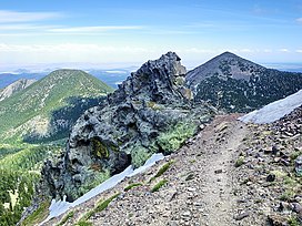 Doyle Peak and Fremont Peak (right) from the east side of Agassiz Peak | |
| Highest point | |
| Elevation | 11,973 ft (3,649 m) NAVD 88[1] |
| Prominence | 615 ft (187 m)[1] |
| Parent peak | Agassiz Peak[1] |
| Coordinates | 35°19′23″N 111°39′40″W / 35.3230643°N 111.6609943°WCoordinates: 35°19′23″N 111°39′40″W / 35.3230643°N 111.6609943°W[2] |
| Geography | |
 Fremont Peak | |
| Location | Coconino County, Arizona, U.S. |
| Parent range | San Francisco Peaks |
| Topo map | USGS Humphreys Peak |
| Geology | |
| Volcanic field | San Francisco volcanic field |
| Climbing | |
| Easiest route | From Doyle Saddle |
Fremont Peak is in the San Francisco Peaks of northern Arizona. It is the third highest point in the state of Arizona.[1] The peak, named in honor John C. Frémont (1813–1890), a civil war general who served as the territorial governor of Arizona from 1878–82.[3] The peak is in the Kachina Peaks Wilderness on the Coconino National Forest.
Fremont offers the best year round views of the south from any high point in the San Francisco Peaks. It can be seen from Flagstaff, Arizona as the pointy peak on the right.

View through a grove of Rocky Mountain Bristlecone Pine growing on the south slope of Fremont Peak, Flagstaff is visible in the background
See also[]
References[]
- ^ a b c d "Fremont Peak, Arizona". Peakbagger.com. Retrieved 2009-01-10.
- ^ "Fremont Peak". Geographic Names Information System. United States Geological Survey. Retrieved 2009-01-10.
- ^ "History of the San Francisco Peaks and how they got their names". Coconino National Forest. Retrieved 2021-03-14.
External links[]
- "Fremont Peak". SummitPost.org.
| Wikimedia Commons has media related to Fremont Peak. |
Categories:
- Volcanoes of Arizona
- Mountains of Arizona
- Landforms of Coconino County, Arizona
- Stratovolcanoes of the United States
- Extinct volcanoes
- Coconino National Forest
- Mountains of Coconino County, Arizona