Frenchtown, Montana
Frenchtown, Montana | |
|---|---|
 | |
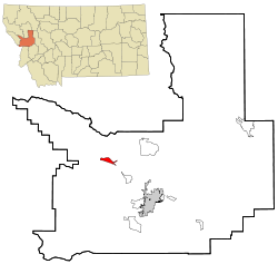 Location of Frenchtown, Montana | |
| Coordinates: 47°1′8″N 114°14′46″W / 47.01889°N 114.24611°WCoordinates: 47°1′8″N 114°14′46″W / 47.01889°N 114.24611°W | |
| Country | United States |
| State | Montana |
| County | Missoula |
| Area | |
| • Total | 3.3 sq mi (8.5 km2) |
| • Land | 3.2 sq mi (8.4 km2) |
| • Water | 0.0 sq mi (0.1 km2) |
| Elevation | 3,045 ft (928 m) |
| Population (2010) | |
| • Total | 1,825 |
| • Density | 271.8/sq mi (104.9/km2) |
| Time zone | UTC-7 (Mountain (MST)) |
| • Summer (DST) | UTC-6 (MDT) |
| ZIP code | 59834 |
| Area code(s) | 406 |
| FIPS code | 30-29350 |
| GNIS feature ID | 0783746 |


Frenchtown is a census-designated place (CDP) in Missoula County, Montana, United States. It is part of the 'Missoula, Montana Metropolitan Statistical Area'. The population was 1,825 at the 2010 census, an increase from its population of 883 in 2000. Frenchtown is also known as an early mixed ancestry settlement in the Pacific Northwest history, sometimes referred as a French Canadian or a Métis settlement.[1]
Nearby is the Frenchtown Pond State Park.
History[]
Americans gave the location a generic name based on the ethnicity or language of the original settlers, namely French Canadians.[2]
The settlement was cofounded around 1858 by two French Canadians moving inland with their Metis families to escape turmoil further west that followed the arrival of the American federal authorities. Jean-Baptiste Ducharme left Puget Sound during the Indian Wars (1855-1856) abandoning his land claim as his Muck Creek neighbors were arrested under martial law. Louis Brown (anglicized name) left the Colville Valley turmoil a few years later with his Pend d'Oreille wife and Metis daughters. Meanwhile the Pend d'Oreilles Kalispel had moved upriver to a new locale accompanied by Jesuit priest Father Hoecken who relocated the Saint-Ignatius mission northeast of the future Frenchtown. Louis Brown Metis daughters and grandchildren married into the wave of French Canadian settlers that swept over the valley in the course of the last four decades of the 19th century. Ducharme four Metis sons and two daughters moved North to the Flathead Indian Reservation marrying into the Pend d'Oreille tribe.[3]
The St. Louis Catholic Church was built in 1864.
A post office called Frenchtown was first established in 1868.[4]
Geography[]
Frenchtown is located at 47°01′08″N 114°14′46″W / 47.018780°N 114.246205°W (47.018780, -114.246205),[5] on the historic Mullan Road.[6]
According to the United States Census Bureau, the CDP has a total area of 3.3 square miles (8.5 km2), of which 3.2 square miles (8.3 km2) is land and 0.04 square miles (0.10 km2) (0.91%) is water.
Demographics[]
As of the census[7] of 2010, there were 1,825 people, 291 households, and 235 families residing in the CDP. The population density was 271.8 people per square mile (104.9/km2). There were 302 housing units at an average density of 92.9 per square mile (35.9/km2). The racial makeup of the CDP was 96.15% White, 1.59% Native American, 0.11% Asian, 0.79% from other races, and 1.36% from two or more races. Hispanic or Latino of any race were 1.81% of the population.
There were 291 households, out of which 47.4% had children under the age of 18 living with them, 67.0% were married couples living together, 7.9% had a female householder with no husband present, and 19.2% were non-families. 12.7% of all households were made up of individuals, and 4.1% had someone living alone who was 65 years of age or older. The average household size was 3.03 and the average family size was 3.32.
In the CDP, the population was spread out, with 34.3% under the age of 18, 6.5% from 18 to 24, 31.3% from 25 to 44, 22.7% from 45 to 64, and 5.3% who were 65 years of age or older. The median age was 34 years. For every 100 females, there were 106.3 males. For every 100 females age 18 and over, there were 101.4 males.
The median income for a household in the CDP was $46,094, and the median income for a family was $45,938. Males had a median income of $36,118 versus $23,750 for females. The per capita income for the CDP was $21,225. None of the population or families were below the poverty line.
Education[]
Frenchtown Public Schools serves grades K-12.[8] Frenchtown High School's team name is the Broncs.[9]
The Missoula Public Library has a branch location in Frenchtown.[10]
Smurfit-Stone mill[]

In September 2015, the EPA announced that it was close to an agreement for testing and environmental remediation of Frenchtown's Smurfit-Stone Container Corp. mill site.[11] Contaminants on the site include dioxins and heavy metals, which has raised concerns that the site might be eligible for the federal Superfund list.[12] The paper mill, which produced containerboard, "began production in 1957 under Waldorf Paper Products Co. of St. Paul, MN."[13] The mill employed 417 workers at the time of its closure in 2010.[14] A meeting was held in February 2017 to create a Community Advisory Group to work with the Superfund grantmaking process. Cleanup of PCBs at the mill site was ongoing as of April 2017.[15] As the second largest taxpayer in Missoula county, the mill was the source of nearly 20% ($134281) of the Frenchtown fire district's budget, and 21.7% ($825,976) of the Frenchtown school district's budget.[16]

| Wikimedia Commons has media related to Frenchtown, Montana. |
References[]
- ^ Barman, Jean French Canadians, Furs, and Indigenous Women in the Making of the Pacific Northwest. UBC Press. Vancouver 2014. Chapter 7: "Initiating Permanent Settlement"
- ^ "Origins of Names on Milwaukee". Roundup Record-Tribune & Winnett Times. August 22, 1940. p. 6. Retrieved 27 April 2015.
- ^ Frenchtown Historical Society, 'Frenchtown Valley Footprints'. Mountain Press Printing. Missoula, Montana 1976. Part I The Beginnings.
- ^ "Missoula County". Jim Forte Postal History. Retrieved 27 April 2015.
- ^ "US Gazetteer files: 2010, 2000, and 1990". United States Census Bureau. 2011-02-12. Retrieved 2011-04-23.
- ^ Briggeman, Kim (July 4, 2012). "Road to Frenchtown has changed since Stone's journey". Missoulian. Retrieved 2015-10-03.
- ^ "U.S. Census website". United States Census Bureau. Retrieved 2008-01-31.
- ^ "Frenchtown School District". Frenchtown School District. Retrieved 13 April 2021.
- ^ "Member Schools". Montana High School Association. Retrieved 19 April 2021.
- ^ "Hours & Locations". Missoula Public Library. Retrieved 13 April 2021.
- ^ Kidston, Martin (2015-10-03). "EPA pledges progress in 'month or two' at former Smurfit site". Missoulian. Retrieved 2015-10-03.
- ^ Chaney, Rob (September 13, 2012). "Former Frenchtown mill site may need Superfund cleanup". Missoulian. Retrieved 2015-10-03.
- ^ Briggeman, Kim (May 5, 2011). "Investment group buys Smurfit's Frenchtown mill" (PDF). Missoulian via logging.com. Retrieved 2015-10-03.
- ^ Cohen, Betsy (January 3, 2010). "Smurfit-Stone closure: Towns struggle to put old mill sites to use". Missoulian. Retrieved 2015-10-03.
- ^ Briggeman, Kim. "Investigations into PCBs, berms ongoing at Frenchtown Superfund site". missoulian.com. Retrieved 2017-07-01.
- ^ Missoulian, BETSY COHEN of the. "Smurfit-Stone to permanently close Frenchtown mill". missoulian.com. Retrieved 2021-01-23.
External links[]
- Frenchtown Historical Society Oral History Project (University of Montana Archives)
| show Municipalities and communities of Missoula County, Montana, United States |
|---|

| show Authority control |
|---|
- Census-designated places in Missoula County, Montana
- Census-designated places in Montana