Gáň
Gáň | |
|---|---|
Municipality | |
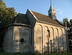 Church in Gáň | |
 Gáň Location of Gáň in the Trnava Region | |
| Coordinates: 48°14′N 17°43′E / 48.233°N 17.717°ECoordinates: 48°14′N 17°43′E / 48.233°N 17.717°E | |
| Country | Slovakia |
| Region | Trnava |
| District | Galanta |
| First mentioned | 1113 |
| Area | |
| • Total | 6.174 km2 (2.384 sq mi) |
| Elevation | 125 m (410 ft) |
| Population | |
| • Total | 695 |
| • Density | 110/km2 (290/sq mi) |
| Time zone | UTC+1 (CET) |
| • Summer (DST) | UTC+2 (CEST) |
| Postal code | 924 01 (pošta Galanta 1) |
| Area code(s) | 421-31 |
| Car plate | GA |
| Website | www.obecgan.sk |


Gáň (Hungarian: Barakony) is a village and municipality in Galanta District of the Trnava Region of south-west Slovakia.
History[]
In historical records the village was first mentioned in 1113.
Geography[]
The municipality lies at an elevation of 125 metres and covers an area of 6.174 km². It has a population of about 695 people.
Genealogical resources[]
The records for genealogical research are available at the state archive "Statny Archiv in Bratislava, Slovakia"
- Roman Catholic church records (births/marriages/deaths): 1691-1921 (parish B)
- Lutheran church records (births/marriages/deaths): 1701-1826 (parish B)
See also[]
External links[]
![]() Media related to Gáň at Wikimedia Commons
Media related to Gáň at Wikimedia Commons
This Trnava Region geography article is a stub. You can help Wikipedia by . |
Categories:
- Villages and municipalities in Galanta District
- Trnava Region geography stubs