Garmab Rural District
Garmab Rural District
دهستان گرماب | |
|---|---|
Rural district | |
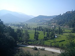 Pole garmab | |
| Country | |
| Province | Mazandaran |
| County | Sari |
| District | Chahardangeh |
| Population (2006) | |
| • Total | 6,610 |
Garmab Rural District (Persian: دهستان گرماب) is a rural district (dehestan) in Chahardangeh District, Sari County, Mazandaran Province, Iran.[1] At the 2006 census, its population was 6,610, in 1,554 families.[2] The rural district has 35 villages.
References[]
- ^ Iranian National Committee for Standardization of Geographical Names website (in Persian)
- ^ "Census of the Islamic Republic of Iran, 1385 (2006)" (Excel). Statistical Center of Iran. Archived from the original on 2011-11-11.
| Capital |
| ||||||||||||||||||||||||||||||||||||||||||||||
|---|---|---|---|---|---|---|---|---|---|---|---|---|---|---|---|---|---|---|---|---|---|---|---|---|---|---|---|---|---|---|---|---|---|---|---|---|---|---|---|---|---|---|---|---|---|---|---|
| Districts |
| ||||||||||||||||||||||||||||||||||||||||||||||
This Sari County location article is a stub. You can help Wikipedia by . |
Categories:
- Rural Districts of Mazandaran Province
- Sari County
- Sari County geography stubs