Garner Field
Garner Field | |||||||||||
|---|---|---|---|---|---|---|---|---|---|---|---|
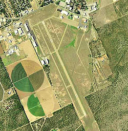 2006 USGS Photo | |||||||||||
| Summary | |||||||||||
| Airport type | Public | ||||||||||
| Owner | City of Uvalde | ||||||||||
| Serves | Uvalde, Texas | ||||||||||
| Elevation AMSL | 942 ft / 287 m | ||||||||||
| Coordinates | 29°12′41″N 099°44′37″W / 29.21139°N 99.74361°W | ||||||||||
| Map | |||||||||||
 KUVA | |||||||||||
| Runways | |||||||||||
| |||||||||||
| Statistics (2005) | |||||||||||
| |||||||||||

Garner Field (IATA: UVA, ICAO: KUVA, FAA LID: UVA) is an airport in Uvalde County, Texas, three miles east of the city of Uvalde, which owns it.[1] It is named for John Nance Garner, 32nd Vice President of the United States.
History[]

Opened in October 1941 with three 6,000 ft hard surfaced runways, (00/18; 04/27; 15/33). Began training United States Army Air Corps flying cadets under contract to Hangar Six Corp with 305th Flying Training Detachment (Contract Pilot School). Assigned to Gulf Coast Training Center (later Central Flying Training Command) as a primary (level 1) pilot training airfield. Hangar Six, Inc. conducted pilot training. Airfield had four local auxiliary airfields for emergency and overflow landings. Flying training used Fairchild PT-19s as the primary trainer. Also had several PT-17 Stearmans and a few P-40 Warhawks.
Inactivated on 30 June 1945 with the drawdown of AAFTC's pilot training program. Declared surplus and turned over to the Army Corps of Engineers on 30 September 1945. Eventually discharged to the War Assets Administration (WAA) and became a civil airport. Very little of the wartime airfield still exists, as most of the airfield has been rebuilt as Southwest Texas Junior College.
Airlines[]
- Trans-Texas Airways DC-3s landed at Uvalde from 1948 to 1954.
- Uvalde Aero Service ran, from 1965 until 1977, scheduled commuter services to other cities in Texas, and an air-mail route to San Antonio. The airline operated Lockheed L-12 Electra Junior, Piper Navajo and Piper Twin Comanche[2]
Facilities[]
Garner Field covers 356 acres (144 ha) at an elevation of 942 feet (287 m). Its one runway, 15/33, is 5,255 by 100 ft (1,602 x 30 m) asphalt. In the year ending April 7, 2005 the airport had 12,565 aircraft operations, average 34 per day: 96% general aviation, 2% air taxi and 2% military. 48 aircraft were then based at the airport: 63% single-engine, 8% multi-engine, 13% jet, 8% helicopter and 8% glider.[1]
See also[]
References[]
- ^ a b c FAA Airport Form 5010 for UVA PDF, effective 2008-07-31.
- ^ "Uvalde Aero Service". Airline History. Retrieved 18 April 2020.
- Other sources
 This article incorporates public domain material from the Air Force Historical Research Agency website http://www.afhra.af.mil/.
- Shaw, Frederick J. (2004), Locating Air Force Base Sites History's Legacy, Air Force History and Museums Program, United States Air Force, Washington DC, 2004.
- Manning, Thomas A. (2005), History of Air Education and Training Command, 1942–2002. Office of History and Research, Headquarters, AETC, Randolph AFB, Texas ASIN: B000NYX3PC
External links[]
| Wikimedia Commons has media related to Garner Field. |
- FAA Terminal Procedures for UVA, effective January 27, 2022
- Resources for this airport:
- FAA airport information for UVA
- AirNav airport information for UVA
- FlightAware airport information and live flight tracker
- SkyVector aeronautical chart for UVA
| Flying Training |
|  | ||||
|---|---|---|---|---|---|---|
| Technical Training |
| |||||
- 1941 establishments in Texas
- USAAF Contract Flying School Airfields
- Airfields of the United States Army Air Forces in Texas
- Airports in Texas
- Buildings and structures in Uvalde County, Texas
- Transportation in Uvalde County, Texas
- Airports established in 1941
- USAAF Central Flying Training Command
- American Theater of World War II