Garnet, Wisconsin
Garnet, Wisconsin | |
|---|---|
 Garnet, Wisconsin | |
| Nickname(s): Cream City | |
 Garnet, Wisconsin | |
| Coordinates: 43°56′08″N 88°15′46″W / 43.93556°N 88.26278°WCoordinates: 43°56′08″N 88°15′46″W / 43.93556°N 88.26278°W | |
| Country | |
| State | |
| County | Fond du Lac |
| Established | circa 1880 |
| Elevation | 287 m (942 ft) |
| Time zone | UTC-6 (Central (CST)) |
| • Summer (DST) | UTC-5 (CDT) |
| Zip codes | 53049 |
| Area code(s) | 920 |
| GNIS feature ID | 1565424[1] |


Garnet, Wisconsin is an unincorporated community in Fond du Lac County, in the U.S. state of Wisconsin.[2] The community is on the north boundary of the county, just south of Calumet County. It is located at the intersection of County Highway HHH and Town Hall Road just east of Calumet County C, in the town of Calumet.[3] Garnet is located 1.95 miles (3.14 km) east of Calumetville.
History[]
The community was settled in around 1880.[4] It is nicknamed "Cream City."[4]
Images[]

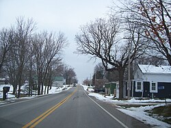
Looking east at Garnet
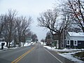
Looking west at Garnet on HHH


Notes[]
- ^ "US Board on Geographic Names". United States Geological Survey. 2007-10-25. Retrieved 2008-01-31.
- ^ http://www.wisconsinhistory.org/dictionary/index.asp?action=view&term_id=5558
- ^ "Archived copy". Archived from the original on 2011-07-15. Retrieved 2009-09-15.
{{cite web}}: CS1 maint: archived copy as title (link) - ^ a b Edens, Mrs. Dale (January 18, 1973). "Historical Insight". Chilton Times-Journal.
Municipalities and communities of Fond du Lac County, Wisconsin, United States | ||
|---|---|---|
| Cities |  | |
| Villages | ||
| Towns | ||
| CDPs | ||
| Other communities |
| |
| Former communities | ||
| Footnotes | ‡This populated place also has portions in an adjacent county or counties | |
| ||
This article about a location in Fond du Lac County, Wisconsin is a stub. You can help Wikipedia by . |
Categories:
- Unincorporated communities in Wisconsin
- Unincorporated communities in Fond du Lac County, Wisconsin
- Northeast Wisconsin geography stubs