Garrisonville, Virginia
Garrisonville | |
|---|---|
district | |
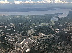 Aerial view of Garrisonville (foreground) and Aquia Harbour (center) with Aquia Creek and the Potomac River in the background | |
 Garrisonville Location within the state of Virginia | |
| Coordinates: 38°28′57″N 77°25′36″W / 38.48250°N 77.42667°WCoordinates: 38°28′57″N 77°25′36″W / 38.48250°N 77.42667°W | |
| Country | United States |
| State | Virginia |
| County | Stafford |
| Time zone | UTC−5 (Eastern (EST)) |
| • Summer (DST) | UTC−4 (EDT) |


Garrisonville is a district of Stafford County in the U.S. state of Virginia.[1] Garrisonville is located south of the Marine Corps Base Quantico, near Interstate 95 at Exit 143.[citation needed]
References[]
- ^ Dodd, Anita L.; Lee, M. Amanda (2007). Stafford County. Arcadia Publishing. p. ix. ISBN 9780738544106.
| Wikimedia Commons has media related to Garrisonville, Virginia. |
| hide Municipalities and communities of Stafford County, Virginia, United States | ||
|---|---|---|
| CDPs |  | |
| districts |
| |
| Unincorporated communities | ||
| Footnotes | ‡This populated place also has portions in an adjacent county or counties | |
| ||
This Stafford County, Virginia state location article is a stub. You can help Wikipedia by . |
Categories:
- Unincorporated communities in Stafford County, Virginia
- Unincorporated communities in Virginia
- Stafford County, Virginia geography stubs