Glonn (Mangfall)
| Glonn | |
|---|---|
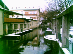 The Glonn in Bad Aibling | |
| Location | |
| Country | Germany |
| State | Bavaria |
| Physical characteristics | |
| Mouth | |
• location | Mangfall |
• coordinates | 47°51′13″N 12°01′01″E / 47.8536°N 12.0170°ECoordinates: 47°51′13″N 12°01′01″E / 47.8536°N 12.0170°E |
| Length | 28.7 km (17.8 mi) [1] |
| Basin size | 145 km2 (56 sq mi) [1] |
| Basin features | |
| Progression | Mangfall→ Inn→ Danube→ Black Sea |

Glonn is a river in Bavaria, Germany.
Its source is in Glonn in the Ebersberg district and it flows in the south-east direction via Beyharting (Tuntenhausen) to Bad Aibling, where it flows into the Mangfall.
The Glonn has a length of about 29 kilometers (18 miles). Its name originates from "Glana", "the clear one" (female) in Celtic languages.
See also[]
- List of rivers in Bavaria
References[]
- ^ Jump up to: a b Complete table of the Bavarian Waterbody Register by the Bavarian State Office for the Environment (xls, 10.3 MB)
External links[]
 Media related to Glonn (Mangfall) at Wikimedia Commons
| Authority control |
|
|---|
Categories:
- Tributaries of the Mangfall
- Rivers of Bavaria
- Rivers of Germany