Mangfall
| Mangfall | |
|---|---|
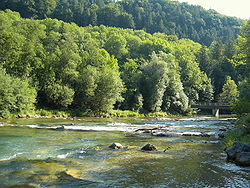 Mangfall bend, looking downstream | |
| Location | |
| Country | Germany |
| State | Bavaria |
| Reference no. | DE: 182 |
| Physical characteristics | |
| Source | |
| • location | Sources: tailstream of the Tegernsee |
| • coordinates | 47°44′52″N 11°44′07″E / 47.74778°N 11.73528°ECoordinates: 47°44′52″N 11°44′07″E / 47.74778°N 11.73528°E |
| • elevation | 726 m above sea level (NN) |
| Mouth | |
• location | in Rosenheim into the Inn |
• coordinates | 47°51′35″N 12°08′10″E / 47.85972°N 12.13611°E |
• elevation | 444 m above sea level (NN) |
| Length | 62.9 km (39.1 mi) [1] |
| Basin size | 1,098 km2 (424 sq mi) [1] |
| Basin features | |
| Progression | Inn→ Danube→ Black Sea |
| Landmarks |
|
| Tributaries | |
| • left | Festenbach (also called Moosbach), , Glonn |
| • right | , Schlierach, Moosbach, Leitzach, Hainerbach, Goldbach (auch Mühlbach), , Kalten |
| Waterbodies | Lakes: Tegernsee |


The Mangfall in Rosenheim
The Mangfall is a river of Upper Bavaria, Germany. The Mangfall is the outflow of the Tegernsee lake and discharges in Rosenheim from the left into the Inn. It is 63 km (39 mi) long.
Towns and villages on the Mangfall[]
- Gmund am Tegernsee
- Valley
- Weyarn
- (district of Valley)
- Feldkirchen-Westerham
- Feldolling
- Bruckmühl
- (district of Bruckmühl)
- (district of Bruckmühl)
- Bad Aibling
- Kolbermoor
- Rosenheim
See also[]
References[]
- ^ Jump up to: a b Complete table of the Bavarian Waterbody Register by the Bavarian State Office for the Environment (xls, 10.3 MB)
External links[]
| Wikimedia Commons has media related to Mangfall. |
| Authority control |
|---|
Categories:
- Tributaries of the Inn
- Mangfall basin
- Rivers of Bavaria
- Miesbach (district)
- Rosenheim (district)
- Rivers of Germany