Gloster, Louisiana
Gloster, Louisiana | |
|---|---|
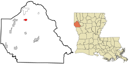 Location in De Soto Parish and the state of Louisiana. | |
| Coordinates: 32°11′28″N 93°48′54″W / 32.19111°N 93.81500°WCoordinates: 32°11′28″N 93°48′54″W / 32.19111°N 93.81500°W | |
| Country | |
| State | |
| Parish | DeSoto |
| Area | |
| • Total | 1.27 sq mi (3.30 km2) |
| • Land | 1.26 sq mi (3.26 km2) |
| • Water | 0.02 sq mi (0.04 km2) |
| Elevation | 241 ft (73 m) |
| Population (2010) | |
| • Total | 94 |
| • Density | 75/sq mi (28.8/km2) |
| Time zone | UTC-6 (Central (CST)) |
| • Summer (DST) | UTC-5 (CDT) |
| ZIP code | 71030 |
| FIPS code | 22-29395 |
| GNIS feature ID | 535251 |

Gloster is an unincorporated community and census-designated place (CDP) in DeSoto Parish, Louisiana, United States. As of the 2010 census it had a population of 94.[1]
Gloster is located 1.5 miles (2.4 km) east of U.S. Route 171, 17 miles (27 km) north of Mansfield, the DeSoto Parish seat, and 30 miles (48 km) south of Shreveport.
It is the nearest community to three places listed on the U.S. National Register of Historic Places:
References[]
- ^ "Geographic Identifiers: 2010 Demographic Profile Data (G001): Gloster CDP, Louisiana". U.S. Census Bureau, American Factfinder. Retrieved October 28, 2015.[dead link]
Municipalities and communities of DeSoto Parish, Louisiana, United States | ||
|---|---|---|
Parish seat: Mansfield | ||
| City |  | |
| Towns | ||
| Villages | ||
| CDPs | ||
| Other unincorporated communities | ||
| ||
This Louisiana state location article is a stub. You can help Wikipedia by . |
Categories:
- Populated places in Ark-La-Tex
- Census-designated places in DeSoto Parish, Louisiana
- Census-designated places in Louisiana
- Census-designated places in Shreveport – Bossier City metropolitan area
- Louisiana geography stubs