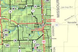
Godfrey, Kansas
Godfrey, Kansas | |
|---|---|
 | |
| Country | United States |
| State | Kansas |
| County | Bourbon |
| Platted | 1871 |
| Time zone | UTC-6 (CST) |
| • Summer (DST) | UTC-5 (CDT) |
| Area code | 620 |
| GNIS ID | 484699 |
Godfrey is an unincorporated community in Bourbon County, Kansas, United States.[1]
History[]
Godfrey was platted in 1871 as a coal mining community.[2] Godfrey had a post office from 1870 until 1901.[3]
References[]
- ^ U.S. Geological Survey Geographic Names Information System: Godfrey, Kansas
- ^ "Many Towns Have Disappeared". The Fort Scott Tribune. Jul 16, 1976. pp. 2C. Retrieved 16 May 2015.
- ^ "Kansas Post Offices, 1828-1961". Kansas Historical Society. Retrieved August 2, 2014.
Further reading[]
External links[]
Coordinates: 37°45′42″N 94°42′36″W / 37.76167°N 94.71000°W
Categories:
- Unincorporated communities in Bourbon County, Kansas
- Unincorporated communities in Kansas
- Southeast Kansas geography stubs

