Golden View Colony, South Dakota
Golden View Colony, South Dakota | |
|---|---|
 Golden View Colony | |
| Coordinates: 43°41′33″N 97°26′55″W / 43.69250°N 97.44861°WCoordinates: 43°41′33″N 97°26′55″W / 43.69250°N 97.44861°W | |
| Country | United States |
| State | South Dakota |
| County | McCook |
| Area | |
| • Total | 1.00 sq mi (2.58 km2) |
| • Land | 0.97 sq mi (2.50 km2) |
| • Water | 0.03 sq mi (0.08 km2) |
| Elevation | 1,487 ft (453 m) |
| Time zone | UTC-6 (Central (CST)) |
| • Summer (DST) | UTC-5 (CDT) |
| ZIP Code | 57058 (Salem) |
| Area code(s) | 605 |
| FIPS code | 46-24760 |
| GNIS feature ID | 2813045[2] |


Golden View Colony is a census-designated place (CDP) corresponding to the Goldenview Hutterite colony[3] in McCook County, South Dakota, United States. It was first listed as a CDP prior to the 2020 census.[2]
It is in the west-central part of the county, 5 miles (8 km) by road southwest of Salem, the county seat.
References[]
- ^ "2020 U.S. Gazetteer Files – South Dakota". United States Census Bureau. Retrieved September 16, 2021.
- ^ a b "Golden View Colony Census Designated Place". Geographic Names Information System. United States Geological Survey.
- ^ Friesen, Bert (May 2021). "Goldenview Hutterite Colony (Salem, South Dakota, USA)". Global Anabaptist Mennonite Encyclopedia Online. Retrieved September 16, 2021.
Municipalities and communities of McCook County, South Dakota, United States | ||
|---|---|---|
| Cities | 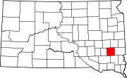 | |
| CDPs | ||
| Unincorporated community | ||
| ||
This South Dakota state location article is a stub. You can help Wikipedia by . |
Categories:
- Census-designated places in McCook County, South Dakota
- Census-designated places in South Dakota
- Hutterite communities
- South Dakota geography stubs