Goonhilly Downs
| Site of Special Scientific Interest | |
 Goonhilly Downs | |
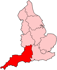
 Location within Cornwall  Goonhilly Downs (England) | |
| Location | Cornwall |
|---|---|
| Grid reference | SW720200 |
| Coordinates | 50°02′22″N 5°10′15″W / 50.0394°N 5.1709°WCoordinates: 50°02′22″N 5°10′15″W / 50.0394°N 5.1709°W |
| Interest | Biological |
| Area | 1,271 hectares (12.7 km2; 4.91 sq mi) |
| Notification | 1951 |
| Natural England website | |

Goonhilly Downs is a Site of Special Scientific Interest (SSSI) that forms a raised plateau in the central western area of the Lizard peninsula in southern Cornwall, England, UK.[1]
Downs[]

Situated just south of Helston and the Royal Naval Air Station RNAS Culdrose, it is famous for its Goonhilly Satellite Earth Station, at one time the largest in the world. The large satellite dishes are an iconic landmark, and can be seen for miles.
Goonhilly Downs is now also home to a 12 megawatt wind farm[2] consisting of six wind turbines of two megawatts, and supports a tourist attraction called Cornish Camels.
The downs themselves are an area of sparse heathland, based on serpentinite geology. This is home to rare plants, such as Cornish heath, which has been adopted as the county flower.[1][3]
A large standing stone known as the Dry Tree menhir can be found on the ex- RAF Dry Tree site on the downs, near to the satellite station.[4]
The name Goonhilly comes from the Cornish language, and means "hunting downs", from goon, "down, moor", and helghi, "to hunt". (See "Cornish place names translated".)
North Predannack Downs Nature Reserve[]
This section needs additional citations for verification. (October 2011) |
A couple of miles west of the BT site is another triple SI (SSSI), and nature reserve, owned and managed by the Cornwall Wildlife Trust. This reserve is prime Cornish heath (Erica vagans) with ponds and willow fen. Early Bronze Age barrows are present, and there are several ancient 'turf-hut' circles. There are remains of buildings which were part of RAF Dry Tree and later RAF Trelanvean, used during the Second World War. Both the adder – a venomous snake, and the stonechat – a passerine bird are commonly sighted here.
Approached from the Helston direction and half a mile before the Satellite dishes is the former Goonhilly Craft Shop and Tea Room, now converted to a private dwelling. Set back from the road, the building was constructed in the early 1960s by a local farmer. The land was originally part of the nearby Trelowarren estate. Planning permission was granted to build a 4-bedroomed bungalow and petrol station/garage and it was known locally as 'Telstar'; (Telstar is the name of various communications satellites, including the first ever such satellite able to relay television signals.) 'Telstar Cafe' used to have a petrol station but petrol is now sold at Helston supermarket garages. 100,000 people a year visited BT's nearby FutureWorld@Goonhilly (now closed) and many of them also called into the Craft Shop and Tea Room before making their way back from Goonhilly.
Goonhilly Downs also serves as a landing point for the SEA-ME-WE 3, the longest submarine cable on Earth.
See also[]
- Geology of Lizard, Cornwall
- List of topics related to Cornwall
- Wind power in the United Kingdom
References[]
- ^ a b "Goonhilly Downs" (PDF). Natural England. 1989. Archived from the original (PDF) on 24 October 2012. Retrieved 27 October 2011.
- ^ "Goonhilly replaces wind turbines". BBC News. 19 August 2010.
- ^ Cornwall County Council, "The County Flower Archived 2008-09-30 at the Wayback Machine."
- ^ "Dry Tree Menhir | HELSTON HISTORY". Retrieved 11 October 2021.
External links[]
- Sites of Special Scientific Interest in Cornwall
- Sites of Special Scientific Interest notified in 1951
- Archaeological sites in Cornwall
- Bronze Age sites in Cornwall
- Nature reserves of the Cornwall Wildlife Trust
- Power stations in South West England
- Wind farms in England
- Lizard Peninsula
