Gore District, New Zealand
Gore District | |
|---|---|
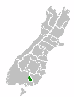 Location of the Gore District within the South Island | |
| Country | New Zealand |
| Region | Southland |
| District | Gore District |
| Wards | Gore Mataura Kaiwera-Waimumu Waikaka |
| Formed | 1989 |
| Seat | Gore |
| Government | |
| • Mayor | Tracy Hicks |
| Area | |
| • Total | 1,254.85 km2 (484.50 sq mi) |
| Population (June 2021)[2] | |
| • Total | 13,050 |
| • Density | 10/km2 (27/sq mi) |
| Time zone | UTC+12 (NZST) |
| • Summer (DST) | UTC+13 (NZDT) |
| Postcode(s) | |
| Website | Gore District Council |
Gore District is a district in the Southland region of the South Island of New Zealand.
Geography[]
The Gore District is located in the south of the South Island. The two neighbouring districts are Southland in the west and Clutha in the east. The district has a land area of 1,254.85 square kilometres (484.50 sq mi). The seat of the district council is in the town of Gore.[3] The district has a population of 13,050 (June 2021)[2]
Towns and localities[]

Gore is the main centre of Gore District. Other places in the district include the following, based on wards:
|
Gore Ward:
Kaiwera-Waimumu Ward: |
Mataura Ward: Waikaka Ward:
|
Demographics[]
Gore District covers 1,253.85 km2 (484.11 sq mi)[1] and had an estimated population of 13,050 as of June 2021,[2] with a population density of 10 people per km2.
| Year | Pop. | ±% p.a. |
|---|---|---|
| 2006 | 12,108 | — |
| 2013 | 12,033 | −0.09% |
| 2018 | 12,396 | +0.60% |
| Source: [4] | ||
Gore District had a population of 12,396 at the 2018 New Zealand census, an increase of 363 people (3.0%) since the 2013 census, and an increase of 288 people (2.4%) since the 2006 census. There were 5,076 households. There were 6,153 males and 6,246 females, giving a sex ratio of 0.99 males per female. The median age was 43.6 years (compared with 37.4 years nationally), with 2,373 people (19.1%) aged under 15 years, 2,079 (16.8%) aged 15 to 29, 5,439 (43.9%) aged 30 to 64, and 2,508 (20.2%) aged 65 or older.
Ethnicities were 89.0% European/Pākehā, 12.9% Māori, 1.1% Pacific peoples, 3.1% Asian, and 1.5% other ethnicities (totals add to more than 100% since people could identify with multiple ethnicities).
The proportion of people born overseas was 8.8%, compared with 27.1% nationally.
Although some people objected to giving their religion, 47.2% had no religion, 43.2% were Christian, 0.4% were Hindu, 0.3% were Muslim, 0.1% were Buddhist and 1.6% had other religions.
Of those at least 15 years old, 1,008 (10.1%) people had a bachelor or higher degree, and 2,883 (28.8%) people had no formal qualifications. The median income was $30,900, compared with $31,800 nationally. 1,197 people (11.9%) earned over $70,000 compared to 17.2% nationally. The employment status of those at least 15 was that 5,121 (51.1%) people were employed full-time, 1,539 (15.4%) were part-time, and 261 (2.6%) were unemployed.[4]
| Name | Area (km2) | Population | Density (per km2) | Households | Median age | Median income |
|---|---|---|---|---|---|---|
| Waikaka Ward | 587.00 | 1,560 | 2.7 | 582 | 39.0 years | $41,400 |
| Kaiwera-Waimumu Ward | 651.22 | 1,689 | 2.6 | 600 | 45.5 years | $38,200 |
| Gore Ward | 10.28 | 7,518 | 731.3 | 3,234 | 44.8 years | $28,900 |
| Mataura Ward | 5.33 | 1,629 | 305.6 | 660 | 39.6 years | $26,600 |
| New Zealand | 37.4 years | $31,800 |
History[]
The European history of Gore started in 1855 with the arrival of Scottish settlers.[3] After the town site was surveyed, the provincial superintendent, James Alexander Robertson Menzies, named the site for his friend, the Governor of New Zealand, Thomas Gore Browne. The original name of the township, Long Ford or Longford, remained for some time, but when the railway reached the town, the shorter name became common and was also applied to the wider district.[5] The township of Gore was incorporated and became a borough council in 1885.[6]
In the local government reform in 1989, the Gore and Mataura borough councils and parts of Council were amalgamated to form Gore District.[3]
Governance[]
The district council is headed by a mayor who is elected at large and complemented by eleven councillors from various wards. Five councillors represent the Gore ward, one councillor each represents the Mataura, Kaiwera-Waimumu, and Waikaka wards, and there is one further district-wide ward that is represented by three councillors.[7] The current mayor, Tracy Hicks, was first elected in the 2004 local elections. He replaced Owen O'Connor who retired in 2004.[8]
Current body[]
As of 2019, the current council members are:-
| Mayor | Tracy Hicks JP |
| Councillors – Gore District Council | Bronwyn Reid Nicky Davis Dough Grant Bret Highsted Cliff Bolger Glenys Dickson Nick Grant Neville Phillips John Gardyne Richard McPhail Stewart MacDonell |
References[]
- ^ a b "ArcGIS Web Application". statsnz.maps.arcgis.com. Retrieved 6 February 2022.
- ^ a b c "Population estimate tables - NZ.Stat". Statistics New Zealand. Retrieved 22 October 2021.
- ^ a b c "District Information". Gore District Council. Retrieved 4 July 2015.
- ^ a b "Statistical area 1 dataset for 2018 Census". Statistics New Zealand. March 2020. Gore District (074). 2018 Census place summary: Gore District
- ^ Reed, A. W. (2010). Peter Dowling (ed.). Place Names of New Zealand. Rosedale, North Shore: Raupo. p. 143. ISBN 9780143204107.
- ^ Cyclopedia Company Limited (1905). "Gore". The Cyclopedia of New Zealand : Otago & Southland Provincial Districts. Christchurch: The Cyclopedia of New Zealand. Retrieved 2 July 2015.
- ^ "Mayor & Councillors". Gore District Council. Retrieved 4 July 2015.
- ^ "Mayoral Election Results 2004 Affecting the Mayors Taskforce For Jobs". Mayors Taskforce for Jobs. Retrieved 5 July 2015.
External links[]
- Gore District, New Zealand
- 1989 establishments in New Zealand