Gore, New Zealand
Gore
Maruawai (Māori) | |
|---|---|
Town and district | |
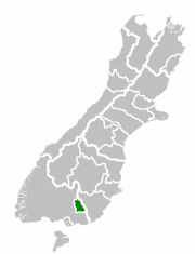 Location of the Gore District within the South Island of New Zealand | |
 Gore Location of Gore | |
| Coordinates: 46°05′57″S 168°56′47″E / 46.09917°S 168.94639°E | |
| Country | |
| Region | Southland |
| Territorial authority | Gore District |
| Government | |
| • Mayor | Tracy Hicks |
| • Deputy Mayor | Cliff Bolger |
| Area | |
| • Territorial | 1,251.62 km2 (483.25 sq mi) |
| Population (June 2020)[1] | |
| • Territorial | 12,900 |
| • Density | 10/km2 (27/sq mi) |
| • Urban | 8,230 |
| Time zone | UTC+12 (NZST) |
| • Summer (DST) | UTC+13 (NZDT) |
| Postcode(s) | 9710 |
| Area code(s) | 03 |
| Local iwi | Ngāi Tahu |
| Website | www.GoreDC.govt.nz |

Gore (Māori: Maruawai) is a town and district in the Southland region of the South Island of New Zealand.
Geography[]

The town of Gore is located on State Highway 1 64 kilometres northeast of Invercargill and 70 km west of Balclutha – Dunedin and Invercargill are the nearest cities. The Gore District has a resident population of 12,900 (June 2020).[1] The urban area estimated resident population at the June 2020 was 8,230, the second largest in Southland.[1] Gore is a service town for the surrounding farm communities. It is divided by the Mataura River into Gore and East Gore, the majority of the town being situated on the western banks of the river.
The Main South Line railway from Christchurch to Invercargill runs through the town, though passenger services ceased in 2002 with the cancellation of the Southerner. Gore was once a busy railway junction; the Waimea Plains Railway ran west to connect with the Kingston Branch in Lumsden, while the Waikaka Branch connected with the Main South Line nearby in McNab. The original Kingston Flyer ran between Gore, on the main Dunedin-Invercargill line, and Kingston, from where lake steamers provided a connection with Queenstown.[2] It was withdrawn in 1937, although specials continued into the 1950s. The 1970s revival of the Flyer did not include Gore.
Climate[]
In Köppen-Geiger climate classification system, it has an oceanic climate.[3]
| hideClimate data for Gore | |||||||||||||
|---|---|---|---|---|---|---|---|---|---|---|---|---|---|
| Month | Jan | Feb | Mar | Apr | May | Jun | Jul | Aug | Sep | Oct | Nov | Dec | Year |
| Average high °C (°F) | 20.1 (68.2) |
20.3 (68.5) |
18.4 (65.1) |
15.6 (60.1) |
12.1 (53.8) |
8.8 (47.8) |
8.8 (47.8) |
10.8 (51.4) |
13.3 (55.9) |
15.3 (59.5) |
17.1 (62.8) |
18.9 (66.0) |
15.0 (58.9) |
| Daily mean °C (°F) | 14.9 (58.8) |
15 (59) |
13.2 (55.8) |
10.7 (51.3) |
7.6 (45.7) |
4.8 (40.6) |
4.5 (40.1) |
6 (43) |
8.4 (47.1) |
10.4 (50.7) |
12 (54) |
13.9 (57.0) |
10.1 (50.3) |
| Average low °C (°F) | 9.8 (49.6) |
9.7 (49.5) |
8.1 (46.6) |
5.8 (42.4) |
3.2 (37.8) |
0.8 (33.4) |
0.3 (32.5) |
1.3 (34.3) |
3.5 (38.3) |
5.5 (41.9) |
6.9 (44.4) |
8.9 (48.0) |
5.3 (41.6) |
| Average precipitation mm (inches) | 104 (4.1) |
71 (2.8) |
88 (3.5) |
86 (3.4) |
102 (4.0) |
83 (3.3) |
69 (2.7) |
59 (2.3) |
74 (2.9) |
84 (3.3) |
76 (3.0) |
91 (3.6) |
987 (38.9) |
| Source: Climate-Data.org[3] | |||||||||||||
Media[]
The FM Hokonui radio station broadcasts from Gore to listeners in Southland and South Otago.
The smaller, locally owned radio station Cave FM broadcasts in Gore and online.
History[]
Before the arrival of Europeans the current site of Gore was a part of or near the routes used by Maori travellers. Tuturau, near modern Mataura, was the nearest Maori settlement. In 1836 southern Maori repelled a raid from the north, which provided sufficient security for Europeans to purchase land and settle in the area. By the mid-1850s large tracts nearby had been converted into sheep runs.
As crossing the Mataura River involved a long fording, the locality became known as "the Long Ford", or Longford. In 1862 a few town sections were surveyed on the west bank of the river and Longford was named Gore as a compliment to Sir Thomas Gore Browne, an early Governor of New Zealand. One of the first buildings was Long Ford House an accommodation house opened by local sawmill owner Daniel Morton[4]
A village named Gordon after Governor Sir Arthur Gordon became established on the opposite bank of the Mataura. By 1864 a road from Balclutha through Gore to Invercargill had been opened for wheeled traffic which allowed the establishment of a regular coach service between Invercargill and Dunedin.
Establishment[]
By 1877 there were enough business opportunities in the area for the Bank of New Zealand to establish a branch in Gore. Within three years both the Bank of Australasia and the Colonial Bank of New Zealand had also opened branches. In 1899 the Bank of New South Wales followed suit.[5]
After its construction began in the early 1870s, a railway line between Invercargill and Gore was opened on 30 August 1875. By 22 January 1879 the railway had been extended to Balclutha where it linked with an existing line to Dunedin. A private Waimea Plains railway from Gore to Lumsden was opened on 31 July 1880. This was subsequently purchased by the Government in 1886. It connected Gore with the Invercargill-Kingston branch line. By 1908 another branch had been completed via McNab to Waikaka. The extension of the railways established Gore as an important hub and had a significant effect on its development.[5]
By 1879, the "Ensign" newspaper was being published in the town, followed in 1887 by the rival "Standard".
Borough[]
In 1885 Gore was constituted a borough and in 1890 Gordon, by now commonly known as East Gore, amalgamated with Gore.[6]
Gore acquired a nickname of "Chicago of the South".[7][8]
By 1905 the population had increased to 2,354, compared with 1,618 in 1891.[9]
The establishment of the Gore Electric Light & Power Syndicate led in 1894 to Gore becoming the third town in New Zealand to install a generator and provide a public electricity supply.[10]
From the end of the Second World War until 1976 Gore enjoyed prosperity driven by record prices for agricultural produce which saw the town’s population rise from 5,000 in 1945 to 9,000 in 1976. By the late 1960s it was reputed to have the highest per-capita retail turnover of any New Zealand town.[6]
Decline[]
The farm sector went into decline after 1976 which led to a corresponding decline in the population. Related businesses also closed, including the town’s iconic cereal mill, which had processed oats and other grains since 1877. Since 2000 prosperity has returned as large numbers of farms in the surrounding area were converted to dairy farms to take advantage of high prices for dairy produce. This growth has led to low unemployment in the town.
Marae[]
O Te Ika Rama Marae is in Gore. It is a marae (meeting ground) of the Hokonui Rūnanga branch of Ngāi Tahu, and includes O Te Ika Rama wharenui (meeting house).[11][12]
In October 2020, the government committed $424,567 from the Provincial Growth Fund to upgrade the marae, creating eight jobs.[13]
Education[]
Gore and surrounding districts have various primary, intermediate and high schools.
The two secondary schools in Gore are:
- Gore High School (the largest school in Gore)
- St Peter's College (Roman Catholic school)
The only intermediate school in Gore is
- Longford Intermediate School. Opened in 1972.[14]
There are four primary schools in Gore:
- East Gore School
- Gore Main School. Opened on 4 October 1878 with 40 pupils. Destroyed by fire on 3 July 1896. This second school was destroyed by fire on7 May 1920 and a replacement was opened in February 1922. With the existing structure reaching the end of its useful life the fourth school on the site on 7 December 1984.[14]
- St Marys School
- West Gore School
There are also another 6 primary schools in the Gore District:
- Knapdale School
- Mataura School
- Otama School
- Pukerau School
- Waikaka School
- Willowbank School
Culture and arts[]
Gore is well known for its connection with Country and Western music, with the annual New Zealand country music awards having been held in the town for 36 years.[15] It has a sister city relationship with Tamworth, New South Wales, the "Country Music Capital of Australia".
Recently Gore has also gained a reputation as a centre for the visual arts in the southern South Island. A major bequest to the town's Eastern Southland Art Gallery by Dr. John Money has left the institution with one of the country's best collections of ethnological art. This is partnered by an impressive collection of modern New Zealand work, including several notable pieces by Ralph Hotere.[16]
Landmarks and notable features[]

The Flemings "Creamoata Mill" is an iconic local building, with Flemings "Creamoata" brand of porridge once promoted by Flemings as the National Breakfast,[17] and the mill itself considered one of the most modern cereal mills in the southern hemisphere. Production of all products was moved to Australia in 2001, and Creamoata was discontinued in 2008 after declining sales.[18] Goodman Fielder claimed that the plant was no longer viable as it was operating at less than one third of its capacity. The building's famous "Sgt Dan" remains because rights to it have been purchased by the buildings current owner "Sgt Dan Stockfoods Ltd".[18] The building has a Category I listing with Heritage New Zealand.[19]
The former East Gore Presbyterian Church of Aotearoa New Zealand is one of the two remaining wooden Gothic churches designed by the eminent architect R.A. Lawson.[20] Built in 1880 and registered as a category 2 historic place by Heritage New Zealand,[21] No longer used as a place of worship the building is currently being converted into an art centre, with a studio and flat for visiting artists. The latter houses the bedroom furniture from the Royal Suite commissioned for the Queen's Royal Tour to Southland in 1954.[22]
The Hokonui Moonshine Museum in the heritage precinct celebrates Gore's part in the "...colourful history of illicit whiskey making and consumption...",[23][24] with illicit whiskey being produced in the Hokonui Hills to the west of the town up until the 1930s.[25]
The St James Theatre on Irk Street is a theatre and cinema, with a main auditorium seating 450 people and a smaller room for 78.[26] It announced in June 2021 that it was in danger of closing if it could not raise money for earthquake strengthening and other renovations.[27]
Notable residents[]
- Ronald Bannerman, a flying ace during World War I. Bannerman Park in north Gore is named after him.
- Jimmy Cowan, international rugby player
- James Hargest, politician and military leader
- Amanda Hooper (Christie), International Women's Hockey
- Luke Hurley, musician
- , television journalist[28]
- Roy Kerr, mathematical physicist
- Shona McFarlane, artist and broadcaster
- Hugh McIntyre (1888–1982), chairman of the Alliance Freezing Company (Southland)
- Brian McKechnie (born 1953), international cricket and rugby player
- Justin Marshall, international rugby player
- Mike Puru, radio host
- Geoff Rabone, international cricketer
- Eric Roy, politician
- Jenny Shipley, former Prime Minister of New Zealand
- Barry Soper, political journalist
- Stu Wilson, international rugby player
- Courtney Winsloe, Otago Sparks cricketer
See also[]
References[]
- ^ Jump up to: a b c "Population estimate tables - NZ.Stat". Statistics New Zealand. Retrieved 22 October 2020.
- ^ "Full steam ahead for Kingston Flyer". New Zealand History. Retrieved 28 September 2018.
- ^ Jump up to: a b "Climate: Gore - Climate graph, Temperature graph, Climate table". Climate-Data.org. Archived from the original on 3 March 2016. Retrieved 2 September 2013.
- ^ "4. – Southland places – Te Ara: The Encyclopedia of New Zealand". Teara.govt.nz. 13 May 2015. Retrieved 9 July 2015.
- ^ Jump up to: a b "Gore". NZETC. Retrieved 9 July 2015.
- ^ Jump up to: a b "GORE – Te Ara: The Encyclopedia of New Zealand". Teara.govt.nz. Retrieved 9 July 2015.
- ^ "A Trip to the Goldfields of Otago - Part VII". The Southland Times. 29 May 1890. p. 3.
- ^ "Untitled". The Mataura Ensign. 3 May 1892. p. 2.
- ^ "Southland". NZETC. Retrieved 9 July 2015.
- ^ Reilly, Helen: "Connecting the Country – New Zealand’s national grid 1886-2007". Page 65. Steele Roberts, Wellington. ISBN 978-1-877448-40-9.
- ^ "Te Kāhui Māngai directory". tkm.govt.nz. Te Puni Kōkiri.
- ^ "Māori Maps". maorimaps.com. Te Potiki National Trust.
- ^ "Marae Announcements" (Excel). growregions.govt.nz. Provincial Growth Fund. 9 October 2020.
- ^ Jump up to: a b Barnett, Robert (2003). Gore (Public) Main School: A Brief Survey of History & Events (Paperback). Gore: Gore Main School. pp. 3–7, 35.
- ^ [1] Archived 18 November 2009 at the Wayback Machine
- ^ [2] Archived 25 June 2007 at the Wayback Machine
- ^ "Nostalgia". New Zealand Post. Archived from the original on 22 May 2010. Retrieved 22 January 2010.
- ^ Jump up to: a b McNeilly, Hamish (6 October 2008). "No Creamoata, but Dan soldiers on". The Otago Daily Times. Retrieved 22 January 2010.
- ^ "Fleming's Creamoata Mill complex". Register of Historic Places. Heritage New Zealand. Retrieved 25 January 2010.
- ^ J.F. McArthur (1981). From the Kirk on the Hill. Gore Publishing Company.
- ^ "Presbyterian Church (former)". Register of Historic Places. Heritage New Zealand. Retrieved 9 January 2016.
- ^ "Visiting Artist Programme with New Zealand" (PDF). Hazelhurst Regional Gallery & Arts Centre, Sutherland Shire Council. Autumn 2004. Archived from the original (PDF) on 24 May 2006.
- ^ Hokonui Moonshiners Museum, Gore District Council
- ^ "Old Hokonui", original label, National Library of New Zealand
- ^ "Illicit Whisky Still", 1934, Auckland Star
- ^ "ABOUT US, St James Theatre". www.sbsstjamesgore.co.nz. Retrieved 1 June 2021.
- ^ "Gore's St James Theatre in danger of closure unless council helps with funding". Stuff. 1 June 2021. Retrieved 1 June 2021.
- ^ "TV's Hadyn Jones". Sunday Star Times. 1 January 2009. Retrieved 30 April 2010.
Further reading[]
- Ballantyne, Tony (2010). "Thinking Local: Knowledge, Sociability and Community in Gore's Intellectual Life, 1875–1914" (PDF). New Zealand Journal of History. Auckland: Department of History, University of Auckland. 44 (2): 128–156.
- Ballantyne, Tony (2011). "On Place, Space and Mobility in Nineteenth-Century New Zealand" (PDF). New Zealand Journal of History. Auckland: Department of History, University of Auckland. 45 (1): 50–70.
- Beattie, Herries (1962). A History of Gore and Surrounding Districts (Paperback). Gore: Gore Publishing Co. ISBN 0-473-04238-X.
- Benny, T. Ralph (1963). What God Hath Wrought: The History of Methodism in the Gore District 1879-1961 (PDF) (Paperback). Gore: Gore Methodist Council.
- Feeley, John R. (2012). Valley of Water: The Story of Gore and District the First Sixty Years (Paperback). Christchurch: J.R. Feeley. ISBN 978-0-4732-2253-6.
- Kerse, E. (1943). The Origin and Development of Gore and Its Surrounding Districts (BA (Honours)). Dunedin: University of Otago.
- McArthur, John Findlay (1966). Progress in retrospect: A history of the first decade of the Mataura Licensing Trust, from 1955 to 1965; with a background to Trust control in the Mataura Licensing District (Paperback). Gore: Gore Publishing Co.
- McArthur, John Findlay (1981). From the Kirk on the Hill 1881-1981 (Paperback). Gore: Gore Publishing Co. A history of the Presbyterian Church in Gore.
- Smith, Hallam L. (1996). A History of the Town of Gore: Part 1, The Beginnings (Paperback). Gore: The Wayland Trust. ISBN 0-473-04238-X.
- Smith, Hallam L. (1997). A History of the Town of Gore: Part 2, The Introduction and Development of the Supply of Light and Power (Paperback). Gore: The Wayland Trust. ISBN 0-473-04238-X.
- Smith, Hallam L. (1997). A History of the Town of Gore: Part 3, The Town's Streets and the Origin of Their Names (Paperback). Gore: The Wayland Trust. ISBN 0-473-04238-X.
- Smith, Rosemarie (1993). The Ladies Are at It Again! Gore Debates the Women's Franchise. Wellington: Victoria University of Wellington. ISBN 978-0-4751-1018-3.
- Tam, Cecilia Wing Sze (2001). Paleoenvironment of the Gore District (BSc(Hons)). Dunedin: University of Otago.
- Gore Heritage Trail Brochure.
External links[]
| Wikimedia Commons has media related to Gore, New Zealand. |
- Gore District Council
- The Golden Guitar Awards site
- Hocken Collection Bulletin 38 - New Zealand’s ‘Little Lichfield’ - The literature of Eastern Southland
| Authority control |
|
|---|
Coordinates: 46°05′57″S 168°56′47″E / 46.09917°S 168.94639°E
- Gore, New Zealand
- Gore District, New Zealand
- Populated places in Southland, New Zealand