Gotland County
Gotland County
Gotlands län | |
|---|---|
 Flag 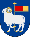 Coat of arms | |
 Gotland County in Sweden | |
 Location map of Gotland County in Sweden | |
| Coordinates: 57°29′57″N 18°30′34″E / 57.49917°N 18.50944°E | |
| Country | Sweden |
| Founded | 1658 |
| Capital | Visby |
| Government | |
| • Governor | Anders Flanking |
| • Municipality | Region Gotland |
| Area | |
| • Total | 3,151.4 km2 (1,216.8 sq mi) |
| Population (September 30, 2017)[1] | |
| • Total | 58,464 |
| • Density | 19/km2 (48/sq mi) |
| Time zone | UTC+1 (CET) |
| • Summer (DST) | UTC+2 (CEST) |
| ISO 3166 code | SE-I |
| GDP/ Nominal | SEK 12,154 million (2004) |
| GDP per capita | SEK 212,000 |
| NUTS Region | SE214 |
| Website | www |
Gotland County (Swedish: Gotlands län) is a county or län of Sweden. Gotland is located in the Baltic Sea to the east of Öland, and is the largest of Sweden's islands. Counties are usually sub-divided into municipalities, but Gotland County only consists of one municipality: Region Gotland. Gotland County is the only county in Sweden that is not governed by a county council. The municipality handles the tasks that are otherwise handled by the county council, mainly health care and public transport. Like other counties, Gotland has a County Administrative Board that oversees implementation of the Swedish state government. Both the County Administrative Board and the municipality have their seat in the largest city Visby, with over 22,000 inhabitants. it has the lowest population of any Swedish County.
Province[]
The provinces of Sweden are no longer officially administrative units, but are used when reporting population size, politics, etc. In this case the province, the county and the municipality all have identical borders and cover an area of 3151 km²[2]
Administration[]
Gotland is the only Swedish county that is not administered by a county council. Instead, the municipality is tasked with the responsibilities of a county, including public health care and public transport.
The main aim of the County Administrative Board is to fulfil the goals set in national politics by the Riksdag and the Government, to coordinate the interests and promote the development of the county, to establish regional goals and safeguard the due process of law in the handling of each case. The County Administrative Board is a Government agency headed by a Governor.
Mats Löfving is the regional police chief for both Stockholm and Gotland Counties.[3]
Politics[]
During a trial period the County Council provisions for Gotland has been evolved to provisions for a Regional Council, meaning that it has assumed certain tasks from the County Administrative Board. Similar provisions are applicable to the counties of Västra Götaland and Skåne during the trial period.
Governors[]
Localities in order of size[]
The five most populous localities of Gotland County in 2010:[4]
| # | Locality | Population |
|---|---|---|
| 1 | Visby | 22,593 |
| 2 | Hemse | 1,715 |
| 3 | Slite | 1,483 |
| 4 | Klintehamn | 1,363 |
| 5 | Vibble | 1,286 |
Foreign background[]
SCB have collected statistics on backgrounds of residents since 2002. These tables consist of all who have two foreign-born parents or are born abroad themselves.[5] The chart lists election years and the last year on record alone.
| Location | 2002 | 2006 | 2010 | 2014 | 2018 | 2019 |
|---|---|---|---|---|---|---|
| Gotland | 4.8 | 5.2 | 5.8 | 6.4 | 8.8 | 9.2 |
| Source: SCB [5] | ||||||
Heraldry[]
Gotland County inherited its coat of arms from the province of Gotland. When it is shown with a royal crown it represents the County Administrative Board.
References[]
- ^ "Folkmängd i riket, län och kommuner 30 september 2017 och befolkningsförändringar 1 juli–30 september 2017. Totalt". Statistics Sweden. 8 November 2017. Retrieved 19 November 2017.
- ^ "Statistisk årsbok för Sverige 2009" (in Swedish). Statistics Sweden.
- ^ Mats Löfving ny Regionpolischef at aftonbladet.se, 1 October 2020, accessed 6 October 2020 (in Swedish)
- ^ "Tätorter 2010 (Localities 2010)". Statistics Sweden (in Swedish). 2010. Retrieved 9 February 2014.
- ^ a b "PxWeb - välj variabler och värden" (in Swedish). SCB. Retrieved 11 August 2020.
External links[]

Regional councils of Sweden | ||
|---|---|---|
Coordinates: 57°29′57″N 18°30′34″E / 57.499167°N 18.509444°E
Authority control | |
|---|---|
| General | |
| National libraries | |
| Other |
|
- Gotland County
- Gotland
- Counties of Sweden