Västernorrland County
Västernorrland County
Västernorrlands län | |
|---|---|
 Flag  Coat of arms | |
 Västernorrland County in Sweden | |
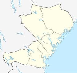 Location map of Västernorrland County in Sweden | |
| Country | |
| Largest city | Sundsvall |
| Founded | 1634 |
| Capital | Härnösand |
| Municipalities | |
| Government | |
| • Governor | |
| • Council | Landstinget Västernorrland |
| Area | |
| • Total | 21,683.8 km2 (8,372.2 sq mi) |
| Population (30 September 2017)[1] | |
| • Total | 246,082 |
| • Density | 11/km2 (29/sq mi) |
| Time zone | UTC+1 (CET) |
| • Summer (DST) | UTC+2 (CEST) |
| ISO 3166 code | SE-Y |
| GDP/ Nominal | SEK 61,540 million (2004) |
| GDP per capita | SEK 251,000 |
| NUTS Region | SE321 |
| Website | www |
Västernorrland County (Swedish: Västernorrlands län) is a county (län) in the north of Sweden. It is bordered by the counties of Gävleborg, Jämtland, Västerbotten and the Gulf of Bothnia.
The name Västernorrland means "Western Norrland", as it was in the western part of the original Norrland (northern Sweden and northern Finland).
Province[]
For History, Geography and Culture, see: Ångermanland or Medelpad
Västernorrland County covers approximately the historical provinces of Ångermanland (Angermannia) and Medelpad.
Administration[]
The main aim of the county administrative board – a government agency headed by a governor – is to fulfil the goals set out in national politics by the Riksdag and the government, to coordinate the interests of the county, to promote the development of the county, to establish regional goals and safeguard the due process of law in the handling of each case. See List of Västernorrland governors.
Politics[]
The county council of Västernorrland is the Landstinget i Västernorrland.
Riksdag elections[]
The table details all Riksdag election results of Västernorrland County since the unicameral era began in 1970. The blocs denote which party would support the Prime Minister or the lead opposition party towards the end of the elected parliament.
| Year | Turnout | Votes | V | S | MP | C | L | KD | M | SD | NyD | Left | Right |
|---|---|---|---|---|---|---|---|---|---|---|---|---|---|
| 1970[2] | 89.1 | 177,619 | 6.6 | 52.2 | 23.0 | 9.5 | 2.5 | 5.9 | 58.8 | 38.4 | |||
| 1973[3] | 92.1 | 178,788 | 6.3 | 50.7 | 27.7 | 5.6 | 2.4 | 6.7 | 57.0 | 40.1 | |||
| 1976[4] | 92.7 | 186,498 | 5.0 | 50.4 | 28.4 | 6.8 | 1.8 | 7.3 | 55.4 | 42.5 | |||
| 1979[5] | 92.0 | 185,794 | 5.4 | 51.2 | 23.6 | 6.5 | 1.8 | 10.8 | 56.6 | 40.9 | |||
| 1982[6] | 92.2 | 186,181 | 5.3 | 53.7 | 1.4 | 20.9 | 3.8 | 2.3 | 12.4 | 59.0 | 37.1 | ||
| 1985[7] | 90.5 | 183,019 | 5.4 | 53.2 | 1.3 | 17.6 | 10.0 | 12.2 | 58.6 | 39.8 | |||
| 1988[8] | 86.6 | 173,568 | 6.0 | 51.6 | 5.1 | 14.9 | 8.8 | 3.6 | 9.4 | 62.7 | 33.1 | ||
| 1991[9] | 86.8 | 173,566 | 5.1 | 47.9 | 3.1 | 11.3 | 7.3 | 7.1 | 13.0 | 4.7 | 53.0 | 38.7 | |
| 1994[10] | 87.1 | 173,210 | 6.7 | 55.0 | 4.8 | 9.2 | 6.0 | 3.9 | 13.0 | 0.7 | 66.6 | 32.1 | |
| 1998[11] | 81.6 | 157,892 | 14.8 | 45.1 | 4.1 | 6.6 | 3.6 | 10.2 | 13.7 | 64.0 | 34.1 | ||
| 2002[12] | 79.5 | 150,966 | 9.9 | 49.3 | 3.8 | 9.6 | 9.3 | 7.6 | 8.5 | 0.8 | 63.0 | 35.0 | |
| 2006[13] | 81.5 | 153,417 | 6.7 | 46.0 | 3.8 | 10.6 | 5.4 | 5.7 | 17.2 | 2.2 | 56.5 | 38.8 | |
| 2010[14] | 84.6 | 159,975 | 6.0 | 44.0 | 5.5 | 7.0 | 5.2 | 4.4 | 21.6 | 4.5 | 55.5 | 38.1 | |
| 2014[15] | 86.1 | 162,112 | 5.7 | 46.3 | 4.4 | 6.7 | 3.4 | 3.8 | 15.9 | 10.8 | 56.3 | 29.8 | |
| 2018[16] | 87.8 | 163,001 | 8.2 | 39.8 | 2.7 | 9.9 | 3.4 | 5.4 | 13.7 | 15.6 | 60.5 | 38.1 |
Municipalities[]

In Medelpad Province:
In Ångermanland Province:
Demographics[]
Foreign background[]
SCB have collected statistics on backgrounds of residents since 2002. These tables consist of all who have two foreign-born parents or are born abroad themselves.[17] The chart lists election years and the last year on record alone.
| Location | 2002 | 2006 | 2010 | 2014 | 2018 | 2019 |
|---|---|---|---|---|---|---|
| Härnösand | 5.9 | 7.7 | 9.1 | 12.7 | 17.4 | 17.7 |
| Kramfors | 5.3 | 6.5 | 8.2 | 11.1 | 15.3 | 15.8 |
| Sollefteå | 5.0 | 6.1 | 7.9 | 11.1 | 14.9 | 14.2 |
| Sundsvall | 7.4 | 8.4 | 10.1 | 11.9 | 13.9 | 14.4 |
| Timrå | 6.4 | 7.8 | 9.5 | 11.0 | 12.2 | 12.2 |
| Ånge | 4.0 | 5.2 | 6.4 | 7.8 | 10.0 | 9.7 |
| Örnsköldsvik | 5.0 | 6.0 | 7.2 | 8.3 | 11.1 | 11.5 |
| Total | 6.1 | 7.3 | 8.8 | 10.8 | 13.5 | 13.9 |
| Source: SCB [17] | ||||||
History[]
Västernorrland County was formed in 1634, when counties were introduced, replacing the older provinces. Västernorrland then included parts of Sweden north of the city of Gävle, except Jämtland and Härjedalen – which belonged to Norway – and except Finland.
The county grew and shrank significantly since its creation. The boundary adjustments:
- Västerbotten County was separated in 1637.
- Jämtland and Härjedalen joined in 1657, but they both separated as Jämtland County in 1810.
- Gävleborg County separated in 1762.
- Other minor changes have taken place.

Even though the name Västernorrland literally means "Western Norrland", it is today situated on the eastern coast of Swedish Norrland. The "west" in its name (väster) arose due to the fact that, at the time, Norrland was a much larger region, including northern Finland as well. Västernorrland was therefore in the western "arm" of Norrland in its broadest sense.
Heraldry[]
The arms for the County of Västernorrland are a combination of those of Ångermanland and Medelpad. When it is shown with a royal crown, it represents the county administrative board. Blazon: "Parted per pale, the arms of Angermannia and the arms of Medelpad."
Miscellaneous topics[]
Local public transport in the county is provided by Din Tur.
See also[]
- Rutberget, a 342m high mountain
References and notes[]
- ^ "Folkmängd i riket, län och kommuner 30 september 2017 och befolkningsförändringar 1 juli–30 september 2017. Totalt". Statistics Sweden. 2017-11-08. Retrieved 2017-11-19.
- ^ "Riksdagsvalet 1970" (PDF). SCB. Retrieved 21 September 2021.
- ^ "Riksdagsvalet 1973" (PDF) (in Swedish). SCB. Retrieved 14 September 2021.
- ^ "Riksdagsvalet 1976" (PDF) (in Swedish). SCB. Retrieved 14 September 2021.
- ^ "Riksdagsvalet 1979" (PDF) (in Swedish). SCB. Retrieved 14 September 2021.
- ^ "Riksdagsvalet 1982)" (PDF) (in Swedish). SCB. Retrieved 14 September 2021.
- ^ "Riksdagsvalet 1985" (PDF) (in Swedish). SCB. Retrieved 14 September 2021.
- ^ "Riksdagsvalet 1988)" (PDF) (in Swedish). SCB. Retrieved 14 September 2021.
- ^ "Riksdagsvalet 1991" (PDF) (in Swedish). SCB. Retrieved 14 September 2021.
- ^ "Riksdagsvalet 1994" (PDF) (in Swedish). SCB. Retrieved 14 September 2021.
- ^ "Riksdagsvalet 1998" (PDF) (in Swedish). SCB. Retrieved 14 September 2021.
- ^ "Valresultat Riksdag 2002" (in Swedish). Valmyndigheten. Retrieved 14 September 2021.
- ^ "Allmänna val 17 september 2006" (in Swedish). Valmyndigheten. Retrieved 14 September 2021.
- ^ "Röster - Val 2010" (in Swedish). Valmyndigheten. Retrieved 14 September 2021.
- ^ "Röster - Val 2014" (in Swedish). Valmyndigheten. Retrieved 14 September 2021.
- ^ "Röster - Val 2018" (in Swedish). Valmyndigheten. Retrieved 14 September 2021.
- ^ a b "PxWeb - välj variabler och värden" (in Swedish). SCB. Retrieved 11 August 2020.
External links[]
| Wikivoyage has a travel guide for Västernorrland County. |
- Västernorrland County Administrative Board
- Västernorrland County Council
- Regional Association of Local Authorities in Västernorrland
Municipalities and seats of Västernorrland County | ||
|---|---|---|
| Municipalities | ||
| Municipal seats | ||
Regional councils of Sweden | ||
|---|---|---|
Coordinates: 62°44′23″N 16°55′48″E / 62.739633°N 16.929932°E

Authority control | |
|---|---|
| General | |
| National libraries | |
| Other |
|
- Västernorrland County
- Counties of Sweden
- Ångermanland
- Medelpad