Grønfjellåga
| Grønfjellåga | |
|---|---|
 | |
 Location of the river | |
| Location | |
| Country | Norway |
| County | Nordland |
| Municipalities | Rana Municipality |
| Physical characteristics | |
| Source | Kopparvassdalen valley |
| • location | Rana, Norway |
| • coordinates | 66°19′59″N 14°52′18″E / 66.333026°N 14.871733°E |
| • elevation | 440 metres (1,440 ft) |
| Mouth | Ranelva river |
• location | Nevernes, Rana, Norway |
• coordinates | 66°22′24″N 14°35′33″E / 66.37332°N 14.592397°ECoordinates: 66°22′24″N 14°35′33″E / 66.37332°N 14.592397°E |
• elevation | 83 metres (272 ft) |
| Length | 17 km (11 mi) |


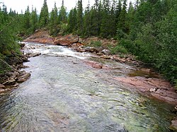
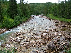
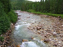
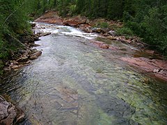
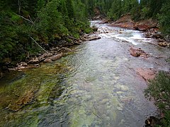
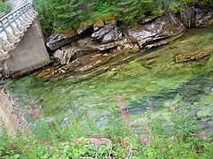
Grønfjellåga (lit. "the river of the green mountain") is a river in the municipality of Rana in Nordland county, Norway. The 17-kilometre (11 mi) long river's source is the lakes Kallvatnet and . It then flows through the Grønfjelldalen valley while absorbing several smaller rivers, before it flows out as a tributary to the river Ranelva at the Dunderforsen waterfall (also called Stupforsen).[1]
Media gallery[]
These photos are from a place 3.5 kilometres (2.2 mi) east of Stupforsen:


References[]
- ^ "Grønfjellåga" (in Norwegian). yr.no. Retrieved 2011-12-20.
This Nordland location article is a stub. You can help Wikipedia by . |
Categories:
- Rana, Norway
- Rivers of Nordland
- Rivers of Norway
- Nordland geography stubs
- Norway river stubs