Grade II listed buildings in Brighton and Hove: P–R

From Wikipedia, the free encyclopedia
The mid-19th-century Prince Albert pub in the North Laine has a Banksy mural and prominent artwork depicting deceased musicians.[1]

As of February 2001, there were 1,124 listed buildings with Grade II status in the English city of Brighton and Hove.[2] The total at 2009 was similar.[3] The city, on the English Channel coast approximately 52 miles (84 km) south of London, was formed as a unitary authority in 1997 by the merger of the neighbouring towns of Brighton and Hove. Queen Elizabeth II granted city status in 2000.[4]

In England, a building or structure is defined as "listed" when it is placed on a statutory register of buildings of "special architectural or historic interest" by the Secretary of State for Culture, Media and Sport, a Government department, in accordance with the Planning (Listed Buildings and Conservation Areas) Act 1990.[5] English Heritage, a non-departmental public body, acts as an agency of this department to administer the process and advise the department on relevant issues.[6] There are three grades of listing status. The Grade II designation is the lowest, and is used for "nationally important buildings of special interest".[7] Grade II* is used for "particularly important buildings of more than special interest";[7] there are 69 such buildings in the city. There are also 24 Grade I listed buildings (defined as being of "exceptional interest" and greater than national importance, and the highest of the three grades)[7] in Brighton and Hove.

This list summarises 123 Grade II-listed buildings and structures whose names begin with P, Q or R. Numbered buildings with no individual name are listed by the name of the street they stand on. Some listings include contributory fixtures such as surrounding walls or railings in front of the building. These are summarised by notes alongside the building name.

Listed buildings[]

Map all coordinates using: OpenStreetMap 
Download coordinates as: KML
Contributory fixtures
Note Listing includes
[A] Attached railings
[B] Attached railings and carriage arch
[C] Attached walls
[D] Attached walls and piers
[E] Attached walls and railings
[F] Attached walls, piers and railings
Building name Area Image Notes Refs
7–19 Palmeira Mansions
(More images)
Hove
50°49′37″N 0°09′46″W / 50.8269°N 0.1627°W / 50.8269; -0.1627 (7–19 Palmeira Mansions, Hove)
7–19 Palmeira Mansions, Church Road, Hove (NHLE Code 1187548) (June 2016).jpg . [8]
21–31 Palmeira Mansions
(More images)
Hove
50°49′38″N 0°09′49″W / 50.8271°N 0.1637°W / 50.8271; -0.1637 (21–31 Palmeira Mansions, Hove)
21–31 Palmeira Mansions, Church Road, Hove (NHLE Code 1187549) (September 2019) (1).jpg . [9]
1–17 Palmeira Square[A]
(More images)
Hove
50°49′35″N 0°09′46″W / 50.8263°N 0.1629°W / 50.8263; -0.1629 (1–17 Palmeira Square, Hove)
1–17 Palmeira Square, Hove (NHLE Code 1298646).JPG . [10]
18–30 Palmeira Square[A]
(More images)
Hove
50°49′35″N 0°09′50″W / 50.8265°N 0.1640°W / 50.8265; -0.1640 (18–30 Palmeira Square, Hove)
18–30 Palmeira Square, Hove (NHLE Code 1187581) (April 2016).JPG . [11]
Parochial Offices (former)
(More images)
Kemptown
50°49′20″N 0°08′09″W / 50.8222°N 0.1358°W / 50.8222; -0.1358 (Parochial Offices (former), Kemptown)
Former Parochial Offices, 15–17 Princes Street, Brighton (NHLE Code 1380776) (June 2010).jpg . [12]
Park Street Gate[F]
(More images)
Queen's Park
50°49′24″N 0°07′36″W / 50.8232°N 0.1268°W / 50.8232; -0.1268 (Park Street Gate, Queen's Park)
Park Street Gate, Park Street, Queen's Park, Brighton (NHLE Code 1380703) (August 2019) (2).JPG Queen's Park opened as Brighton Park in 1823 and was given two triumphal arch entrances in the late 19th century. In 1890 Francis May designed both Egremont Gate and the less ornate Park Gate, which is built of artificial stone with a tall central arch to the road and flat-arched side entrances for pedestrians. The main arch has an architrave with a prominent keystone, a dentil cornice and an inscribed panel naming the trustees who were responsible for giving the park to the residents of Brighton. [13][14]
Patcham Court Farmhouse Patcham
50°52′02″N 0°09′04″W / 50.8673°N 0.1512°W / 50.8673; -0.1512 (Patcham Court Farmhouse, Patcham)
Patcham Court Farmhouse, Vale Avenue, Patcham (NHLE Code 1381069) (December 2016).JPG . [15]
4–7 Pavilion Buildings Brighton
50°49′20″N 0°08′18″W / 50.8221°N 0.1382°W / 50.8221; -0.1382 (4–7 Pavilion Buildings, Brighton)
4–7 Pavilion Buildings, Brighton (NHLE Code 1380707) (July 2010).jpg . [16]
12–14 Pavilion Buildings
(More images)
Brighton
50°49′18″N 0°08′18″W / 50.8216°N 0.1382°W / 50.8216; -0.1382 (12–14 Pavilion Buildings, Brighton)
12–14 Pavilion Buildings, Brighton (NHLE Code 1380709) (September 2018).JPG . [17]
3 and 4 Pavilion Parade[A] Brighton
50°49′22″N 0°08′10″W / 50.8227°N 0.1360°W / 50.8227; -0.1360 (3 and 4 Pavilion Parade, Brighton)
3 and 4 Pavilion Parade, Brighton (NHLE Code 1380711) (August 2019) (1).JPG . [18]
5 Pavilion Parade Brighton
50°49′22″N 0°08′10″W / 50.8227°N 0.1361°W / 50.8227; -0.1361 (5 Pavilion Parade, Brighton)
5 Pavilion Parade, Brighton (NHLE Code 1380712) (August 2010).jpg . [19]
6–11 Pavilion Parade Brighton
50°49′21″N 0°08′10″W / 50.8224°N 0.1362°W / 50.8224; -0.1362 (6–11 Pavilion Parade, Brighton)
6–11 Pavilion Parade, Brighton (NHLE Code 1380713) (January 2012).jpg . [20]
Pavilion Theatre
(More images)
North Laine
50°49′25″N 0°08′21″W / 50.8236°N 0.1391°W / 50.8236; -0.1391 (Pavilion Theatre, North Laine)
Pavilion Theatre, New Road, North Laine, Brighton (NHLE Code 1380108) (December 2012) (3).JPG . [21]
Pearson House Kemptown
50°49′07″N 0°07′14″W / 50.8185°N 0.1205°W / 50.8185; -0.1205 (Pearson House, Kemptown)
Pearson House (now Sussex House - part of RSCH), St George's Road, Kemptown, Brighton (NHLE Code 1380723) (June 2010).jpg . [22]
Pelham Institute (former)
(More images)
Kemptown
50°49′12″N 0°07′34″W / 50.8200°N 0.1262°W / 50.8200; -0.1262 (Pelham Institute (former), Kemptown)
Pelham Institute, Upper Bedford Street, Brighton (NHLE Code 1381050) (July 2015) (1).jpg . [23]
1–7 Pelham Square North Laine
50°49′40″N 0°08′11″W / 50.8277°N 0.1364°W / 50.8277; -0.1364 (1–7 Pelham Square, North Laine)
1–7 Pelham Square, North Laine, Brighton (NHLE Code 1380715) (June 2010).JPG . [24]
8–12 Pelham Square[A] North Laine
50°49′39″N 0°08′13″W / 50.8275°N 0.1369°W / 50.8275; -0.1369 (8–12 Pelham Square, North Laine)
8–12 Pelham Square, North Laine, Brighton (NHLE Code 1380715) (June 2010).JPG . [25]
15–24 Pelham Square North Laine
50°49′40″N 0°08′14″W / 50.8277°N 0.1371°W / 50.8277; -0.1371 (15–24 Pelham Square, North Laine)
15–24 Pelham Square, North Laine, Brighton (NHLE Code 1380717) (June 2010).JPG . [26]
25 Pelham Square North Laine
50°49′41″N 0°08′13″W / 50.8280°N 0.1370°W / 50.8280; -0.1370 (25 Pelham Square, North Laine)
25 Pelham Square, North Laine, Brighton (NHLE Code 1381034) (August 2010).jpg . [27]
Pennant Lodge[F] Queen's Park
50°49′36″N 0°07′31″W / 50.8266°N 0.1253°W / 50.8266; -0.1253 (Pennant Lodge, Queen's Park)
Pennant Lodge, West Drive, Queen's Park, Brighton (NHLE Code 1381095) (April 2013) (2).jpg . [28]
Pepper Pot
(More images)
Queen's Park
50°49′38″N 0°07′29″W / 50.8273°N 0.1248°W / 50.8273; -0.1248 (Pepper Pot, Queen's Park)
The Pepper Pot, Tower Road, Queen's Park, Brighton (NHLE Code 1381031) (April 2013) (3).jpg . [29]
1–8 Percival Terrace[A]
(More images)
Kemp Town
50°49′00″N 0°06′59″W / 50.8166°N 0.1164°W / 50.8166; -0.1164 (1–8 Percival Terrace, Kemp Town)
1–8 Percival Terrace, Kemp Town, Brighton (NHLE Code 1380719) (May 2010).JPG . [30]
Percy and Wagner Almshouses
(More images)
Brighton
50°49′54″N 0°07′47″W / 50.8317°N 0.1297°W / 50.8317; -0.1297 (Percy and Wagner Almshouses, Brighton)
Percy and Wagner Almshouses, Lewes Road, Brighton (March 2013).JPG . [31]
Phoenix Brewery office (former)
(More images)
Brighton
50°49′44″N 0°08′00″W / 50.8289°N 0.1333°W / 50.8289; -0.1333 (Phoenix Brewery office (former), Brighton)
Former Phoenix Brewery Office (now Phoenix Community Centre), Phoenix Place, Brighton (NHLE Code 1380720) (March 2016) (4).jpg . [32]
Pillar Box at Montpelier Road
(More images)
Brighton
50°49′29″N 0°09′11″W / 50.8248°N 0.1530°W / 50.8248; -0.1530 (Pillar Box at Montpelier Road, Brighton)
Pillar Box at Montpelier Road, Brighton (NHLE Code 1381589) (January 2012).JPG This pillar box is a First National Standard type dating from 1859 and cast by the Cochrane Grove & Co. foundry in Dudley. Such boxes are very rare, but this example is believed to be the only "anonymous" one in the United Kingdom, lacking any Royal cypher or any emblem indicating that it belongs to the General Post Office. It is a cylindrical cast iron box on a moulded plinth, topped with a shallow dome immediately above the narrow slot. [33]
Port Hall[C] Prestonville
50°50′09″N 0°09′06″W / 50.8359°N 0.1517°W / 50.8359; -0.1517 (Port Hall, Prestonville)
Port Hall, 70 Dyke Road, Prestonville, Brighton (NHLE Code 1380458) (May 2016).JPG . [34]
1–11 Portland Place[F] Kemptown
50°49′05″N 0°07′15″W / 50.8180°N 0.1209°W / 50.8180; -0.1209 (1–11 Portland Place, Kemptown)
1–11 Portland Place, Brighton (NHLE Code 1380722) (June 2010).JPG . [35]
15–25 Portland Place[A] Kemptown
50°49′04″N 0°07′13″W / 50.8179°N 0.1204°W / 50.8179; -0.1204 (15–25 Portland Place, Kemptown)
15–25 Portland Place, Brighton (NHLE Code 1380724) (June 2010).JPG . [36]
Portslade railway station[C]
(More images)
Portslade
50°50′09″N 0°12′19″W / 50.8357°N 0.2052°W / 50.8357; -0.2052 (Portslade railway station, Portslade)
Portslade Railway Station (Main Building), Portland Road, Portslade (NHLE Code 1209609) (November 2015) (4).JPG . [37]
Post Office (former), College Road[F] Kemptown
50°49′10″N 0°07′23″W / 50.8194°N 0.1231°W / 50.8194; -0.1231 (Post Office (former), College Road, Kemptown)
Former Post Office, College Road, Kemptown, Brighton (NHLE Code 1380418) (June 2010).jpg . [38]
Post Office (former), Ship Street
(More images)
The Lanes
50°49��22″N 0°08′30″W / 50.8227°N 0.1416°W / 50.8227; -0.1416 (Post Office (former), Ship Street, The Lanes)
Former Post Office, Ship Street, The Lanes, Brighton (NHLE Code 1380919) (May 2013).JPG . [39]
Post on pavement outside 77 and 78 West Street Brighton
50°49′17″N 0°08′40″W / 50.8213°N 0.1444°W / 50.8213; -0.1444 (Post on pavement outside 77 and 78 West Street, Brighton)
Post on pavement outside 77 and 78 West Street, Brighton (NHLE Code 1381097) (August 2010).JPG . [40]
1–11 Powis Square[A] Montpelier
50°49′40″N 0°08′55″W / 50.8278°N 0.1487°W / 50.8278; -0.1487 (1–11 Powis Square, Montpelier)
1–11 Powis Square, Montpelier, Brighton (NHLE Code 1380726) (September 2010).jpg . [41]
12 Powis Square[A] Montpelier
50°49′39″N 0°08′54″W / 50.8275°N 0.1483°W / 50.8275; -0.1483 (12 Powis Square, Montpelier)
12 Powis Square, Montpelier, Brighton (NHLE Code 1380727) (September 2010).JPG . [42]
13 Powis Square[A] Montpelier
50°49′39″N 0°08′54″W / 50.8274°N 0.1483°W / 50.8274; -0.1483 (13 Powis Square, Montpelier)
13 Powis Square, Montpelier, Brighton (NHLE Code 1380728) (September 2010).JPG . [43]
14–24 Powis Square[A] Montpelier
50°49′39″N 0°08′56″W / 50.8274°N 0.1490°W / 50.8274; -0.1490 (14–24 Powis Square, Montpelier)
14–24 Powis Square, Brighton (NHLE Code 1380729).jpg . [44]
2 Powis Villas[C] Montpelier
50°49′38″N 0°08′54″W / 50.8273°N 0.1482°W / 50.8273; -0.1482 (2 Powis Villas, Montpelier)
2 Powis Villas, Montpelier, Brighton (NHLE Code 1380733) (September 2010).JPG . [45]
3 Powis Villas[C] Montpelier
50°49′39″N 0°08′53″W / 50.8275°N 0.1480°W / 50.8275; -0.1480 (3 Powis Villas, Montpelier)
3 Powis Villas, Montpelier, Brighton (NHLE Code 1380734) (September 2010).JPG . [46]
4 Powis Villas Montpelier
50°49′40″N 0°08′52″W / 50.8277°N 0.1479°W / 50.8277; -0.1479 (4 Powis Villas, Montpelier)
4 Powis Villas, Montpelier, Brighton (NHLE Code 1380735) (September 2010).JPG . [47]
5 Powis Villas[C] Montpelier
50°49′39″N 0°08′51″W / 50.8276°N 0.1475°W / 50.8276; -0.1475 (5 Powis Villas, Montpelier)
5 Powis Villas, Montpelier, Brighton (NHLE Code 1380736) (September 2010).JPG . [48]
6 and 7 Powis Villas[C] Montpelier
50°49′39″N 0°08′52″W / 50.8274°N 0.1477°W / 50.8274; -0.1477 (6 and 7 Powis Villas, Montpelier)
6 and 7 Powis Villas, Montpelier, Brighton (NHLE Code 1380737) (January 2012).JPG . [49]
8 and 9 Powis Villas[C] Montpelier
50°49′38″N 0°08′52″W / 50.8272°N 0.1478°W / 50.8272; -0.1478 (8 and 9 Powis Villas, Montpelier)
8 and 9 Powis Villas, Montpelier, Brighton (NHLE Code 1380738) (September 2010).JPG . [50]
10–13 Powis Villas[C] Montpelier
50°49′37″N 0°08′53″W / 50.8270°N 0.1480°W / 50.8270; -0.1480 (10–13 Powis Villas, Montpelier)
10–13 Powis Villas, Montpelier, Brighton (NHLE Code 1380740) (September 2010).JPG . [51]
Pressley's Brighton
50°49′18″N 0°08′17″W / 50.8217°N 0.1380°W / 50.8217; -0.1380 (Pressley's, Brighton)
Pressleys, Palace Place, Brighton (NHLE Code 1380692) (August 2010).JPG . [52]
199 Preston Road Preston Village
50°50′33″N 0°09′06″W / 50.8426°N 0.1516°W / 50.8426; -0.1516 (199 Preston Road, Preston Village)
199 Preston Road, Preston Village, Brighton (NHLE Code 1380754) (August 2013).JPG . [53]
5 Preston Street Brighton
50°49′21″N 0°09′06″W / 50.8224°N 0.1518°W / 50.8224; -0.1518 (5 Preston Street, Brighton)
5 Preston Street, Brighton (NHLE Code 1380758) (July 2010).jpg . [54]
58 Preston Street Brighton
50°49′27″N 0°09′02″W / 50.8241°N 0.1506°W / 50.8241; -0.1506 (58 Preston Street, Brighton)
58 Preston Street, Brighton (NHLE Code 1380759) (July 2010).jpg . [55]
60 Preston Street Brighton
50°49′26″N 0°09′02″W / 50.8240°N 0.1506°W / 50.8240; -0.1506 (60 Preston Street, Brighton)
60 Preston Street, Brighton (NHLE Code 1380760) (July 2010).jpg . [56]
79 Preston Street[A] Brighton
50°49′22″N 0°09′05″W / 50.8227°N 0.1513°W / 50.8227; -0.1513 (79 Preston Street, Brighton)
79 Preston Street, Brighton (NHLE Code 1380762) (July 2010).jpg . [57]
Prince Albert pub
(More images)
North Laine
50°49′42″N 0°08′27″W / 50.8284°N 0.1407°W / 50.8284; -0.1407 (Prince Albert pub, North Laine)
Prince Albert pub, 48 Trafalgar Street, North Laine, Brighton (NHLE Code 1381035) (June 2019) (1).JPG . [58]
1 Prince Albert Street The Lanes
50°49′16″N 0°08′26″W / 50.8210°N 0.1405°W / 50.8210; -0.1405 (1 Prince Albert Street, The Lanes)
1 Prince Albert Street, The Lanes, Brighton (NHLE Code 1380763) (August 2010).jpg . [59]
2–8 Prince Albert Street The Lanes
50°49′16″N 0°08′27″W / 50.8210°N 0.1409°W / 50.8210; -0.1409 (2–8 Prince Albert Street, The Lanes)
2–8 Prince Albert Street, The Lanes, Brighton (NHLE Code 1380764) (July 2014).JPG . [60]
10 Prince Albert Street The Lanes
50°49′17″N 0°08′28″W / 50.8214°N 0.1412°W / 50.8214; -0.1412 (10 Prince Albert Street, The Lanes)
10 Prince Albert Street, The Lanes, Brighton (NHLE Code 1380765) (July 2014).jpg . [61]
11–13 Prince Albert Street The Lanes
50°49′17″N 0°08′29″W / 50.8215°N 0.1413°W / 50.8215; -0.1413 (11–13 Prince Albert Street, The Lanes)
11–13 Prince Albert Street, The Lanes, Brighton (NHLE Code 1380766) (August 2010).jpg . [62]
15 Prince Albert Street[A] The Lanes
50°49′18″N 0°08′28″W / 50.8217°N 0.1411°W / 50.8217; -0.1411 (15 Prince Albert Street, The Lanes)
15 Prince Albert Street, The Lanes, Brighton (NHLE Code 1380767) (June 2010).JPG . [63]
15b Prince Albert Street The Lanes
50°49′18″N 0°08′28″W / 50.8217°N 0.1412°W / 50.8217; -0.1412 (15b Prince Albert Street, The Lanes)
15b Prince Albert Street, The Lanes, Brighton (NHLE Code 1380768) (August 2010).jpg . [64]
16 Prince Albert Street The Lanes
50°49′17″N 0°08′28″W / 50.8214°N 0.1410°W / 50.8214; -0.1410 (16 Prince Albert Street, The Lanes)
16 Prince Albert Street, The Lanes, Brighton (NHLE Code 1380769) (August 2010).jpg . [65]
17 and 17a Prince Albert Street The Lanes
50°49′17″N 0°08′27″W / 50.8213°N 0.1409°W / 50.8213; -0.1409 (17 and 17a Prince Albert Street, The Lanes)
17 and 17a Prince Albert Street, The Lanes, Brighton (NHLE Code 1380770) (August 2010).jpg . [66]
18 and 19 Prince Albert Street The Lanes
50°49′17″N 0°08′27″W / 50.8213°N 0.1408°W / 50.8213; -0.1408 (18 and 19 Prince Albert Street, The Lanes)
18 and 19 Prince Albert Street, The Lanes, Brighton (NHLE Code 1380771) (May 2010).jpg . [67]
20, 21, 21a and 21b Prince Albert Street The Lanes
50°49′16″N 0°08′27″W / 50.8212°N 0.1407°W / 50.8212; -0.1407 (20, 21, 21a and 21b Prince Albert Street, The Lanes)
20, 21, 21a and 21b Prince Albert Street, The Lanes, Brighton (NHLE Code 1380772) (August 2010).jpg . [68]
24 Prince Albert Street The Lanes
50°49′16″N 0°08′25″W / 50.8212°N 0.1404°W / 50.8212; -0.1404 (24 Prince Albert Street, The Lanes)
24 Prince Albert Street, The Lanes, Brighton (NHLE Code 1381766) (August 2010).jpg . [69]
Princes House
(More images)
Brighton
50°49′21″N 0°08′21″W / 50.8224°N 0.1391°W / 50.8224; -0.1391 (Princes House, Brighton)
Princes House, 166–169 North Street, Brighton (NHLE Code 1380623) (July 2014) (2).jpg . [70]
18–20 Princes Street[A] Kemptown
50°49′19″N 0°08′10″W / 50.8219°N 0.1360°W / 50.8219; -0.1360 (18–20 Princes Street, Kemptown)
18–20 Princes Street, Brighton (NHLE Code 1380774) (August 2010).jpg . [71]
Prospect Cottage
(More images)
Rottingdean
50°48′23″N 0°03′33″W / 50.8064°N 0.0592°W / 50.8064; -0.0592 (Prospect Cottage, Rottingdean)
Prospect Cottage, The Green, Rottingdean (NHLE Code 1381014) (August 2010).JPG . [72]
Puget's Cottage Brighton
50°49′20″N 0°08′23″W / 50.8222°N 0.1398°W / 50.8222; -0.1398 (Puget's Cottage, Brighton)
Puget's Cottage, 14 North Street, Brighton (NHLE Code 1415925) (July 2019).JPG . [73]
Pump House Tavern
(More images)
The Lanes
50°49′17″N 0°08′25″W / 50.8215°N 0.1402°W / 50.8215; -0.1402 (Pump House Tavern, The Lanes)
Pump House Tavern, 45 Market Street, Brighton (NHLE Code 1381767) (August 2010).JPG . [74]
Pylon on east side of London Road Patcham
50°52′50″N 0°09′54″W / 50.8806°N 0.1651°W / 50.8806; -0.1651 (Pylon on east side of London Road, Patcham)
East Pylon, A23 (London Road), Patcham (NHLE Code 1381679).jpg . [75]
Pylon on west side of London Road Patcham
50°52′50″N 0°09′55″W / 50.8806°N 0.1654°W / 50.8806; -0.1654 (Pylon on west side of London Road, Patcham)
West Pylon, A23 (London Road), Patcham (NHLE Code 1381679).JPG . [76]
The Quadrant pub Brighton
50°49′27″N 0°08′37″W / 50.8241°N 0.1435°W / 50.8241; -0.1435 (The Quadrant pub, Brighton)
The Quadrant Pub, Queens Road, Brighton (July 2010).JPG . [77]
Queens Hotel (eastern wing) Brighton
50°49′11″N 0°08′21″W / 50.8198°N 0.1392°W / 50.8198; -0.1392 (Queens Hotel (eastern wing), Brighton)
2 East Street (part of Queens Hotel), Brighton (NHLE Code 1380462) (September 2018).JPG . [78]
4–9 Queens Place
(More images)
Brighton
50°49′47″N 0°08′06″W / 50.8298°N 0.1351°W / 50.8298; -0.1351 (4–9 Queens Place, Brighton)
4–9 Queens Place, Brighton (NHLE Code 1380793) (July 2014).JPG . [79]
27 Queens Road[A]
(More images)
Brighton
50°49′33″N 0°08′34″W / 50.8258°N 0.1427°W / 50.8258; -0.1427 (27 Queens Road, Brighton)
27 Queens Road, Brighton (NHLE Code 1380795) (November 2011) (1).jpg . [80]
Railings at Marine Parade East Cliff
50°49′00″N 0°07′08″W / 50.8167°N 0.1189°W / 50.8167; -0.1189 (Railings at Marine Parade, East Cliff)
Railings at Marine Parade, Brighton (NHLE Code 1381754) (September 2010).jpg . [81]
Railings at Queens Road Rest Garden (east side) Brighton
50°49′31″N 0°08′33″W / 50.8254°N 0.1426°W / 50.8254; -0.1426 (Railings at Queens Road Rest Garden (east side), Brighton)
Railings at Queens Road Rest Garden (East Range), Brighton (NHLE Code 1380799) (August 2010).JPG . [82]
Railings at Queens Road Rest Garden (south side) Brighton
50°49′31″N 0°08′34″W / 50.8252°N 0.1427°W / 50.8252; -0.1427 (Railings at Queens Road Rest Garden (south side), Brighton)
Railings at Queens Road Rest Garden (South Range), Brighton (NHLE Code 1380800) (July 2010).jpg . [83]
Railings at The Esplanade Brighton
50°49′20″N 0°09′21″W / 50.8223°N 0.1558°W / 50.8223; -0.1558 (Railings at The Esplanade, Brighton)
Railings at The Esplanade, King's Road, Brighton (NHLE Code 1381647) (July 2010).jpg . [84]
Railings on west side of Queen's Road Brighton
50°49′33″N 0°08′33″W / 50.8258°N 0.1426°W / 50.8258; -0.1426 (Railings on west side of Queen's Road, Brighton)
Railings on West side of Queens Road, Brighton (NHLE Code 1380798) (July 2010).jpg . [85]
Ralli Hall
(More images)
Hove
50°50′05″N 0°10′12″W / 50.8346°N 0.1699°W / 50.8346; -0.1699 (Ralli Hall, Hove)
Ralli Hall, 81 Denmark Villas, Hove (NHLE Code 1298671) (March 2020) (3).JPG . [86]
Ray Mausoleum at Brighton Extramural Cemetery Brighton
50°50′13″N 0°07′13″W / 50.8369°N 0.1202°W / 50.8369; -0.1202 (Ray Mausoleum at Brighton Extramural Cemetery, Brighton)
Ray Mausoleum at Brighton Extramural Cemetery, off Lewes Road, Brighton (NHLE Code 1381665) (September 2010).jpg . [87]
Rectory Cottage
(More images)
Ovingdean
50°48′57″N 0°04′38″W / 50.8159°N 0.0771°W / 50.8159; -0.0771 (Rectory Cottage, Ovingdean)
Rectory Cottage, Greenways, Ovingdean (NHLE Code 1381596) (February 2011).JPG . [88]
Rectory Lodge Ovingdean
50°48′58″N 0°04′37″W / 50.8160°N 0.0770°W / 50.8160; -0.0770 (Rectory Lodge, Ovingdean)
Rectory Lodge, Greenways, Ovingdean (NHLE Code 1381595) (February 2011).JPG . [89]
10 and 11 Regency Mews Brighton
50°49′25″N 0°09′03″W / 50.8235°N 0.1508°W / 50.8235; -0.1508 (10 and 11 Regency Mews, Brighton)
10 and 11 Regency Mews, Brighton (NHLE Code 1380801) (August 2010).jpg . [90]
22–25 Regency Square and 67 Preston Street[A] Brighton
50°49′24″N 0°09′03″W / 50.8234°N 0.1509°W / 50.8234; -0.1509 (22–25 Regency Square and 67 Preston Street, Brighton)
22-25 Regency Square and 67 Preston Street, Brighton (IoE Code 481128).jpg . [91]
38–46 Regency Square[B] Brighton
50°49′23″N 0°08′57″W / 50.8231°N 0.1493°W / 50.8231; -0.1493 (38–46 Regency Square, Brighton)
38–46 Regency Square, Brighton (IoE Code 481130).jpg . [92]
46a Regency Square Brighton
50°49′23″N 0°08′56″W / 50.8230°N 0.1489°W / 50.8230; -0.1489 (46a Regency Square, Brighton)
46a Regency Square, Brighton (NHLE Code 1380807) (July 2010).jpg . [93]
46b Regency Square Brighton
50°49′22″N 0°08′56″W / 50.8229°N 0.1489°W / 50.8229; -0.1489 (46b Regency Square, Brighton)
46b Regency Square, Brighton (NHLE Code 1380808) (August 2010).jpg . [94]
47–49 Regency Square[A] Brighton
50°49′22″N 0°08′57″W / 50.8229°N 0.1491°W / 50.8229; -0.1491 (47–49 Regency Square, Brighton)
47–49 Regency Square, Brighton (NHLE Code 1380809) (July 2010).jpg . [95]
Regency Tavern
(More images)
Brighton
50°49′22″N 0°08′56″W / 50.8229°N 0.1488°W / 50.8229; -0.1488 (Regency Tavern, Brighton)
Regency Tavern, Regency Square, Brighton (NHLE Code 1380816) (September 2015).JPG . [96]
18–20 Regent Hill Brighton
50°49′29″N 0°08′48″W / 50.8247°N 0.1466°W / 50.8247; -0.1466 (18–20 Regent Hill, Brighton)
18–20 Regent Hill, Brighton (NHLE Code 1380818) (July 2010).jpg . [97]
1–3 Richmond Terrace[F] Brighton
50°49′45″N 0°08′00″W / 50.8292°N 0.1334°W / 50.8292; -0.1334 (1–3 Richmond Terrace, Brighton)
1–3 Richmond Terrace, Brighton (NHLE Code 1380819) (January 2012) (2).jpg . [98]
4–6 Richmond Terrace[A] Brighton
50°49′46″N 0°07′59″W / 50.8294°N 0.1331°W / 50.8294; -0.1331 (4–6 Richmond Terrace, Brighton)
4–6 Richmond Terrace, Brighton (NHLE Code 1380820) (March 2016).jpg . [99]
7 Richmond Terrace[D] Brighton
50°49′46″N 0°07′59″W / 50.8295°N 0.1330°W / 50.8295; -0.1330 (7 Richmond Terrace, Brighton)
7 Richmond Terrace, Brighton (NHLE Code 1380821) (January 2012).jpg . [100]
11–14 Richmond Terrace[D] Brighton
50°49′48″N 0°07′56″W / 50.8300°N 0.1323°W / 50.8300; -0.1323 (11–14 Richmond Terrace, Brighton)
11–14 Richmond Terrace, Brighton (NHLE Code 1380823) (January 2012).jpg . [101]
15 Richmond Terrace[A] Brighton
50°49′49″N 0°07′56″W / 50.8302°N 0.1321°W / 50.8302; -0.1321 (15 Richmond Terrace, Brighton)
15 Richmond Terrace, Brighton (NHLE Code 1380824) (September 2010).JPG . [102]
16 Richmond Terrace Brighton
50°49′49″N 0°07′55″W / 50.8303°N 0.1320°W / 50.8303; -0.1320 (16 Richmond Terrace, Brighton)
16 Richmond Terrace, Brighton (NHLE Code 1380826) (September 2010).JPG . [103]
17 and 18 Richmond Terrace[C] Brighton
50°49′49″N 0°07′54″W / 50.8304°N 0.1318°W / 50.8304; -0.1318 (17 and 18 Richmond Terrace, Brighton)
17 and 18 Richmond Terrace, Brighton (NHLE Code 1380828) (September 2010).JPG . [104]
Robin's Row Portslade
50°50′32″N 0°13′12″W / 50.8422°N 0.2201°W / 50.8422; -0.2201 (Robin's Row, Portslade)
Robin's Row, South Street, Portslade (NHLE Code 1292518) (August 2010).JPG . [105]
Roedean School
(More images)
Roedean
50°48′43″N 0°05′03″W / 50.8120°N 0.0841°W / 50.8120; -0.0841 (Roedean School, Roedean)
Roedean School, Roedean Way (off A259), Roedean, Brighton (NHLE Code 1380831) (December 2016) (6).JPG . [106]
Rokesley House and Grosvenor House[A] East Cliff
50°49′05″N 0°07′21″W / 50.8180°N 0.1225°W / 50.8180; -0.1225 (Rokesley House and Grosvenor House, East Cliff)
Rokesley House and Grosvenor House, 122–123 Marine Parade, Brighton (NHLE Code 1381739) (January 2010).jpg . [107]
Rookery Cottage Hangleton
50°49′54″N 0°10′04″W / 50.8316°N 0.1679°W / 50.8316; -0.1679 (Rookery Cottage, Hangleton)
Rookery Cottage, Hangleton Valley Drive, Hangleton (NHLE Code 1187558) (December 2011).JPG . [108]
Rottingdean Club Rottingdean
50°48′20″N 0°03′31″W / 50.8056°N 0.0587°W / 50.8056; -0.0587 (Rottingdean Club, Rottingdean)
Rottingdean Club, 89 High Street, Rottingdean (NHLE Code 1381626) (January 2010).JPG . [109]
1–13 Roundhill Crescent[A] Round Hill
50°50′06″N 0°07′47″W / 50.8350°N 0.1297°W / 50.8350; -0.1297 (1–13 Roundhill Crescent, Round Hill)
1–13 Roundhill Crescent, Round Hill, Brighton (NHLE Code 1380833) (February 2014) (1).JPG . [110]
19 and 21 Roundhill Crescent[A] Round Hill
50°50′07″N 0°07′47″W / 50.8354°N 0.1296°W / 50.8354; -0.1296 (19 and 21 Roundhill Crescent, Round Hill)
19 and 21 Roundhill Crescent, Brighton (IoE Code 481158).jpg . [111]
23–27 Roundhill Crescent[A] Round Hill
50°50′09″N 0°07′46″W / 50.8357°N 0.1294°W / 50.8357; -0.1294 (23–27 Roundhill Crescent, Round Hill)
23–27 Roundhill Crescent, Brighton (NHLE Code 1380835) (September 2010).jpg . [112]
69 and 71 Roundhill Crescent[A] Round Hill
50°50′11″N 0°07′42″W / 50.8364°N 0.1284°W / 50.8364; -0.1284 (69 and 71 Roundhill Crescent, Round Hill)
69 and 71 Roundhill Crescent, Brighton (NHLE Code 1380836) (September 2010).jpg . [113]
101–113 Roundhill Crescent[A] Round Hill
50°50′12″N 0°07′36″W / 50.8367°N 0.1268°W / 50.8367; -0.1268 (101–113 Roundhill Crescent, Round Hill)
101–113 Roundhill Crescent, Brighton (NHLE Code 1380837) (February 2014) (2).JPG . [114]
Royal Albion Hotel (western wing)
(More images)
Brighton
50°49′11″N 0°08′14″W / 50.8198��N 0.1373°W / 50.8198; -0.1373 (Royal Albion Hotel (western wing), Brighton)
Western Section of the Royal Albion Hotel, Pool Valley, Brighton (NHLE Code 1388280) (August 2013).jpg . [115]
Royal Crescent Mansions[E]
(More images)
East Cliff
50°49′06″N 0°07′28″W / 50.8182°N 0.1245°W / 50.8182; -0.1245 (Royal Crescent Mansions, East Cliff)
Royal Crescent Mansions, 100–101 Marine Parade, Brighton (NHLE Code 1381755) (September 2018) (1).jpg . [116]
Royal Gymnasium (former)[A]
(More images)
Kemptown
50°49′07″N 0°07′07″W / 50.8187°N 0.1185°W / 50.8187; -0.1185 (Royal Gymnasium (former), Kemptown)
Former Royal Gymnasium, Paston Place, Kemptown, Brighton (NHLE Code 1380705) (April 2013) (2).JPG . [117]
Royal Mail Sorting Office Brighton
50°49′30″N 0°08′31″W / 50.8251°N 0.1419°W / 50.8251; -0.1419 (Royal Mail Sorting Office, Brighton)
Former Drill Hall, 76 Church Street, North Laine, Brighton (NHLE Code 1380394) (August 2019).JPG . [118]
Royal Pavilion Tavern[A]
(More images)
Brighton
50°49′17″N 0°08′19″W / 50.8214°N 0.1385°W / 50.8214; -0.1385 (Royal Pavilion Tavern, Brighton)
Royal Pavilion Tavern, 7–8 Castle Square, Brighton (NHLE Code 1380055) (September 2018).jpg . [119]
Royal Sovereign pub
(More images)
Brighton
50°49′25″N 0°09′03″W / 50.8237°N 0.1508°W / 50.8237; -0.1508 (Royal Sovereign pub, Brighton)
Royal Sovereign pub, 66 Preston Street, Brighton (NHLE Code 1380761) (July 2010).jpg . [120]
Royal Spa Queen's Park
50°49′24″N 0°07′38″W / 50.8234°N 0.1271°W / 50.8234; -0.1271 (Royal Spa, Queen's Park)
Royal Spa, Queen's Park, Brighton (NHLE Code 1380699) (August 2010).jpg . [121]
Royal Sussex County Hospital Chapel Kemptown
50°49′11″N 0°07′06″W / 50.8196°N 0.1183°W / 50.8196; -0.1183 (Royal Sussex County Hospital Chapel, Kemptown)
Chapel at Royal Sussex County Hospital, Eastern Road, Brighton (NHLE Code 1380482) (January 2012).JPG . [122]
Royal York Buildings
(More images)
Brighton
50°49′13″N 0°08′18″W / 50.8202°N 0.1382°W / 50.8202; -0.1382 (Royal York Buildings, Brighton)
Royal York Buildings (Youth Hostel), Old Steine, Brighton (NHLE Code 1380677) (August 2013) (4).JPG . [123]
Ruin and grotto at St Mary's Convent Portslade
50°50′36″N 0°13′03″W / 50.8433°N 0.2176°W / 50.8433; -0.2176 (Ruin and grotto at St Mary's Convent, Portslade)
Ruin and grotto at St Mary's Convent, Manor Road, Portslade (IoE Code 365593).jpg . [124]
3, 5 and 7 Russell Crescent[E] Prestonville
50°49′57″N 0°08′53″W / 50.8324°N 0.1481°W / 50.8324; -0.1481 (3, 5 and 7 Russell Crescent, Prestonville)
3, 5 and 7 Russell Crescent, Prestonville, Brighton (NHLE Code 1380841) (December 2013) (1).JPG . [125]
22 and 23 Russell Square Brighton
50°49′24″N 0°08′54″W / 50.8232°N 0.1483°W / 50.8232; -0.1483 (22 and 23 Russell Square, Brighton)
22 and 23 Russell Square, Brighton (NHLE Code 1380842) (July 2010).jpg . [126]
25 Russell Square Brighton
50°49′24″N 0°08′55″W / 50.8232°N 0.1485°W / 50.8232; -0.1485 (25 Russell Square, Brighton)
25 Russell Square, Brighton (NHLE Code 1380843) (July 2010).jpg . [127]
28–31 Russell Square[A] Brighton
50°49′23″N 0°08′55″W / 50.8231°N 0.1487°W / 50.8231; -0.1487 (28–31 Russell Square, Brighton)
28–31 Russell Square, Brighton (NHLE Code 1380844) (July 2010).jpg . [128]
35 Russell Square Brighton
50°49′22″N 0°08′55″W / 50.8229°N 0.1487°W / 50.8229; -0.1487 (35 Russell Square, Brighton)
35 Russell Square, Brighton (NHLE Code 1380845) (August 2010).jpg . [129]
36–45 Russell Square[A] Brighton
50°49′22″N 0°08′54″W / 50.8229°N 0.1484°W / 50.8229; -0.1484 (36–45 Russell Square, Brighton)
36–45 Russell Square, Brighton (NHLE Code 1380846) (July 2010).jpg . [130]
46 Russell Square Brighton
50°49′22″N 0°08′52″W / 50.8228°N 0.1477°W / 50.8228; -0.1477 (46 Russell Square, Brighton)
46 Russell Square, Brighton (NHLE Code 1380847) (August 2010).jpg . [131]

See also[]

References[]

Notes[]

  1. ^ Midgley, Hannah (21 August 2018). "Aretha Franklin Mural Added to Prince Albert Pub". Brighton Journal. Archived from the original on 10 May 2020. Retrieved 10 May 2020.
  2. ^ "Images of England — Statistics by County (East Sussex)". Images of England. English Heritage. 2007. Archived from the original on 27 December 2012. Retrieved 27 December 2012.
  3. ^ Collis 2010, p. 178.
  4. ^ "Our city by the sea". The Argus. Newsquest Media Group. 18 December 2000. Archived from the original on 17 February 2013. Retrieved 17 February 2013.
  5. ^ "Planning (Listed Buildings and Conservation Areas) Act 1990 (c. 9)". The UK Statute Law Database. Ministry of Justice. 24 May 1990. Archived from the original on 24 January 2013. Retrieved 11 November 2012.
  6. ^ "What English Heritage Does". English Heritage. 2012. Archived from the original on 24 January 2013. Retrieved 24 January 2013.
  7. ^ a b c "Listed Buildings". English Heritage. 2012. Archived from the original on 24 January 2013. Retrieved 24 January 2013.
  8. ^ Historic England. "Palmeira Avenue Mansions 17–19, Church Road, BN3 2FA (Grade II) (1187548)". National Heritage List for England. Retrieved 9 May 2020.
  9. ^ Historic England. "Palmeira Mansions 25–31, Church Road, BN3 2FT (Grade II) (1187549)". National Heritage List for England. Retrieved 9 May 2020.
  10. ^ Historic England. "Nos 1–17 (consecutive) and Attached Railings 1–17, Palmeira Square, BN3 2JB (Grade II) (1298646)". National Heritage List for England. Retrieved 9 May 2020.
  11. ^ Historic England. "Nos 18–30 (consecutive) and Attached Railings 18–30, Palmeira Square, BN3 2JN (Grade II) (1187581)". National Heritage List for England. Retrieved 9 May 2020.
  12. ^ Historic England. "Former Parochial Offices, Princes Street (Grade II) (1380776)". National Heritage List for England. Retrieved 9 May 2020.
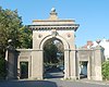
  13. ^ Historic England. "Park Street Gate and Attached Walls and Piers and Railings, Park Street (Grade II) (1380703)". National Heritage List for England. Retrieved 9 May 2020.
  14. ^ Antram & Morrice 2008, p. 190.
  15. ^ Historic England. "Patcham Court Farmhouse 133, Vale Avenue (Grade II) (1381069)". National Heritage List for England. Retrieved 9 May 2020.
  16. ^ Historic England. "4–7, Pavilion Buildings (Grade II) (1380707)". National Heritage List for England. Retrieved 9 May 2020.
  17. ^ Historic England. "12, 13 and 14, Pavilion Buildings (Grade II) (1380709)". National Heritage List for England. Retrieved 9 May 2020.
  18. ^ Historic England. "Numbers 3 and 4 and Attached Railings 3 and 4, Pavilion Parade (Grade II) (1380711)". National Heritage List for England. Retrieved 9 May 2020.
  19. ^ Historic England. "5, Pavilion Parade (Grade II) (1380712)". National Heritage List for England. Retrieved 9 May 2020.
  20. ^ Historic England. "6–11, Pavilion Parade (Grade II) (1380713)". National Heritage List for England. Retrieved 9 May 2020.
  21. ^ Historic England. "The Pavilion Theatre and Booking Office 29, New Road (Grade II) (1380108)". National Heritage List for England. Retrieved 9 May 2020.
  22. ^ Historic England. "Pearson House, Abbey Road (Grade II) (1380723)". National Heritage List for England. Retrieved 9 May 2020.
  23. ^ Historic England. "Pelham Institute, Upper Bedford Street (Grade II) (1381050)". National Heritage List for England. Retrieved 9 May 2020.
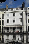
  24. ^ Historic England. "1–7, Pelham Square (Grade II) (1380715)". National Heritage List for England. Retrieved 9 May 2020.
  25. ^ Historic England. "Numbers 8–12 and Attached Railings 8–12, Pelham Square (Grade II) (1380716)". National Heritage List for England. Retrieved 9 May 2020.
  26. ^ Historic England. "15–24, Pelham Square (Grade II) (1380717)". National Heritage List for England. Retrieved 9 May 2020.
  27. ^ Historic England. "25, Pelham Square (Grade II) (1381034)". National Heritage List for England. Retrieved 9 May 2020.
  28. ^ Historic England. "Pennant Lodge and Attached Walls and Piers and Railings 30, West Drive (Grade II) (1381095)". National Heritage List for England. Retrieved 9 May 2020.
  29. ^ Historic England. "The Tower or Pepper Pot 1, Tower Road (Grade II) (1381031)". National Heritage List for England. Retrieved 9 May 2020.
  30. ^ Historic England. "Numbers 1–8 and Attached Railings 1–8, Percival Terrace (Grade II) (1380719)". National Heritage List for England. Retrieved 9 May 2020.
  31. ^ Historic England. "Percy and Wagner Almshouses 1–12, Lewes Road (Grade II) (1381669)". National Heritage List for England. Retrieved 9 May 2020.
  32. ^ Historic England. "Former Phoenix Brewery Office, Phoenix Place (Grade II) (1380720)". National Heritage List for England. Retrieved 9 May 2020.
  33. ^ Historic England. "Pillar Box At Junction With Western Road, Montpelier Road (Grade II) (1381589)". National Heritage List for England. Retrieved 9 May 2020.
  34. ^ Historic England. "Port Hall and Attached Walls, Dyke Road (Grade II) (1380458)". National Heritage List for England. Retrieved 9 May 2020.
  35. ^ Historic England. "Numbers 1–11 and Attached Wall and Pier and Railings 1–11, Portland Place (Grade II) (1380722)". National Heritage List for England. Retrieved 9 May 2020.
  36. ^ Historic England. "Numbers 15–25 and Attached Railings 15–25, Portland Place (Grade II) (1380724)". National Heritage List for England. Retrieved 9 May 2020.
  37. ^ Historic England. "Portslade Railway Station and Walls Abutting, Portland Road, BN3 5SG (Grade II) (1209609)". National Heritage List for England. Retrieved 9 May 2020.
  38. ^ Historic England. "Post Office and Attached Walls Piers and Railings, College Road (Grade II) (1380418)". National Heritage List for England. Retrieved 9 May 2020.
  39. ^ Historic England. "Post Office 51, Ship Street (Grade II) (1380919)". National Heritage List for England. Retrieved 9 May 2020.
  40. ^ Historic England. "Post on the Pavement At the Junction of Numbers 77 and 78 (number 78 Not Included), West Street (Grade II) (1381097)". National Heritage List for England. Retrieved 9 May 2020.
  41. ^ Historic England. "Numbers 1–11 and Attached Railings 1–11, Powis Square (Grade II) (1380726)". National Heritage List for England. Retrieved 9 May 2020.
  42. ^ Historic England. "Number 12 and Attached Railings 12, Powis Square (Grade II) (1380727)". National Heritage List for England. Retrieved 9 May 2020.
  43. ^ Historic England. "Number 13 and Attached Railings 13, Powis Square (Grade II) (1380728)". National Heritage List for England. Retrieved 9 May 2020.
  44. ^ Historic England. "Numbers 14–24 and Attached Railings 14–24, Powis Square (Grade II) (1380729)". National Heritage List for England. Retrieved 9 May 2020.
  45. ^ Historic England. "Number 2 and Attached Walls 2, Powis Villas (Grade II) (1380733)". National Heritage List for England. Retrieved 9 May 2020.
  46. ^ Historic England. "Number 3 and Attached Walls 3, Powis Villas (Grade II) (1380734)". National Heritage List for England. Retrieved 9 May 2020.
  47. ^ Historic England. "4, Powis Villas (Grade II) (1380735)". National Heritage List for England. Retrieved 9 May 2020.
  48. ^ Historic England. "Number 5 and Attached Walls 5, Powis Villas (Grade II) (1380736)". National Heritage List for England. Retrieved 9 May 2020.
  49. ^ Historic England. "Numbers 6 and 7 and Attached Walls 6 and 7, Powis Villas (Grade II) (1380737)". National Heritage List for England. Retrieved 9 May 2020.
  50. ^ Historic England. "Numbers 8 and 9 and Attached Walls 8 and 9, Powis Villas (Grade II) (1380738)". National Heritage List for England. Retrieved 9 May 2020.
  51. ^ Historic England. "Numbers 10–13 and Attached Walls and Railings 10–13, Powis Villas (Grade II) (1308740)". National Heritage List for England. Retrieved 9 May 2020.
  52. ^ Historic England. "Pressleys, Palace Place (Grade II) (1380692)". National Heritage List for England. Retrieved 9 May 2020.
  53. ^ Historic England. "199, Preston Road (Grade II) (1380754)". National Heritage List for England. Retrieved 9 May 2020.
  54. ^ Historic England. "5, Preston Street (Grade II) (1380758)". National Heritage List for England. Retrieved 9 May 2020.
  55. ^ Historic England. "58, Preston Street (Grade II) (1380759)". National Heritage List for England. Retrieved 9 May 2020.
  56. ^ Historic England. "60, Preston Street (Grade II) (1380760)". National Heritage List for England. Retrieved 9 May 2020.
  57. ^ Historic England. "Number 79 and Attached Railings 79, Preston Street (Grade II) (1380762)". National Heritage List for England. Retrieved 9 May 2020.
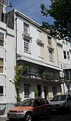
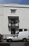
  58. ^ Historic England. "The Prince Albert Public House 48, Trafalgar Street (Grade II) (1381035)". National Heritage List for England. Retrieved 9 May 2020.
  59. ^ Historic England. "1, Prince Albert Street (Grade II) (1380763)". National Heritage List for England. Retrieved 9 May 2020.
  60. ^ Historic England. "2–8, Prince Albert Street (Grade II) (1380764)". National Heritage List for England. Retrieved 9 May 2020.
  61. ^ Historic England. "10, Prince Albert Street (Grade II) (1380765)". National Heritage List for England. Retrieved 9 May 2020.
  62. ^ Historic England. "11, 12 and 13, Prince Albert Street (Grade II) (1380766)". National Heritage List for England. Retrieved 9 May 2020.
  63. ^ Historic England. "Number 15 and Attached Railings 15, Prince Albert Street (Grade II) (1380767)". National Heritage List for England. Retrieved 9 May 2020.
  64. ^ Historic England. "15b, Prince Albert Street (Grade II) (1380768)". National Heritage List for England. Retrieved 9 May 2020.
  65. ^ Historic England. "16, Prince Albert Street (Grade II) (1380769)". National Heritage List for England. Retrieved 9 May 2020.
  66. ^ Historic England. "17 and 17a, Prince Albert Street (Grade II) (1380770)". National Heritage List for England. Retrieved 9 May 2020.
  67. ^ Historic England. "18 and 19, Prince Albert Street (Grade II) (1380771)". National Heritage List for England. Retrieved 9 May 2020.
  68. ^ Historic England. "20, 21, 21a and 21b, Prince Albert Street (Grade II) (1380772)". National Heritage List for England. Retrieved 9 May 2020.
  69. ^ Historic England. "24, Prince Albert Street (Grade II) (1381766)". National Heritage List for England. Retrieved 9 May 2020.
  70. ^ Historic England. "Norwich Union House 166–169, North Street (Grade II) (1380623)". National Heritage List for England. Retrieved 9 May 2020.
  71. ^ Historic England. "Numbers 18 and 19 and 20 and Attached Railings 18, 19 and 20, Princes Street (Grade II) (1380774)". National Heritage List for England. Retrieved 9 May 2020.
  72. ^ Historic England. "Prospect Cottage, The Green (Grade II) (1381014)". National Heritage List for England. Retrieved 9 May 2020.
  73. ^ Historic England. "Puget's Cottage, attached to the south-west of 14 North Street (Grade II) (1415925)". National Heritage List for England. Retrieved 9 May 2020.
  74. ^ Historic England. "The Pump House Tavern 44, 45 and 46, Market Street (Grade II) (1381767)". National Heritage List for England. Retrieved 9 May 2020.
  75. ^ Historic England. "East Pylon, London Road (Grade II) (1381679)". National Heritage List for England. Retrieved 9 May 2020.
  76. ^ Historic England. "West Pylon, London Road (Grade II) (1381681)". National Heritage List for England. Retrieved 9 May 2020.
  77. ^ Historic England. "The Quadrant Public House 12 and 13, North Street Quadrant (Grade II) (1380627)". National Heritage List for England. Retrieved 9 May 2020.
  78. ^ Historic England. "2 To 5, Kings Road (Grade II) (1380462)". National Heritage List for England. Retrieved 9 May 2020.
  79. ^ Historic England. "4–9, Queens Place (Grade II) (1380793)". National Heritage List for England. Retrieved 9 May 2020.
  80. ^ Historic England. "Number 27 and Attached Railings 27, Queens Road (Grade II) (1380795)". National Heritage List for England. Retrieved 9 May 2020.
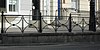
  81. ^ Historic England. "Railings Running the Length of Marine Parade, Marine Parade (Grade II) (1381754)". National Heritage List for England. Retrieved 9 May 2020.
  82. ^ Historic England. "Railings To Queens Road Rest Garden East Range, Queens Road (Grade II) (1380799)". National Heritage List for England. Retrieved 9 May 2020.
  83. ^ Historic England. "Railings To the Queens Road Rest Garden South Range, Queens Road (Grade II) (1380800)". National Heritage List for England. Retrieved 9 May 2020.
  84. ^ Historic England. "Railings To the Esplanade, Kings Road (Grade II) (1381647)". National Heritage List for England. Retrieved 9 May 2020.
  85. ^ Historic England. "Railings on West Side Running North–south Between North Road and Church Street, Queens Road (Grade II) (1380798)". National Heritage List for England. Retrieved 9 May 2020.
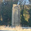
  86. ^ Historic England. "Ralli Memorial Hall, Station Approach (Grade II) (1298671)". National Heritage List for England. Retrieved 9 May 2020.
  87. ^ Historic England. "Brighton Extra Mural Cemetery Ray Mausoleum, Lewes Road (Grade II) (1381665)". National Heritage List for England. Retrieved 9 May 2020.
  88. ^ Historic England. "Rectory Cottage, Greenways (Grade II) (1381596)". National Heritage List for England. Retrieved 9 May 2020.
  89. ^ Historic England. "Rectory Lodge, Greenways (Grade II) (1381595)". National Heritage List for England. Retrieved 9 May 2020.
  90. ^ Historic England. "10 and 11, Regency Mews (Grade II) (1380801)". National Heritage List for England. Retrieved 9 May 2020.
  91. ^ Historic England. "Nos.22–25 (Consecutive) and Attached Railings, Regency Square (includes 67 Preston Street) (Grade II) (1380804)". National Heritage List for England. Retrieved 9 May 2020.
  92. ^ Historic England. "Numbers 38–46 Including Carriage Arch and Attached Railings 38–46, Regency Square (Grade II) (1380806)". National Heritage List for England. Retrieved 9 May 2020.
  93. ^ Historic England. "46a, Regency Square (Grade II) (1380807)". National Heritage List for England. Retrieved 9 May 2020.
  94. ^ Historic England. "46b, Regency Square (Grade II) (1380808)". National Heritage List for England. Retrieved 9 May 2020.
  95. ^ Historic England. "Numbers 47 and 48 and 49 and Attached Railings 47, 48 and 49, Regency Square (Grade II) (1380809)". National Heritage List for England. Retrieved 9 May 2020.
  96. ^ Historic England. "The Regency Tavern, Regency Square (Grade II) (1380816)". National Heritage List for England. Retrieved 9 May 2020.
  97. ^ Historic England. "18, 19 and 20, Regent Hill (Grade II) (1380818)". National Heritage List for England. Retrieved 9 May 2020.
  98. ^ Historic England. "Numbers 1 and 2 and 3 and Attached Railings and Walls and Gate Piers 1, 2 and 3, Richmond Terrace (Grade II) (1380819)". National Heritage List for England. Retrieved 9 May 2020.
  99. ^ Historic England. "Numbers 4 and 5 and 6 and Attached Railings 4, 5 and 6, Richmond Terrace (Grade II) (1380820)". National Heritage List for England. Retrieved 9 May 2020.
  100. ^ Historic England. "Number 7 and Attached Piers and Railings 7, Richmond Terrace (Grade II) (1380821)". National Heritage List for England. Retrieved 9 May 2020.
  101. ^ Historic England. "Numbers 11–14 and Attached Gate Piers and Railings 11–14, Richmond Terrace (Grade II) (1380823)". National Heritage List for England. Retrieved 9 May 2020.
  102. ^ Historic England. "Number 15 and Attached Railings 15, Richmond Terrace (Grade II) (1380824)". National Heritage List for England. Retrieved 9 May 2020.
  103. ^ Historic England. "16, Richmond Terrace (Grade II) (1380826)". National Heritage List for England. Retrieved 9 May 2020.
  104. ^ Historic England. "Numbers 17 and 18 and Attached Walls 17 and 18, Richmond Terrace (Grade II) (1380828)". National Heritage List for England. Retrieved 9 May 2020.
  105. ^ Historic England. "Robin's Row (cottages) 1–5, South Street, BN3 5SG (Grade II) (1292518)". National Heritage List for England. Retrieved 9 May 2020.
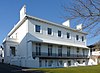
  106. ^ Historic England. "Roedean School Main Buildings, Roedean Way (Grade II) (1380831)". National Heritage List for England. Retrieved 9 May 2020.
  107. ^ Historic England. "Rokesley House (122) and Grosvenor House (123) and Attached Railings 122 and 123, Marine Parade (Grade II) (1381739)". National Heritage List for England. Retrieved 9 May 2020.
  108. ^ Historic England. "Rookery Cottage, Hangleton Valley Drive, BN3 8AN (Grade II) (1187558)". National Heritage List for England. Retrieved 9 May 2020.
  109. ^ Historic England. "Rottingdean Club 89, High Street (Grade II) (1381626)". National Heritage List for England. Retrieved 9 May 2020.
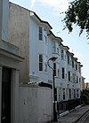
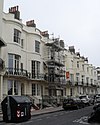
  110. ^ Historic England. "Numbers 1–13 and Attached Railings 1–13, Roundhill Crescent (Grade II) (1380833)". National Heritage List for England. Retrieved 9 May 2020.
  111. ^ Historic England. "Numbers 19 and 21 and Attached Railings 19 and 21, Roundhill Crescent (Grade II) (1380834)". National Heritage List for England. Retrieved 9 May 2020.
  112. ^ Historic England. "Numbers 23–27 and Attached Railings 23–27, Roundhill Crescent (Grade II) (1380835)". National Heritage List for England. Retrieved 9 May 2020.
  113. ^ Historic England. "Numbers 69 and 71 and Attached Railings 69 and 71, Roundhill Crescent (Grade II) (1380836)". National Heritage List for England. Retrieved 9 May 2020.
  114. ^ Historic England. "Numbers 101–113 and Attached Railings 101–113, Roundhill Crescent (Grade II) (1380837)". National Heritage List for England. Retrieved 9 May 2020.
  115. ^ Historic England. "Western Wing of the Royal Albion Hotel, Old Steine, BN1 1NT (Grade II) (1388280)". National Heritage List for England. Retrieved 9 May 2020.
  116. ^ Historic England. "Royal Crescent Hotel and Attached Walls and Railings, Marine Parade (Grade II) (1381755)". National Heritage List for England. Retrieved 9 May 2020.
  117. ^ Historic England. "The Royal Gymnasium and Attached Railings, Paston Place (Grade II) (1380705)". National Heritage List for England. Retrieved 9 May 2020.
  118. ^ Historic England. "Former Drill Hall Now Royal Mail Sorting Office, Church Street (Grade II) (1380394)". National Heritage List for England. Retrieved 9 May 2020.
  119. ^ Historic England. "The Royal Pavilion Tavern and Attached Railings 7, Castle Square (Grade II) (1380055)". National Heritage List for England. Retrieved 9 May 2020.
  120. ^ Historic England. "The Royal Sovereign Hotel 66, Preston Street (Grade II) (1380761)". National Heritage List for England. Retrieved 9 May 2020.
  121. ^ Historic England. "The Royal Spa, Park Hill (Grade II) (1380699)". National Heritage List for England. Retrieved 9 May 2020.
  122. ^ Historic England. "Chapel of the Royal County Sussex Hospital, Eastern Road (Grade II) (1380482)". National Heritage List for England. Retrieved 9 May 2020.
  123. ^ Historic England. "Royal York Buildings Including Bus Depot, Old Steine (Grade II) (1380677)". National Heritage List for England. Retrieved 9 May 2020.
  124. ^ Historic England. "Ruin With Grotto Adjoining the West Front of St Mary's Convent, Manor Road, BN3 5SG (Grade II) (1187576)". National Heritage List for England. Retrieved 9 May 2020.
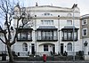
  125. ^ Historic England. "Numbers 3 and 5 and 7 and Attached Walls and Railings 3, 5 and 7, Russell Crescent (Grade II) (1380841)". National Heritage List for England. Retrieved 9 May 2020.
  126. ^ Historic England. "22 and 23, Russell Square (Grade II) (1380842)". National Heritage List for England. Retrieved 9 May 2020.
  127. ^ Historic England. "25, Russell Square (Grade II) (1380843)". National Heritage List for England. Retrieved 9 May 2020.
  128. ^ Historic England. "Numbers 28–31 and Attached Railings 28–31, Russell Square (Grade II) (1380844)". National Heritage List for England. Retrieved 9 May 2020.
  129. ^ Historic England. "35, Russell Square (Grade II) (1380845)". National Heritage List for England. Retrieved 9 May 2020.
  130. ^ Historic England. "Numbers 36–45 and Attached Railings 36–45, Russell Square (Grade II) (1380846)". National Heritage List for England. Retrieved 9 May 2020.
  131. ^ Historic England. "46, Russell Square (Grade II) (1380847)". National Heritage List for England. Retrieved 9 May 2020.

Bibliography[]

  • Antram, Nicholas; Morrice, Richard (2008). Brighton and Hove. Pevsner Architectural Guides. London: Yale University Press. ISBN 978-0-300-12661-7.
  • Brighton Polytechnic. School of Architecture and Interior Design (1987). A Guide to the Buildings of Brighton. Macclesfield: McMillan Martin. ISBN 1-869865-03-0.
  • Carder, Timothy (1990). The Encyclopaedia of Brighton. Lewes: East Sussex County Libraries. ISBN 0-86147-315-9.
  • Collis, Rose (2010). The New Encyclopaedia of Brighton. (based on the original by Tim Carder) (1st ed.). Brighton: Brighton & Hove Libraries. ISBN 978-0-9564664-0-2.
  • Dale, Antony (1991). Brighton Cemeteries. Brighton: Brighton Borough Council.
  • Fines, Ken (2002). A History of Brighton & Hove. Chichester: Phillimore & Co. ISBN 1-86077-231-5.
  • Middleton, Judy (2002). The Encyclopaedia of Hove & Portslade. Brighton: Brighton & Hove Libraries.
  • Musgrave, Clifford (1981). Life in Brighton. Rochester: Rochester Press. ISBN 0-571-09285-3.
  • Myall, Steve (2008). The Victorian Development of the Clifton, Montpelier and Powis Estates of Brighton. Lewes: Pomegranate Press. ISBN 978-0-9559006-0-0.
Retrieved from ""