Brighton and Hove
This article needs additional citations for verification. (February 2013) |
Brighton and Hove
City of Brighton and Hove | |
|---|---|
City and unitary authority | |
 Brighton and Hove shown within East Sussex and England | |
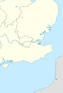 Brighton and Hove Location of Brighton and Hove | |
| Coordinates: 50°49′40″N 0°09′10″W / 50.82778°N 0.15278°WCoordinates: 50°49′40″N 0°09′10″W / 50.82778°N 0.15278°W | |
| Sovereign state | |
| Country | |
| Region | South East England |
| Historic county | |
| Ceremonial county | East Sussex |
| Administrative seat | Hove |
| Established | 1 April 1997 |
| City status | 31 January 2001 |
| Government | |
| • Type | Unitary authority |
| • Body | Brighton and Hove City Council |
| • Governance | Committee system(G) |
| • Executive | NOC (Green administration) |
| • Leader | Phélim MacCafferty |
| • Mayor | Alan Robins |
| • MPs | Peter Kyle (L) Caroline Lucas (G) Lloyd Russell-Moyle (L) |
| Area | |
| • City and unitary authority | 33.80 sq mi (82.79 km2) |
| • Urban | 34.5 sq mi (89.4 km2) |
| Area rank | 229th |
| Population (mid-2019 est.) | |
| • City and unitary authority | 290,885 |
| • Rank | 45th |
| • Density | 9,090/sq mi (3,508/km2) |
| • Urban | 474,485 (15th) |
| • Urban density | 13,740/sq mi (5,304/km2) |
| • Metro | 769,000 (15th) |
| • Ethnicity (2011 Census) | 80.5% White British 8.5% Other White 3.7% Mixed Race 3% Asian 1.5% Black 1.1% Chinese 0.8% Arab 2.1% Other |
| Time zone | UTC (Greenwich Mean Time) |
| • Summer (DST) | UTC+1 (British Summer Time) |
| Postcode areas | BN (1, 2, 3, 41) |
| ONS code | 00ML (ONS) E06000043 (GSS) |
| ISO 3166-2 | GB-BNH |
| Website | www |


Brighton and Hove (/ˈbraɪtən ... ˈhoʊv/) is a city and unitary authority in East Sussex, England. It consists primarily of the settlements of Brighton and Hove, alongside neighbouring villages.
Often referred to synonymously as Brighton, the City of Brighton and Hove is England’s most populous seaside resort, as well as the most populous urban area in South East England. It is administered by Brighton and Hove City Council, which is currently in Green minority control.
History[]
Brighton[]

Brighton has been the most populous settlement in Sussex since at least the 17th century, and a town hall and evidence of citizen's control over town affairs predates 1580.[1] The original Parish of Brighton covered what is today much of central Brighton. The parish border ran from Little Western Street and Boundary Passage in the west, to Whitehawk Road in the east, and roughly followed the Old Shoreham Road and Bear Road to the north.[2] The Great Reform Act of 1832 created the parliamentary constituency of Brighton. Brighton obtained a royal charter for incorporation in 1854 and was organised into six wards: Park, Pavilion, Pier, St Nicholas, St Peter and West. The ward of Preston was added in 1873, expanding Brighton to the north. In 1889 Brighton attained county borough status.[1]
The Brighton Corporation Act of 1927 added the settlements of Ovingdean and Rottingdean, as well as western parts of Falmer, Patcham and West Blatchington.[1] These reforms expanded the Brighton the north and west dramatically. Between 1920 and 1950 housing estates were developed in Woodingdean, Moulsecoomb, Bevendean and Whitehawk increasing the population of the town substantially. As a result, the number of wards had by now increased to 19. The rest of Falmer, Coldean and the parish of Stanmer were added to Brighton by the Brighton Extension Act 1951, completing the northward extension of the town.[3] A final expansion of the town's boundaries was approved in 1968, incorporating reclaimed land from the sea for the Brighton Marina project.
Brighton was split into two parliamentary constituencies in 1950. The first, Brighton Pavilion, covers the centre and north of the town. The second, Brighton Kemptown, covers the east of the town. The latter has since expanded further east to include the neighbouring towns of East Saltdean, Telscombe Cliffs and Peacehaven. Brighton became a municipal borough as a result of the 1972 Local Government Act, losing unitary control of town affairs to East Sussex County Council.[3] This reform was later followed by a reduction of wards to 16 in 1983. Brighton Borough Council remained under this structure until unification with Hove.
Hove[]

A small parish at the end of the 18th century, Hove began to expand in the early 19th century alongside the westward development of Brighton, and in 1832 became incorporated into the parliamentary constituency of Brighton.[4] In 1873 commissioners from Hove, West Hove and Brunswick were amalgamated as means to guard against the dominance of Brighton.[5] The first public buildings were completed in the late 19th century, including the original town hall in 1882. The parish of Aldrington was annexed by Hove in 1893.[4] A municipal borough of Hove was formed by royal charter in 1889, granting Hove administrative autonomy. Further expansion took place in 1927, with the addition of the parishes of Preston Rural and Hangleton and westerly sections of West Blatchington and Patcham.[4] Hove gained its own parliamentary constituency in 1950. The Local Government Act 1972 abolished the remaining parishes of Hove, Aldrington and Hangleton and West Blatchington to form the unparished non-metropolitan district of Hove.[6] It also incorporated the nearby town of Portslade-by-Sea into the new district. The new boundaries established by the Act remained largely the same until unification with Brighton a quarter of a century later.
Unification[]

In 1992 a government commission was set up to conduct a structural review of local government arrangements across England. In its draft proposals for East Sussex, the commission suggested two separate unitary authorities be created for the towns of Brighton and Hove, with the latter authority to include Hove, Worthing and the Adur District.[7] Support within Brighton for its own unitary authority was high, however respondents in Hove expressed reservations towards a merger with Worthing and Adur. A report following consultation noted that more than 25% of respondents in both Brighton and Hove had "unprompted, indicated support for a merger of those two areas." Although this option had not been included in the draft proposals, subsequent polling indicated that the merger was the most popular option among residents.[7]
Nevertheless, the proposal of a merger proved controversial, particularly in Hove. Hove Borough Council opposed the move on the grounds that Brighton would dominate affairs in the city, and the commission acknowledged that residents of Hove "have significant negative feelings towards Brighton" and greater identification towards Sussex.[7] Ultimately, the view was taken that support for a single tier of government in both towns outweighed opposition to unification, and as a result the commission recommended that the borough councils of Brighton and Hove be made a single unitary authority independent of East Sussex County Council. In 1997, Brighton and Hove Borough Council was formed, and assumed responsibility for all matters of local government across both towns.
Twenty years earlier, as part of the Queen's Silver Jubilee celebrations, Brighton had been shortlisted as a candidate for city status, though eventually lost out to larger Derby. Following unification of the towns, Brighton and Hove applied for city status again as part of the Millennium City Status Competition, and was subsequently granted city status on December 18th 2000, along with Wolverhampton and Inverness.[8] As a result, the borough council became a city council.
Although the city now operates as a single entity, locals generally still consider Brighton and Hove to be separate settlements with different identities. Hove is largely residential and has its own distinct seafront and established town centre located around George Street, while Brighton has a higher profile as the country's most popular seaside resort, a significant digital economy, and hosts several festivals of national prominence. Recognition of the city's twin identities is evident from the continued popularity of the local saying "Hove, actually", a phrase which long predates unification.
Some organisations such as the local football club, Brighton and Hove Albion, and the bus company Brighton & Hove, predate the unification of the towns by several decades.
In 2014, Brighton and Hove formed the Greater Brighton City Region with neighbouring local authorities.[9]
Geography[]

From west to east the administrative boundary of Brighton and Hove begins on the coast at Gate 4 of Shoreham Port. It crosses the Southwick Ship Canal and the A259 between Brambledean Road and St Richard's Road in Portslade. From here, the border joins Eastbrook Road, and runs north up St Aubrey's Crescent. It then runs along the Sussex Border Path, through Fishersgate Station, separating Portslade from the neighbouring town of Southwick. Running west of Mile Oak, the border crosses the A27 skirting Mile Oak Farm and continues towards Devil's Dyke, before turning east over the Downs. The border then extends north from Tydell Farm to the outskirts of Pyecombe - its most northerly point. It crosses the A23 at the Patcham Pylons, which signifies the border for incoming traffic.
Continuing east, the border runs north of the Chattri and Standean Farm, before crossing Ditchling Road at the Upper Lodges and running along the northerly limits of Stanmer Park and Stanmer Village. At this point the border turns south and runs to the eastern edge of the University of Sussex campus, re-crossing the A27 along The Drove and passing east of Falmer Stadium. It continues along The Drove and Falmer Road to Woodingdean. Running north of Woodingdean, the border then heads south-east through Balsdean before adjoining to a footpath which enters Saltdean at the top of Longridge Avenue. The border runs down Longridge Avenue to the junction with Lynwood Road, where it turns south over houses and back across the A259 before returning the coastline at the eastern end of Saltdean Beach.
Governance[]

As a unitary authority, Brighton and Hove City Council provides a full range of local government services, combining the functions of a non-metropolitan county and district council. Elections to the council are held every four years, with the most recent taking place in 2019.[10] Councillors annually elect a Mayor of Brighton and Hove - a ceremonial position. The current mayor is Councillor Alan Robins.[11] A proposal to introduce a directly elected mayor to the city was rejected by referendum in 2001. As a result, the council uses a cabinet system to form its executive. Geoff Raw is the current chief executive.[12] Both Brighton Town Hall in The Lanes, and Hove Town Hall on Church Road are used as meeting places for council.

The council was under Labour majority control until 2003, when it fell into no overall control where it has remained since. During this period the council has been controlled by minority administrations of all three major parties in Brighton and Hove: Labour, the Conservatives and the Greens. The first Green administration, elected in 2011, was the first time any Green Party had run a council in the UK, highlighting the city as the party's primary area of support. A Labour administration was elected in 2015, and the party narrowly retained a plurality in 2019, however expulsions from the Labour group led to the Greens regaining control of the administration in 2020. At the most recent by-elections in May 2021, the Greens gained one seat from Labour, further extending their plurality on the council.[13] Convenor of the Green Group Councillor Phélim MacCafferty is the current Leader of the Council. [14]
Three constituencies cover Brighton and Hove in the UK Parliament. Hove is represented by Labour MP Peter Kyle. Brighton Pavilion, which covers central and northern Brighton, is represented by Green MP Caroline Lucas - the UK's first and only MP from the Green Party. Brighton Kemptown, which covers East Brighton, as well as areas outside of Brighton and Hove, such as Telscombe Cliffs and Peacehaven, is represented by Labour MP Lloyd Russell-Moyle.
Wording of the Letters Patent[]
The Letters Patent of 2001 that confers City status is worded thus:
Elizabeth the second by the Grace of God of the United Kingdom of Great Britain and Northern Ireland & of Our Realms & Territories Queen Head of the Commonwealth Defender of the Faith.
To all whom these Presents shall come Greeting. Whereas We for divers good causes and considerations Us thereunto moving are graciously pleased to confer on the Towns of Brighton and Hove the status of a city. Now Therefore Know Ye that We of Our especial grace and favour and mere motion do by these Presents ordain declare and direct that the TOWNS OF BRIGHTON AND HOVE shall henceforth have the status of a CITY and shall have all such rank liberties privileges and immunities as are incident to a City. In witness whereof We have caused Our Letters to be made Patent Witness Ourself at Westminster the thirty first day of January in the forty ninth year of our reign.
By Warrant under The Queens Sign Manual.[15]
Wards[]
| Ward | Location | Population[16] | Ward | Location | Population |
|---|---|---|---|---|---|
| Brunswick and Adelaide | 
|
11,475 | Preston Park | 
|
15,263 |
| Central Hove | 
|
9,831 | Queens Park | 
|
16,284 |
| East Brighton | 
|
14,138 | Regency | 
|
11,986 |
| Goldsmid | 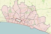
|
16,571 | Rottingdean Costal | 
|
14,325 |
| Hangleton and Knoll | 
|
14,848 | South Portslade | 
|
9,836 |
| Hanover and Elm Grove | 
|
17,673 | St Peter's and North Laine | 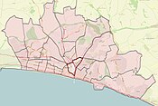
|
20,670 |
| Hollingdean and Stamner | 
|
18,121 | Westbourne | 
|
10,360 |
| Hove Park | 
|
11,081 | Wish | 
|
10,031 |
| Moulsecoombe and Bevendean | 
|
18,772 | Withdean | 
|
15,196 |
| North Portslade | 
|
9,968 | Woodingdean | 
|
9,968 |
| Patcham | 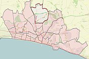
|
14,606 |
Census[]
The first census of Brighton was in 1801.[citation needed]
The resident population of Brighton and Hove at the 2011 census was 273,369 persons, 50% male and 50% female.[17]
The 2011 census found the ethnic composition of Brighton and Hove to be 89.1% white (80.5% white British, 1.4% white Irish, 7.1% other white), 4.1% Asian (1.1% Chinese, 1.1% Indian, 0.5% Bangladeshi, 1.2% other Asian), 3.8% mixed race (1.5% mixed black/white, 1.2% mixed white/Asian, 1.0% other mix), 1.5% black and 0.8% Arab.[18]
The 2011 census found the religious composition to be 42.90% Christian, 42.42% nonreligious, 2.23% Muslim, 1.00% Buddhist, 0.98% Jewish. 1.66% were adherents of some other religion, while 8.81% did not state their religion.[18]
In the 2001 census, Brighton and Hove had the highest percentage of citizens indicating their religion as Jedi among all principal areas of England and Wales.[19]
Economy and demography[]
The economy of the city is service-based with a strong emphasis on creative, digital and electronic technologies. Tourism and entertainment are important sectors for the City, which has many hotels and amusements, as well as Brighton Pier and Shoreham/Portslade Harbour.
The United Kingdom Census 2011 showed a substantial fall in the proportion of the population claiming Jobseeker's Allowance or Income Support, from 10.1% of the resident population in 2001, to 4.5% of the resident population in 2011.[20]
Freedom of the City[]
The following people and military units have received the Freedom of the City of Brighton and Hove.
This list is incomplete; you can help by . (July 2021) |
Individuals[]
- Sir Peter Field KCVO KStJ: 15 July 2021.[21]
Military Units[]
- The Royal Sussex Regiment: 27 October 1944. (Borough of Brighton).
- The Royal Sussex Regiment: 1958. (Borough of Hove).[22]
- The Queen's Regiment: 31 December 1966. (Borough of Brighton).[23]
- The Princess of Wales’s Royal Regiment: 1996.[24]
See also[]
- Healthcare in Sussex
- Pipe organs of Brighton and Hove
- Brighton
- Hove
References[]
- ^ Jump up to: a b c Salzman, L.F. (1940). A History of the County of Sussex: Volume 7, the Rape of Lewes. 244-263: British History Online. Retrieved 13 May 2021.CS1 maint: location (link)
- ^ "Boundaries". My Brighton and Hove. Retrieved 13 May 2021.
- ^ Jump up to: a b "Administration". Brighton History. Retrieved 13 May 2021.
- ^ Jump up to: a b c Salzman, L.F. (1940). A History of the County of Sussex: Volume 7, the Rape of Lewes. 265-268: British History Online. Retrieved 12 May 2021.CS1 maint: location (link)
- ^ "Records of Hove Borough Council and its predecessors". National Archives. Retrieved 12 May 2021.
- ^ "HOVE REGISTRATION DISTRICT". UK BMD. Retrieved 12 May 2021.
- ^ Jump up to: a b c "Final Recommendations for the Future Local Government of East Sussex" (PDF). Local Government Commission For England. December 1994. Retrieved 19 May 2021.
- ^ "MILLENNIUM CITY STATUS COMPETITION - WINNING CITIES ANNOUNCED". Wired Gov. Retrieved 19 May 2021.
- ^ "City Deal; The beginning of a great city region". Brighton and Hove City Council. 2014. Retrieved 31 May 2020.
- ^ "Brighton & Hove local elections results 2019". Archived from the original on 4 May 2019. Retrieved 4 May 2019.
- ^ "The Mayor of Brighton & Hove". Brighton & Hove City Council. Retrieved 3 September 2020.
- ^ "Chief executive". Brighton and Hove City Council. Retrieved 3 December 2015.
- ^ "Results of the Hollingdean & Stanmer by-election". Brighton & Hove City Council. 7 May 2021. Retrieved 11 May 2021.
- ^ "The leader". Brighton & Hove City Council. Retrieved 3 September 2020.
- ^ "The Brighton & Hove crest". Brighton & Hove City Council. Archived from the original on 30 August 2012. Retrieved 5 February 2013.
- ^ "UNITED KINGDOM: South East England Local Authority Districts and Wards". City Population. Retrieved 11 May 2020.
- ^ "Brighton & Hove City Snapshot – Summary of Statistics 2014" (PDF). Brighton & Hove City Council. Archived (PDF) from the original on 6 May 2016. Retrieved 3 September 2017.
- ^ Jump up to: a b UK Census (2011). "Local Area Report – Brighton and Hove Local Authority (1946157280)". Nomis. Office for National Statistics. Retrieved 14 March 2018.
- ^ "2001 Census". statistics.gov.uk. Archived from the original on 9 January 2007.
- ^ Key Statistics: Population; Quick Statistics: Economic indicators Archived 11 February 2003 at the Wayback Machine. (2011 census and 2001 census) Retrieved 2015-02-27.
- ^ "Queen's man on the ground to be given 'freedom of the city'". Brighton and Hove News. Retrieved 13 July 2021.
- ^ "The Royal West Sussex Regiment" (PDF). West Sussex County Council. Retrieved 13 July 2021.
- ^ "Freedom of the Borough – Corporation and Council – Topics – My Brighton and Hove". mybrightonandhove.org.uk.
- ^ "Freedom of the city march". My Brighton and Hove. 22 June 2011. Archived from the original on 14 October 2012.
External links[]
- "Brighton & Hove City Council". Retrieved 20 August 2007.
 Brighton travel guide from Wikivoyage
| show City of Brighton and Hove |
|---|
| show Districts of South East England |
|---|

| show |
|---|

| show Authority control |
|---|
- Brighton and Hove
- Government agencies established in 1997
- Local government in East Sussex
- Unitary authority districts of England
- Cities in South East England
- Towns in East Sussex
- Local government districts of South East England
- Coast to Capital Local Enterprise Partnership
- 1997 establishments in England