Grande Ronde River
| Grande Ronde River | |
|---|---|
 The lower Grande Ronde in Oregon | |
 Map of the Grande Ronde watershed | |
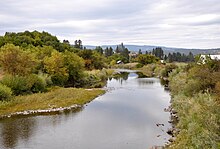
 Mouth of the Grande Ronde River in Washington | |
| Location | |
| Country | United States |
| State | Oregon, Washington |
| Counties | Union and Wallowa counties in Oregon, Asotin County in Washington |
| Cities | La Grande, Elgin |
| Physical characteristics | |
| Source | Blue Mountains |
| • location | Elkhorn Range |
| • coordinates | 44°57′34″N 118°15′38″W / 44.95944°N 118.26056°W[1] |
| • elevation | 7,444 ft (2,269 m)[2] |
| Mouth | Snake River |
• coordinates | 46°4′49″N 116°58′47″W / 46.08028°N 116.97972°WCoordinates: 46°4′49″N 116°58′47″W / 46.08028°N 116.97972°W[1] |
• elevation | 830 ft (250 m)[2] |
| Length | 182 mi (293 km)[3] |
| Basin size | 4,130 sq mi (10,700 km2)[4] |
| Discharge | |
| • location | below Wenaha River, near Troy, OR[5] |
| • average | 3,034 cu ft/s (85.9 m3/s)[5] |
| • minimum | 344 cu ft/s (9.7 m3/s) |
| • maximum | 42,200 cu ft/s (1,190 m3/s) |
| Basin features | |
| Tributaries | |
| • left | Wenaha River |
| • right | Catherine Creek, Wallowa River, Joseph Creek |
| Type | Wild, Recreational |
| Designated | October 28, 1988 |

- For other places with the same name, see Grande Ronde (disambiguation).
The Grande Ronde River (/ɡrænd rɑːnd/ or, less commonly, /ɡrænd raʊnd/) is a tributary of the Snake River, 182 miles (293 km) long,[3] in northeastern Oregon and southeastern Washington in the United States. It drains an area southeast of the Blue Mountains and northwest of the Wallowa Mountains, on the Columbia Plateau. It flows through the agricultural Grande Ronde Valley in its middle course and through a series of scenic canyons in its lower course.
Course[]
The Grande Ronde River rises in the Blue Mountains near the Anthony Lakes recreation area in the Wallowa–Whitman National Forest in southwestern Union County approximately 20 miles (32 km) south of La Grande. It flows generally north along the east side of the Blue Mountains, then east, past La Grande, then generally northeast through the Grande Ronde Valley in a meandering course between the Blue Mountains and the Wallowa Mountains, receiving Catherine Creek east of La Grande.
Approximately 10 miles (16 km) northwest of Minam it receives the Wallowa River from the southeast, then receives the Wenaha River at Troy just south of the Washington border. It crosses into southeastern Washington, traversing the extreme southeast corner of the state and entering the Snake at Rogersburg Washington, approximately 5 miles (8 km) north of the Oregon border and 15 miles (24 km) downstream from the mouth of the Salmon River. It receives Joseph Creek from the south 2 miles (3.2 km) upstream from its mouth on the Snake.
The mouth of the Grande Ronde River is at the Snake's river mile 169, which is 493 miles (793 km) from the mouth of the Columbia River.[6]
River modifications[]
A diversion channel approximately 5 miles (8 km) long in the Grande Ronde Valley east of La Grande allows the river to bypass a long meandering loop, providing access to its water for irrigation.
History[]
In the early 19th century, the valley of the river was inhabited by Nez Perce, Umatilla, Walla Walla, and Cayuse tribes of Native Americans. Numerous archaeological sites are on the public land around the river.
The Grande Ronde River was given its name sometime before 1821 by French Canadian voyageurs working for the Montreal-based fur trading North West Company.[7] Grande Ronde is a French name meaning "great round".[8]
A portion Grande Ronde and its valley were part of the Oregon Trail. It was first used by settlers in 1844 when led his party to the river from Fort Hall and then turned northwest to cross the Blue Mountains. Harris' navigation would be subsequently repeated, becoming a regular part of the Oregon Trail.[9] The river was called the "Grand Round River" by at least one English-speaking traveler.[10]
In 1988, the United States Congress designated about 44 miles (71 km) of the river, from its confluence with the Wallowa River to the Oregon–Washington border, as the Grande Ronde Wild and Scenic River, as part of the National Wild and Scenic Rivers System.
The river today is a popular destination for hunting, especially for game animals such as mule deer, elk, black bear, cougar, and bighorn sheep. Fishing, rafting and hiking are also popular along the designated Wild and Scenic portion of the river. Most of the middle reaches of the river are inaccessible to motor vehicles.
Fish[]
The Grande Ronde River supports populations of spring chinook salmon, summer steelhead, bull trout, mountain whitefish, as well as other species. The river has a sport steelhead fishery and has some tribal fishing for spring chinook.
See also[]
- List of rivers of Oregon
- List of longest streams of Oregon
- List of rivers of Washington
- Joseph Canyon
References[]
- ^ Jump up to: a b U.S. Geological Survey Geographic Names Information System: Grande Ronde River, USGS, GNIS
- ^ Jump up to: a b Google Earth elevation for GNIS coordinates.
- ^ Jump up to: a b U.S. Geological Survey. National Hydrography Dataset high-resolution flowline data. The National Map Archived 2012-03-29 at the Wayback Machine, accessed May 3, 2011
- ^ "Boundary Descriptions and Names of Regions, Subregions, Accounting Units and Cataloging Units". U.S. Geological Survey. Retrieved 2010-08-22.
- ^ Jump up to: a b Water Resources Data, Oregon, 2005, USGS
- ^ Grande Ronde Subbasin Plan (PDF), Northwest Power and Conservation Council
- ^ Mackie, Richard Somerset (1997). Trading Beyond the Mountains: The British Fur Trade on the Pacific 1793-1843. Vancouver: University of British Columbia (UBC) Press. p. 26. ISBN 0-7748-0613-3.
- ^ Gannett, Henry (1905). The Origin of Certain Place Names in the United States. Govt. Print. Off. p. 141.
- ^ Billington, Ray Allen (1962). The Far Western Frontier: 1830–1860. New York: Harper& Row. pp. 105–06.
- ^ Goltra, Elizabeth J (1970). Journal Kept by Mrs. E.J. Goltra of Her Travels Across the Plains in the Year 1853. Eugene, Oregon: Lane County Historical Society.
External links[]
- Grande Ronde Model Watershed
 Media related to Grande Ronde River at Wikimedia Commons
- Grande Ronde Wild and Scenic River
| hide Authority control | |
|---|---|
| General |
|
| National libraries | |
| Other | |
- Rivers of Oregon
- Rivers of Washington (state)
- Archaeological sites in Oregon
- Archaeological sites in Washington (state)
- Wild and Scenic Rivers of the United States
- Tributaries of the Snake River
- Rivers of Union County, Oregon