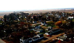
Grandview, Iowa
Grandview, Iowa | |
|---|---|
 | |
 Location of Grandview, Iowa | |
| Coordinates: 41°16′38″N 91°11′20″W / 41.27722°N 91.18889°WCoordinates: 41°16′38″N 91°11′20″W / 41.27722°N 91.18889°W | |
| Country | |
| State | |
| County | Louisa |
| Area | |
| • Total | 0.23 sq mi (0.60 km2) |
| • Land | 0.23 sq mi (0.60 km2) |
| • Water | 0.00 sq mi (0.00 km2) |
| Elevation | 712 ft (217 m) |
| Population | |
| • Total | 437 |
| • Density | 1,900.00/sq mi (728.33/km2) |
| Time zone | UTC-6 (Central (CST)) |
| • Summer (DST) | UTC-5 (CDT) |
| ZIP code | 52752 |
| Area code(s) | 319 |
| FIPS code | 19-32115 |
| GNIS feature ID | 0457030 |

Grandview is a city in Louisa County, Iowa, United States. The population was 437 at the time of the 2020 census.[2] It is part of the Muscatine Micropolitan Statistical Area.
History[]
Grandview was laid out in 1841 by Alvin Clark and Robert Childers.[3]
Grandview was seriously affected by an EF3 tornado on June 1, 2007, which damaged or destroyed dozens of houses and impacted other parts of the city.[4]
Geography[]
Grandview is located at 41°16′38″N 91°11′20″W / 41.27722°N 91.18889°W (41.277239, -91.188977).[5]
According to the United States Census Bureau, the city has a total area of 0.23 square miles (0.60 km2), all land.[6]
Demographics[]
| Year | Pop. | ±% |
|---|---|---|
| 1910 | 374 | — |
| 1920 | 341 | −8.8% |
| 1930 | 321 | −5.9% |
| 1940 | 315 | −1.9% |
| 1950 | 311 | −1.3% |
| 1960 | 300 | −3.5% |
| 1970 | 357 | +19.0% |
| 1980 | 473 | +32.5% |
| 1990 | 514 | +8.7% |
| 2000 | 600 | +16.7% |
| 2010 | 556 | −7.3% |
| 2020 | 437 | −21.4% |
| Source:"U.S. Census website". United States Census Bureau. Retrieved 2020-03-28. and Iowa Data Center Source: | ||
2010 census[]
As of the census[8] of 2010, there were 556 people, 207 households, and 154 families living in the city. The population density was 2,417.4 inhabitants per square mile (933.4/km2). There were 233 housing units at an average density of 1,013.0 per square mile (391.1/km2). The racial makeup of the city was 92.3% White, 0.9% African American, 0.2% Native American, 0.9% Asian, 4.0% from other races, and 1.8% from two or more races. Hispanic or Latino of any race were 8.5% of the population.
There were 207 households, of which 40.6% had children under the age of 18 living with them, 51.7% were married couples living together, 16.4% had a female householder with no husband present, 6.3% had a male householder with no wife present, and 25.6% were non-families. 19.3% of all households were made up of individuals, and 8.7% had someone living alone who was 65 years of age or older. The average household size was 2.69 and the average family size was 2.97.
The median age in the city was 34.4 years. 28.4% of residents were under the age of 18; 7.9% were between the ages of 18 and 24; 26.8% were from 25 to 44; 26% were from 45 to 64; and 11% were 65 years of age or older. The gender makeup of the city was 47.3% male and 52.7% female.
2000 census[]
As of the census[9] of 2000, there were 600 people, 204 households, and 157 families living in the city. The population density was 3,093.0 people per square mile (1,219.3/km2). There were 216 housing units at an average density of 1,113.5 per square mile (438.9/km2). The racial makeup of the city was 92.83% White, 0.50% African American, 0.17% Native American, 1.00% Asian, 0.50% Pacific Islander, 4.00% from other races, and 1.00% from two or more races. Hispanic or Latino of any race were 7.33% of the population.
There were 204 households, out of which 44.1% had children under the age of 18 living with them, 58.3% were married couples living together, 14.7% had a female householder with no husband present, and 23.0% were non-families. 18.6% of all households were made up of individuals, and 7.8% had someone living alone who was 65 years of age or older. The average household size was 2.94 and the average family size was 3.28.
32.0% were under the age of 18, 9.3% from 18 to 24, 30.0% from 25 to 44, 18.7% from 45 to 64, and 10.0% were 65 years of age or older. The median age was 33 years. For every 100 females, there were 89.3 males. For every 100 females age 18 and over, there were 88.0 males.
The median income for a household in the city was $37,625, and the median income for a family was $38,500. Males had a median income of $35,682 versus $20,417 for females. The per capita income for the city was $17,152. About 7.5% of families and 10.1% of the population were below the poverty line, including 9.5% of those under age 18 and 11.1% of those age 65 or over.
Education[]
Louisa-Muscatine Community School District operates the area public schools for this municipality.[10]
Notable people[]
- Murray Wier, University of Iowa basketball star, NBA player
References[]
- ^ "2019 U.S. Gazetteer Files". United States Census Bureau. Retrieved July 17, 2020.
- ^ Jump up to: a b c "2020 Census State Redistricting Data". census.gov. United states Census Bureau. Retrieved 12 August 2021.
- ^ Springer, Arthur (1912). History of Louisa County, Iowa, from Its Earliest Settlement to 1912, Volume 1. S. J. Clarke Publishing Company. p. 304.
- ^ Storm Tears Through Eastern Iowa Wilson, Mike (Associated Press writer), ABC, 2007-01-06. Accessed 2007-01-06.
- ^ "US Gazetteer files: 2010, 2000, and 1990". United States Census Bureau. 2011-02-12. Retrieved 2011-04-23.
- ^ "US Gazetteer files 2010". United States Census Bureau. Archived from the original on 2012-01-25. Retrieved 2012-05-11.
- ^ "Census of Population and Housing". Census.gov. Retrieved June 4, 2015.
- ^ "U.S. Census website". United States Census Bureau. Retrieved 2012-05-11.
- ^ "U.S. Census website". United States Census Bureau. Retrieved 2008-01-31.
- ^ "Louisa-Muscatine" (PDF). Iowa Department of Education. Retrieved 2020-04-02.
External links[]
| Wikimedia Commons has media related to Grandview, Iowa. |
| show Municipalities and communities of Louisa County, Iowa, United States |
|---|
| show Authority control |
|---|
- Cities in Iowa
- Cities in Louisa County, Iowa
- Muscatine, Iowa micropolitan area