Granity
Granity | |
|---|---|
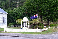 Granity War Memorial | |
 | |
| Coordinates: 41°37′47″S 171°51′13″E / 41.62972°S 171.85361°ECoordinates: 41°37′47″S 171°51′13″E / 41.62972°S 171.85361°E | |
| Country | New Zealand |
| Region | West Coast |
| District | Buller District |
| Ward | Seddon |
| Electorates | West Coast-Tasman Te Tai Tonga |
| Population (2018)[1] | |
| • Total | 168 |
Granity is a small town on the West Coast of New Zealand's South Island, 28 kilometres (17 mi) north-east of Westport on . Karamea is 68 kilometres (42 mi) further north.[2][3]
Squeezed between the often-tempestuous Tasman Sea to the west and steep forested cloud-shrouded mountains to the immediate east, the town is the largest in this sparsely populated part of New Zealand. Long known as a coal-mining town, the population has declined as the industry has waned. The population was 168 in the 2018 census, a decrease of 33 from 2013.[1] Several neighbouring towns, such as Denniston, have become virtually ghost towns.
The name "Granity" was given to the town by gold prospectors, in reference to the large quantity of granite in the area.[4]
Demographics[]
The population of Granity was 168 in the 2018 census, a decrease of 33 from 2013. There were 93 males and 75 females. 94.6% of people identified as European/Pākehā, 12.5% as Māori and 1.8% as Pacific peoples. 14.3% were under 15 years old, 7.1% were 15–29, 53.6% were 30–64, and 25.0% were 65 or older.[1]
| Year | Pop. | ±% p.a. |
|---|---|---|
| 2006 | 939 | — |
| 2013 | 987 | +0.71% |
| 2018 | 909 | −1.63% |
| Source: [5] | ||
The statistical area of Buller Coalfields, which at 499 square kilometres is much larger than Granity, had a population of 909 at the 2018 New Zealand census, a decrease of 78 people (−7.9%) since the 2013 census, and a decrease of 30 people (−3.2%) since the 2006 census. There were 447 households. There were 480 males and 429 females, giving a sex ratio of 1.12 males per female. The median age was 54 years (compared with 37.4 years nationally), with 135 people (14.9%) aged under 15 years, 84 (9.2%) aged 15 to 29, 486 (53.5%) aged 30 to 64, and 204 (22.4%) aged 65 or older.
Ethnicities were 90.1% European/Pākehā, 11.9% Māori, 1.3% Pacific peoples, 1.7% Asian, and 3.6% other ethnicities (totals add to more than 100% since people could identify with multiple ethnicities).
The proportion of people born overseas was 11.9%, compared with 27.1% nationally.
Although some people objected to giving their religion, 60.4% had no religion, 24.8% were Christian, 0.3% were Buddhist and 2.0% had other religions.
Of those at least 15 years old, 78 (10.1%) people had a bachelor or higher degree, and 231 (29.8%) people had no formal qualifications. The median income was $19,600, compared with $31,800 nationally. The employment status of those at least 15 was that 264 (34.1%) people were employed full-time, 93 (12.0%) were part-time, and 39 (5.0%) were unemployed.[5]
Economy[]
The Granity Creek Sawmill was established in 1846 and was a significant employer in the area. The town was also the location of the engineering division of the Westport Coal Company, and the railway station was used for loading and dispatching coal from the nearby Millerton mine.[6]
Education[]
Granity School opened in 1879 in Ngakawau and was later re-located to a site between Ngakawau and Granity. In 1901 it had a roll of 100 pupils.[6] The school is a co-educational full primary school (years 1–8), with a roll of 32 as of November 2021.[7][8] The natural erosion of the beach, at a rate of 40 centimetres (16 in) per year, is threatening the school buildings, and a stopbank has resulted in the school grounds protruding further out onto the beach than adjoining properties.[9]
Biodiversity[]
The very rare and critically endangered cobble skink is only known to occur on a short stretch of cobbled coast at Granity.[10]
Gallery[]
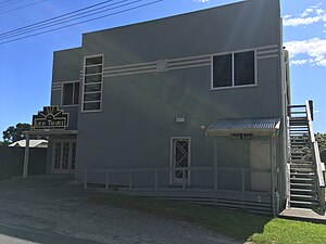
The Lyric Theatre
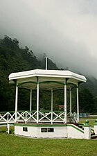
Band rotunda
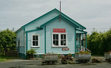
Fund-raising Centre - the community "op-shop"


References[]
- ^ a b c "Age and sex by ethnic group (grouped total response), for census usually resident population counts, 2006, 2013, and 2018 Censuses (urban rural areas)". Statistics New Zealand. Retrieved 4 February 2021.
- ^ Peter Dowling, ed. (2004). Reed New Zealand Atlas. Reed Books. map 62. ISBN 0-7900-0952-8.
- ^ Roger Smith, GeographX (2005). The Geographic Atlas of New Zealand. Robbie Burton. map 134. ISBN 1-877333-20-4.
- ^ Reed, A. W. (2002). The Reed Dictionary of New Zealand Place Names. Auckland: Reed Books. ISBN 0-7900-0761-4.
- ^ a b "Statistical area 1 dataset for 2018 Census". Statistics New Zealand. March 2020. Buller Coalfields (309500). 2018 Census place summary: Buller Coalfields
- ^ a b "Granity | NZETC". nzetc.victoria.ac.nz. Retrieved 2020-09-10.
- ^ "New Zealand Schools Directory". New Zealand Ministry of Education. Retrieved 22 December 2021.
- ^ Education Counts: Granity School
- ^ "Little Granity School versus the sea". Timaru Herald. 25 June 2012. Retrieved 25 June 2012.
- ^ "Critter of the Week". RNZ. 10 June 2016. Retrieved 10 June 2016.
External links[]
![]() Media related to Granity at Wikimedia Commons
Media related to Granity at Wikimedia Commons
- Buller District
- Populated places in the West Coast, New Zealand