Grazzanise
Grazzanise | |
|---|---|
| Comune di Grazzanise | |
 | |
 Coat of arms | |
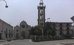
Location of Grazzanise  | |
 Grazzanise Location of Grazzanise in Italy | |
| Coordinates: 41°5′N 14°6′E / 41.083°N 14.100°E | |
| Country | Italy |
| Region | Campania |
| Province | Caserta (CE) |
| Frazioni | Brezza, Borgo Appio |
| Government | |
| • Mayor | Enrico Petrella |
| Area | |
| • Total | 47.0 km2 (18.1 sq mi) |
| Elevation | 12 m (39 ft) |
| Population | |
| • Total | 6,812 |
| • Density | 140/km2 (380/sq mi) |
| Demonym(s) | Grazzanisani |
| Time zone | UTC+1 (CET) |
| • Summer (DST) | UTC+2 (CEST) |
| Postal code | 81046 |
| Dialing code | 0823 |
| Patron saint | St. John the Baptist |
| Website | Official website |


Grazzanise is a comune (municipality) in the Province of Caserta in the Italian region Campania, located about 30 kilometres (19 mi) northwest of Naples and about 20 kilometres (12 mi) west of Caserta.
History[]
In ancient Roman times, it was an area covered by marshes caused by the nearby Volturno's floods. The town is mentioned for the first time in a bull by emperor Frederick II of 1234, as Graczanum. It was later populated by local vassals of the Angevine kings of Naples and their feudataries. In 1303 it is mentioned as Graczanisius.
During World War II, the area housed an airfield, which was repeatedly attacked by Allied bombers in August 1943 and from 4 to 6 September 1943. The German occupied it in 1943, after the Armistice between Italy and the Allies of 8 September 1943, expelling the Italian infantry division "Pasubio". Some 100 people died during another bombing, aiming at a bridge on the Volturno, performed by American B-26s in the night of 30 September 1943. The airport was captured by British troops in the following 10 October. Grazzanise Air Base, with limited civil use serving Caserta, is now used by the Italian Air Force 9° Stormo Caccia (9th Fighters Wing) and the 2nd NATO Signal Battalion.
In 1996–2000, the city's municipal council was disbanded by the Italian Ministry of Interior Affairs, due to camorra presence in the local political affairs.
References[]
- ^ "Superficie di Comuni Province e Regioni italiane al 9 ottobre 2011". Italian National Institute of Statistics. Retrieved 16 March 2019.
- ^ Data from Istat
- ^ "Popolazione Residente al 1° Gennaio 2018". Italian National Institute of Statistics. Retrieved 16 March 2019.
| Wikimedia Commons has media related to Grazzanise. |
This Campanian location article is a stub. You can help Wikipedia by . |
- Cities and towns in Campania
- Municipalities of the Province of Caserta
- Campanian geography stubs