Great Bend Township, Barton County, Kansas
Great Bend Township | |
|---|---|
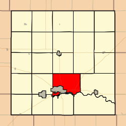 Location in Barton County | |
| Coordinates: 38°23′27″N 098°45′22″W / 38.39083°N 98.75611°WCoordinates: 38°23′27″N 098°45′22″W / 38.39083°N 98.75611°W | |
| Country | United States |
| State | Kansas |
| County | Barton |
| Area | |
| • Total | 40.46 sq mi (104.79 km2) |
| • Land | 40.25 sq mi (104.26 km2) |
| • Water | 0.2 sq mi (0.53 km2) 0.51% |
| Elevation | 1,847 ft (563 m) |
| Population (2010) | |
| • Total | 1,752 |
| • Density | 43/sq mi (17/km2) |
| GNIS feature ID | 0475651 |

Great Bend Township is a township in Barton County, Kansas, United States. As of the 2010 census, its population was 1,752.[1]
Great Bend Township was organized in 1872.[2]
Geography[]
Great Bend Township covers an area of 40.46 square miles (100 km2) and contains one incorporated settlement, Great Bend (the county seat). According to the USGS, it contains two cemeteries: Golden Belt Memorial Park and Great Bend.
The stream of Dry Walnut Creek runs through this township.
Transportation[]
Great Bend Township contains two airports or landing strips: Button Airport and Great Bend Municipal Airport.
References[]
- ^ "Profile of General Population and Housing Characteristics: 2010 Demographic Profile Data (DP-1): Great Bend township, Barton County, Kansas". United States Census Bureau. Retrieved July 13, 2012.
- ^ History of the State of Kansas: Containing a Full Account of Its Growth from an Uninhabited Territory to a Wealthy and Important State. A. T. Andreas. 1883. p. 762.
External links[]
Municipalities and communities of Barton County, Kansas, United States | ||
|---|---|---|
| Cities |  | |
| Unincorporated communities | ||
| Townships | ||
| Footnotes | †This populated place is designated a Census-Designated Place (CDP) by the United States Census Bureau. ‡This populated place also has portions in an adjacent county or counties. | |
| ||
Categories:
- Townships in Barton County, Kansas
- Townships in Kansas
- Kansas geography stubs