Greenbank, Queensland
| Greenbank Logan City, Queensland | |||||||||||||||
|---|---|---|---|---|---|---|---|---|---|---|---|---|---|---|---|
 Original Greenbank State School building, 2014 | |||||||||||||||
 Greenbank | |||||||||||||||
| Coordinates | 27°41′29″S 152°57′21″E / 27.6913°S 152.9558°E | ||||||||||||||
| Population | 7,694 (2016 census)[1] | ||||||||||||||
| • Density | 69.63/km2 (180.34/sq mi) | ||||||||||||||
| Postcode(s) | 4124 | ||||||||||||||
| Area | 110.5 km2 (42.7 sq mi) | ||||||||||||||
| Time zone | AEST (UTC+10:00) | ||||||||||||||
| Location |
| ||||||||||||||
| LGA(s) | Logan City | ||||||||||||||
| State electorate(s) | Jordan | ||||||||||||||
| Federal Division(s) | Wright | ||||||||||||||
| |||||||||||||||

Greenbank is a rural residential suburb in the City of Logan, Queensland, Australia.[2] In the 2016 census Greenbank had a population of 7,694 people.[1]
Geography[]
This section does not cite any sources. (June 2017) |
Once divided between the Shire of Beaudesert and Logan City, the Queensland Government's amalgamation of local government resulted in Greenbank becoming entirely within Logan City, since 15 March 2008.
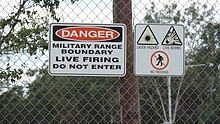
The suburb is surrounded by farmland and includes the forested Greenbank Military Range (27°42′24″S 152°59′18″E / 27.7068°S 152.9884°E), which is on the Commonwealth Heritage List.[3] A strip of parkland and a watercourse originally named The Platypus Pools and Bracken Way is a natural habitat for a number of species of flora and fauna including platypus, the rare black cockatoo, kookaburra, the blue wren, kingfisher, honeyeaters, owls, kangaroos, wallabies, koalas, possums, bearded dragons, legless lizards and water monitors up to 2.5 metres in length. Many more species have been sighted living in this natural habitat. The watercourse and natural forest are fed by torrential rains and natural springs dotted throughout the Spring Mountain area, continuing through to Greenbank, Browns Plains and finishing at Karrawatha National Park. Snakes, mostly consisting of python, whip snakes and red-bellied black snakes, and to a much lesser degree brown snakes. Bird-eating spiders, huntsman spiders, redback spiders and the orb-weaver spider also share the watercourse and forest area.
The parkland stretches along on either side of the watercourse and a variety of walking tracks of different fitness levels are used by residents for casual strolls, nature lovers and athletic enthusiasts, horse and bike riding. The tracks extend out into estates of Greenbank; such as Blue Grass, New Beith, Lyons and Teviot Downs Estates which cover more forested areas, while Spring Mountain Estate contains the natural forest areas and watercourse. The walking track connects with neighbouring Boronia Heights.
History[]
Greenbank is situated in the Yugarabul traditional Aboriginal country of the Brisbane and surrounding regions.[4] Towards the south of Greenbank is the Bundjalung traditional Aboriginal country.[5]
The early name of the district was Teviot but derives its present name Greenbank from the name of a cattle property belonging to William Slack.[6]
Greenbank was first settled by Europeans in the 1840s. In the 1880s the main industries were dairying, farming and timber cutting. Cobb & Co had a changing station for their coaches at a hotel on the corner of Teviot Road and Pub Lane; from there, they would travel to Beaudesert via the Old Paradise Road between Acacia Ridge and Jimboomba. When the coach service ceased in 1924, the hotel licence lapsed.[7]
Greenbank Provisional School was built by volunteer labour and opened on 23 January 1893 with 12 pupils under teacher Mary Mulroney who received an annual salary of £50.[8][9] It became Greenbank State School on 1 January 1909.[10][11] It closed between 1943 and 1950 due to low student numbers.[7]
In the 2011 census Greenbank had a population of 7,328 people.[12]
In the 2016 census Greenbank had a population of 7,694 people.[1]
Education[]
Greenbank State School is a government primary (Prep-6) school for boys and girls at 12-54 Goodna Road (27°42′37″S 152°58′39″E / 27.7103°S 152.9776°E).[13][14] In 2013, the school had an enrolment of 1,117 students with 72 teachers (63 full-time equivalent).[15] In 2018, the school had an enrolment of 1,048 students with 76 teachers (66 full-time equivalent) and 37 non-teaching staff (25 full-time equivalent).[16] It includes a special education program.[13]
Another government primary school is proposed in the southern part of Greenbank nearby North Maclean with an expected opening and commencement in 2022.[17]
There are no secondary schools in Greenbank. The nearest secondary schools are Park Ridge State High School in neighbouring Park Ridge to the east and Springfield Central State High School in Springfield Central to the west.[18]
Amenities[]
The Greenbank Community Centre and Library, operated since March 2008 by the Logan City Council, is located at 145-167 Teviot Road (27°43′49″S 152°59′01″E / 27.73040°S 152.98357°E).[19][20]
There are a number of parks in the area, including:
- Andrew Josey Gully (27°41′44″S 152°55′48″E / 27.6956°S 152.9299°E)[21]
- Argyle Road Park (27°43′37″S 152°57′48″E / 27.7270°S 152.9634°E)[21]
- Bradley Court Park (27°43′38″S 152°56′10″E / 27.7273°S 152.9361°E)[21]
- Butterfly Park (27°40′29″S 152°55′47″E / 27.6747°S 152.9296°E)[21]
- Greenbank Meadows Park (27°43′37″S 153°00′14″E / 27.7270°S 153.0039°E)[21]
- Greenwood Lakes (27°39′45″S 152°59′43″E / 27.6626°S 152.9954°E)[21]
- Habitat Springs (27°40′00″S 152°55′48″E / 27.6666°S 152.9301°E)[21]
- Lance Road Park (27°44′38″S 152°58′35″E / 27.7440°S 152.9764°E)[21]
- Lyndale Road Park (27°43′33″S 152°55′37″E / 27.7257°S 152.9269°E)[21]
- Oxley Creek (27°42′02″S 152°56′05″E / 27.7006°S 152.9348°E)[21]
- Oxley Creek Park (27°43′46″S 152°55′00″E / 27.7295°S 152.9168°E)[21]
- Pub Lane Park (27°44′06″S 152°57′46″E / 27.7350°S 152.9629°E)[21]
- Roberts Road Park (27°43′48″S 152°56′49″E / 27.7299°S 152.9470°E)[21]
- Thompson Road Park (27°42′06″S 152°57′35″E / 27.7016°S 152.9598°E)[21]
- Tully Connection Road Par (27°44′18″S 152°55′30″E / 27.7384°S 152.9251°E)[21]
- White Rock- Spring Mountain Conservation Estate (27°42′55″S 152°53′25″E / 27.7154°S 152.8903°E)[21]
- Woodfall Road Park (27°43′24″S 152°58′21″E / 27.7232°S 152.9725°E)[21]
Sports[]


The Greenbank Recreation Reserve is home to the Greenbank Sports & Recreation Club and the Greenbank Raiders Rugby League Club. Situated on Middle Rd (27°43′11″S 152°59′01″E / 27.71971°S 152.98365°E) the rugby club caters for teams from under 6 to under 18 in 2009. Three teams won premierships in 2009. Under 15 division 4, Under 18 division 1 and the very successful under 16 division 2 which completed the year undefeated. They were minor premiers and won the grand final.
Greenbank is also home to the successful Greenbank Football Club. In 2011, the team made history by winning three senior Premierships and two Championships in three divisions. Greenbank FC is affiliated with Football Brisbane and provides an avenue for both junior and senior players. In 2011, Greenbank FC fielded teams from squirts up to under 14 age groups and both men and women teams.
2016 was Greenbank FC's 40th anniversary.
Demographics[]
The population of Greenbank in 1996 was 5,098 people. By 2001 the population was 5,261 showing a population growth of 3% in the area during that time. In 2011, the figure had grown to 7,328.[12]
Mostly consisting of acreage blocks close to Springfield, Queensland, households in Greenbank are primarily couples with children and are likely to be repaying between $800.00 – $1500.00 per month on mortgage repayments. In general, people in Greenbank work in a trades position occupation, through to management positions and owner operated businesses. In 1996, 84% of the homes in Greenbank were owner-occupied compared with 86% in 2001. In May 2014, the median sale price of houses in the area in Australian dollars was $395,000. As of June 2017, the median sale price of houses had risen to $560,000[22]
In the 2011 census, Greenbank recorded a population of 7,328 people, 49.4% female and 50.6% male. The median age of the Greenbank population was 36 years, 1 year below the national median of 37. 75.1% of people living in Greenbank were born in Australia. The other top responses for country of birth were England 5.8%, New Zealand 5.5%, Vietnam 0.9%, Taiwan 0.7%, South Africa 0.6%. 87.6% of people spoke only English at home; the next most common languages were 1.5% Vietnamese, 1.1% Mandarin, 0.6% Hmong, 0.5% Mon-Khmer, 0.5% Spanish.[12]
References[]
- ^ Jump up to: a b c Australian Bureau of Statistics (27 June 2017). "Greenbank (SSC)". 2016 Census QuickStats. Retrieved 20 October 2018.

- ^ "Greenbank – suburb in City of Logan (entry 45266)". Queensland Place Names. Queensland Government. Retrieved 27 December 2020.
- ^ "Greenbank Military Training Area (part), Middle Rd, Greenbank, QLD, Australia". Commonwealth Heritage List. Archived from the original on 16 February 2021. Retrieved 9 June 2017.
- ^ "AIATSIS code E66: Yugarabul". Federal government. Australian Institute of Aboriginal and Torres Strait Islander Studies. Retrieved 31 July 2020.
- ^ "Bundjalung – Muurrbay Aboriginal Language and Culture Co-operative". muurrbay.org.au. Retrieved 19 December 2020.
- ^ "News and Notes of General Interest for the Man on the Land". The Brisbane Courier. National Library of Australia. 4 October 1930. p. 9. Archived from the original on 16 February 2021. Retrieved 8 May 2014.
- ^ Jump up to: a b "Greenbank". Suburbs. Logan City Council. Archived from the original on 8 May 2014. Retrieved 7 May 2014.
- ^ "Opening and closing dates of Queensland Schools". Queensland Government. Retrieved 7 May 2014.
- ^ "How old is Greenbank State School?". Greenbank State School. 29 November 2012. Archived from the original on 19 August 2014. Retrieved 18 August 2014.
- ^ "Agency ID 5273, Greenbank State School". Queensland State Archives. Retrieved 7 May 2014.
- ^ Queensland Family History Society (2010), Queensland schools past and present (Version 1.01 ed.), Queensland Family History Society, ISBN 978-1-921171-26-0
- ^ Jump up to: a b c Australian Bureau of Statistics (31 October 2012). "Greenbank". 2011 Census QuickStats. Retrieved 27 December 2012.
- ^ Jump up to: a b "State and non-state school details". Queensland Government. 9 July 2018. Archived from the original on 21 November 2018. Retrieved 21 November 2018.
- ^ "Greenbank State School". Archived from the original on 22 October 2020. Retrieved 16 February 2021.
- ^ "2013 School Annual Report" (PDF). Greenbank State School. Archived from the original (PDF) on 19 August 2014. Retrieved 18 August 2014.
- ^ "ACARA School Profile 2018". Australian Curriculum, Assessment and Reporting Authority. Archived from the original on 27 August 2020. Retrieved 28 January 2020.
- ^ "Tradies take up tools on new school at Greenbank". Queensland government - Ministerial Media Statements. Retrieved 10 April 2021.
- ^ "Queensland Globe". State of Queensland. Retrieved 16 February 2021.
- ^ "Greenbank Library". Library locations. Logan City Council. Archived from the original on 8 May 2014. Retrieved 7 May 2014.
- ^ "Greenbank Community Centre". Community centres. Logan City Council. Archived from the original on 8 May 2014. Retrieved 7 May 2014.
- ^ Jump up to: a b c d e f g h i j k l m n o p q "Land for public recreation - Queensland". Queensland Open Data. Queensland Government. 20 November 2020. Archived from the original on 22 November 2020. Retrieved 22 November 2020.
- ^ "Raine & Horne Suburb Profile: Greenbank". Raine & Horne. Raine & Horne. Archived from the original on 19 February 2017. Retrieved 5 June 2017.
Further reading[]
- Scott, Joanne; Greenbank State School (1993), Greenbank State School centenary book : including New Beith, North Maclean and Maclean schools, Greenbank State School, ISBN 978-0-646-14341-5
External links[]
| Wikimedia Commons has media related to Greenbank, Queensland. |
- University of Queensland: Queensland Places: Greenbank
- "News and Notes of General Interest for the Man on the Land". The Brisbane Courier. National Library of Australia. 4 October 1930. — a description of Greenbank in 1930
| show Authority control |
|---|
- Suburbs of Logan City