Greenland Plain
| Greenland Abyssal Plain | |
|---|---|
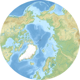 Location in the Arctic
 | |
| Location | Greenland Sea |
| Coordinates | 73°N 3°W / 73°N 3°WCoordinates: 73°N 3°W / 73°N 3°W |
| Geology | bathymetric depression |

The Greenland Abyssal Plain at 75°N 3°W / 75°N 3°W is a bathymetric depression in the Greenland Sea. It is delimited by and Jan Mayen pressure zone in the South and separated by a smaller ridge to the Boreas Abyssal Plain in the North.
Oceanography[]
In 1988/89 ocean acoustic tomography was performed there[1] to study the Greenland Sea gyre and deep water formation. Deep water formation simply means surface water being transported downwards into the ocean, this is important to drive the global ocean currents by thermohaline circulation. The study showed that the mixed layer at the surface forms in autumn. During winter, the region is covered by sea ice. In early spring when the sea ice vanishes, the layer gets thicker (up to 1.5 km). When the Polar day starts in late March the seasonal cycle starts again with another shallow mixed layer.[2]
References[]
- ^ Pawlowicz, Richard; Lynch, J. F.; Owens, W. B.; Worcester, P. F.; Morawitz, W. M. L.; Sutton, P. J. (January 1995). "Thermal evolution of the Greenland Sea Gyre in 1988–1989". Journal of Geophysical Research. 100 (C3): 4727. doi:10.1029/94JC02509.
- ^ "Greenland Sea Tomography Experiment". Ocean Acoustic Tomography. Woods Hole Oceanographic Institute. June 2011. Retrieved 2 October 2012.
External links[]
| Major |  | |
|---|---|---|
| Minor | ||
| Micro |
| |
| Historical | ||
| Oceanic ridges |
| |
| Ancient oceanic ridges | ||
This article about a specific oceanic location or ocean current is a stub. You can help Wikipedia by . |
This Arctic-related article is a stub. You can help Wikipedia by . |
- Geography of the Arctic
- Oceanic basins of the Arctic Ocean
- Abyssal plains
- Marine geography stubs
- Arctic stubs