Greenleaf, Wisconsin
Greenleaf, Wisconsin | |
|---|---|
 | |
 Location in Brown County and the state of Wisconsin. | |
| Coordinates: 44°18′48″N 88°05′46″W / 44.31333°N 88.09611°WCoordinates: 44°18′48″N 88°05′46″W / 44.31333°N 88.09611°W | |
| Country | United States |
| State | Wisconsin |
| County | Brown |
| Town | Wrightstown |
| Area | |
| • Total | 1.042 sq mi (2.70 km2) |
| • Land | 1.042 sq mi (2.70 km2) |
| • Water | 0 sq mi (0 km2) |
| Elevation | 712 ft (217 m) |
| Population | |
| • Total | 607 |
| • Density | 580/sq mi (220/km2) |
| Time zone | UTC-6 (Central (CST)) |
| • Summer (DST) | UTC-5 (CDT) |
| Area code(s) | 920 |
| GNIS feature ID | 1565848[3] |

Greenleaf is an unincorporated census-designated place in Brown County, Wisconsin, United States, in the town of Wrightstown.[3]
History[]
As of the 2010 census it had a population of 607.[4] Greenleaf was named for Emery B. Greenleaf, the general manager of the Milwaukee & Northern railroad at the time the Greenleaf post office was established in 1873.[5]
Incorporation as a Village[]
In 2020, 800 residents of the community petitioned the state of Wisconsin to become a village.[6] The Wisconsin Incorporation Review Board denied the petition's "characteristics of the territory" requirement as the petition included 2 separate areas: one in the vicinity of a roundabout of state highways WIS 57 and Wisconsin Highway 96 and another isolated area to the east of the Niagara Escarpment.[6] The second area is isolated from the first by the escarpment, a quarry and vacant lands.[6]
Geography[]
It is located at the intersection of Wisconsin Highways 57/32 and 96.[7] It uses ZIP code 54126.[8] Greenleaf has an area of 1.042 square miles (2.70 km2), all of it land. The community is part of the Green Bay Metropolitan Statistical Area.
References[]
- ^ "US Gazetteer files: 2010, 2000, and 1990". United States Census Bureau. 2011-02-12. Retrieved 2011-04-23.
- ^ "U.S. Census website". United States Census Bureau. Retrieved 2011-05-14.
- ^ a b "Greenleaf, Wisconsin". Geographic Names Information System. United States Geological Survey.
- ^ "Geographic Identifiers: 2010 Demographic Profile Data (G001): Greenleaf CDP, Wisconsin". U.S. Census Bureau, American Factfinder. Archived from the original on February 12, 2020. Retrieved May 13, 2014.
- ^ Callary, Edward (2016). Place Names of Wisconsin. Madison, WI: University of Wisconsin Press. p. 110. ISBN 978-0-299-30964-0.
- ^ a b c News, Brian Kerhin, FOX 11 (October 21, 2020). "Petition to create the village of Greenleaf denied". WLUK-TV. Retrieved January 24, 2021.
- ^ "Greenleaf, Wisconsin". Google Maps. Retrieved 2009-09-19.
- ^ United States Postal Service (2012). "USPS - Look Up a ZIP Code". Retrieved 2012-02-15.
Images[]
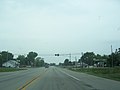
Looking north at the intersection of Wisconsin Highways 57/32 and 96 in Greenleaf

The sign for Greenleaf
Greenleaf Post office

Looking east at Greenleaf along WIS 96

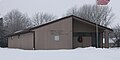
Greenleaf Fire department


Municipalities and communities of Brown County, Wisconsin, United States | ||
|---|---|---|
| Cities |  | |
| Villages | ||
| Towns | ||
| CDPs | ||
| Unincorporated communities |
| |
| Indian reservation | ||
| Ghost towns/ neighborhoods | ||
| Footnotes | ‡This populated place also has portions in an adjacent county or counties | |
| ||
This article about a location in Brown County, Wisconsin is a stub. You can help Wikipedia by . |
- Census-designated places in Brown County, Wisconsin
- Census-designated places in Wisconsin
- Green Bay metropolitan area
- Green Bay metropolitan area geography stubs