Gregory, Texas
Gregory, Texas | |
|---|---|
| Motto(s): The Pathway to the Future | |
 | |
| Coordinates: 27°55′14″N 97°17′33″W / 27.92056°N 97.29250°WCoordinates: 27°55′14″N 97°17′33″W / 27.92056°N 97.29250°W | |
| Country | United States |
| State | Texas |
| County | San Patricio |
| Government | |
| • Type | General Law Type A |
| • Mayor | Celestino Zambrano |
| • Mayor Pro-Tem | Pablo Martinez |
| • Alderman | Alvaro Lopez Jr., Christopher A. Flores |
| • Alderwoman | Kristina Zambrano, Odelia Reyes |
| Area | |
| • Total | 1.35 sq mi (3.50 km2) |
| • Land | 1.35 sq mi (3.50 km2) |
| • Water | 0.00 sq mi (0.00 km2) |
| Elevation | 30 ft (9 m) |
| Population (2010) | |
| • Total | 1,907 |
| • Estimate (2019)[4] | 1,886 |
| • Density | 1,396.00/sq mi (538.81/km2) |
| Time zone | UTC−6 (Central (CST)) |
| • Summer (DST) | UTC−5 (CDT) |
| ZIP Code | 78359 |
| Area code(s) | 361 Exchange: 777 |
| FIPS code | 48-31064[2] |
| GNIS feature ID | 1337010[3] |
| Website | Official website |

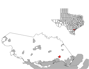
Gregory is a city in San Patricio County, Texas, United States. The population was 1,907 at the 2010 census.
Geography[]
Gregory is located at 27°55′14″N 97°17′33″W / 27.92056°N 97.29250°W (27.920604, -97.292480).[5]
According to the United States Census Bureau, the city has a total area of 1.4 square miles (3.6 km2), all land.
Demographics[]
| Historical population | |||
|---|---|---|---|
| Census | Pop. | %± | |
| 1960 | 1,970 | — | |
| 1970 | 2,246 | 14.0% | |
| 1980 | 2,739 | 22.0% | |
| 1990 | 2,458 | −10.3% | |
| 2000 | 2,318 | −5.7% | |
| 2010 | 1,907 | −17.7% | |
| 2019 (est.) | 1,886 | [4] | −1.1% |
| U.S. Decennial Census[6] | |||
As of the census[2] of 2000, there were 2,318 people, 658 households, and 561 families residing in the city. The population density was 1,636.8 people per square mile (630.3/km2). There were 743 housing units at an average density of 524.6/sq mi (202.0/km2). The racial makeup of the city was 70.10% White, 0.60% African American, 0.65% Native American, 0.09% Asian, 0.04% Pacific Islander, 25.37% from other races, and 3.15% from two or more races. Hispanic or Latino of any race were 94.65% of the population.
There were 658 households, out of which 43.6% had children under the age of 18 living with them, 61.1% were married couples living together, 16.3% had a female householder with no husband present, and 14.6% were non-families. 13.7% of all households were made up of individuals, and 5.2% had someone living alone who was 65 years of age or older. The average household size was 3.52 and the average family size was 3.85.
In the city, the population was spread out, with 33.4% under the age of 18, 10.6% from 18 to 24, 26.0% from 25 to 44, 20.2% from 45 to 64, and 9.8% who were 65 years of age or older. The median age was 30 years. For every 100 females, there were 97.4 males. For every 100 females age 18 and over, there were 93.1 males.
The median income for a household in the city was $31,250, and the median income for a family was $33,750. Males had a median income of $29,375 versus $16,226 for females. The per capita income for the city was $10,752. About 16.8% of families and 18.7% of the population were below the poverty line, including 23.1% of those under age 18 and 20.3% of those age 65 or over.
Education[]

Gregory is served by the Gregory-Portland Independent School District.
Stephen F. Austin Elementary School (PK-5) is in Gregory. A new elementary school was built for the 2007–2008 school year.
Gregory-Portland Intermediate School (6), Gregory-Portland Junior High School (7-8), and Gregory-Portland High School (9-12) in nearby Portland also serves Gregory.
Media[]
The 1981 film Raggedy Man starring Sissy Spacek was set in Gregory in 1944. She played the town's telephone operator.
Historic facts[]
Gregory once had a high school named Gregory High School that schooled residents of Gregory and Portland. Later, it was moved to Portland, named Gregory-Portland High School and remains there to this present day.
References[]
- ^ "2019 U.S. Gazetteer Files". United States Census Bureau. Retrieved August 7, 2020.
- ^ Jump up to: a b "U.S. Census website". United States Census Bureau. Retrieved 2008-01-31.
- ^ "US Board on Geographic Names". United States Geological Survey. 2007-10-25. Retrieved 2008-01-31.
- ^ Jump up to: a b "Population and Housing Unit Estimates". United States Census Bureau. May 24, 2020. Retrieved May 27, 2020.
- ^ "US Gazetteer files: 2010, 2000, and 1990". United States Census Bureau. 2011-02-12. Retrieved 2011-04-23.
- ^ "Census of Population and Housing". Census.gov. Retrieved June 4, 2015.
| show Municipalities and communities of San Patricio County, Texas, United States |
|---|

| show Authority control |
|---|
- Cities in Texas
- Cities in San Patricio County, Texas
- Cities in the Corpus Christi metropolitan area