Gressitt Glacier
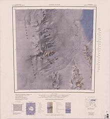
Gressitt Glacier (71°30′S 161°15′E / 71.500°S 161.250°ECoordinates: 71°30′S 161°15′E / 71.500°S 161.250°E) is a broad glacier, about 45 nautical miles (80 km) long, draining the area between the Daniels Range and the Emlen Peaks in the Usarp Mountains of Victoria Land, Antarctica, and flowing northeast to enter the Rennick Glacier just north of the Morozumi Range. This geographical feature was first mapped by the United States Geological Survey from surveys and U.S. Navy air photos, 1960–63, and was so named by the Advisory Committee on Antarctic Names for biologist J. Linsley Gressitt, Program Director, who made biological studies, particularly in the Ross Sea area, during six austral summers, 1959–60 to 1965–66.[1] The glacier lies situated on the Pennell Coast, a portion of Antarctica lying between Cape Williams and Cape Adare.
 WikiMiniAtlas
Further reading[]
- Paul A. Mayewski, John W. Attig, David J. Drewry, Pattern of Ice Surface Lowering for Rennick Glacier, Northern Victoria Land, Antarctica, Journal of Glaciology, Volume 22, Issue 86 1979, pp. 53–65, DOI: https://doi.org/10.3189/S0022143000014052
- Charles Swithinbank, Antarctica, Issue 1386, Part 2, P 52
External links[]
- Gressitt Glacier on USGS website
- Gressitt Glacier on the Antarctica New Zealand Digital Asset Manager website
- Gressitt Glacier on AADC website
- Gressitt Glacier on SCAR website
- Gressitt Glacier distance calculator
References[]
- ^ "Gressitt Glacier". Geographic Names Information System. United States Geological Survey. Retrieved 2012-05-07.
![]() This article incorporates public domain material from the United States Geological Survey document: "Gressitt Glacier". (content from the Geographic Names Information System)
This article incorporates public domain material from the United States Geological Survey document: "Gressitt Glacier". (content from the Geographic Names Information System)
This article about a glacier in Pennell Coast is a stub. You can help Wikipedia by . |
- Glaciers of Pennell Coast
- Victoria Land glacier stubs
- Pennell Coast geography stubs