Guasimal
Guasimal | |
|---|---|
Village | |
 OSM map showing Guasimal | |
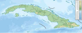
 Location of Guasimal in Cuba | |
| Coordinates: 21°44′24.6″N 79°27′49.3″W / 21.740167°N 79.463694°WCoordinates: 21°44′24.6″N 79°27′49.3″W / 21.740167°N 79.463694°W | |
| Country | |
| Province | Sancti Spíritus |
| Municipality | Sancti Spíritus |
| Founded | 1865 |
| Elevation | 60 m (200 ft) |
| Population (2011)[1] | |
| • Total | 5,000 |
| Time zone | UTC-5 (EST) |
| Area code(s) | +53-41 |
Guasimal is a Cuban village and consejo popular ("people's council", i.e. hamlet) of the municipality of Sancti Spíritus, in Sancti Spíritus Province. In 2011 it had a population of about 5,000.[1]
History[]
The village was founded in 1865. In late 1950s, during the Cuban Revolution, Che Guevara established his first guerrilla camp near the town.[2] In November 2010, Aero Caribbean Flight 883 crashed near the village.
Geography[]
Located on a plain between Zaza Reservoir and the Caribbean Coast, Guasimal is a rural village surrounded by some scattered hillocks and a forest area. It is 11 km from Paredes, 17 from Entronque Guasimal, 20 from , 23 from , 27 from Sancti Spíritus, 36 from La Sierpe and 74 from Trinidad. Nearest rivers are (west) and (east).[3]
Transport[]
The village is served by a railway station on the Sancti Spíritus-Tunas de Zaza line. Entronque Guasimal, 17 km north of it, is crossed in the middle by the state highway "Circuito Sur" (CS).
See also[]
References[]
- ^ a b (in Spanish) Spíritus) Guasimal on EcuRed
- ^ Guasimal desanda la memoria Archived 2008-09-22 at the Wayback Machine
- ^ 1550708026 Guasimal on OpenStreetMap
External links[]
| Wikimedia Commons has media related to Guasimal. |
- Guasimal Destination Guide on trip-suggest.com
- Guasimal Weather on accuweather.com
- Populated places in Sancti Spíritus Province
- Sancti Spíritus
- Populated places established in 1865
