La Sierpe, Cuba
La Sierpe | |
|---|---|
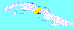 La Sierpe municipality (red) within Sancti Spíritus Province (yellow) and Cuba | |
| Coordinates: 21°45′38″N 79°14′36″W / 21.76056°N 79.24333°WCoordinates: 21°45′38″N 79°14′36″W / 21.76056°N 79.24333°W | |
| Country | Cuba |
| Province | Sancti Spíritus |
| Area | |
| • Total | 1,035 km2 (400 sq mi) |
| Elevation | 35 m (115 ft) |
| Population (2004)[2] | |
| • Total | 16,937 |
| • Density | 16.4/km2 (42/sq mi) |
| Time zone | UTC-5 (EST) |
| Area code(s) | +53-41 |
La Sierpe is a municipality and town in the Sancti Spíritus Province of Cuba. It is located in the south-eastern part of the province, 30 kilometres (19 mi) from Sancti Spiritus, the provincial capital.
Geography[]
It borders the Gulf of Ana Maria of the Caribbean Sea to the south and the province of Ciego de Ávila to the east.
Demographics[]
In 2004, the municipality of La Sierpe had a population of 16,937.[2] With a total area of 1,035 km2 (400 sq mi),[1] it has a population density of 16.4/km2 (42/sq mi).
See also[]
References[]
- ^ a b Statoids (July 2003). "Municipios of Cuba". Retrieved 2007-10-07.
- ^ a b Atenas.cu (2004). "2004 Population trends, by Province and Municipality" (in Spanish). Retrieved 2007-10-07.[dead link]
External links[]
![]() Media related to La Sierpe, Cuba at Wikimedia Commons
Media related to La Sierpe, Cuba at Wikimedia Commons
Places adjacent to La Sierpe, Cuba | ||||||||||||||||
|---|---|---|---|---|---|---|---|---|---|---|---|---|---|---|---|---|
| ||||||||||||||||
This Cuban location article is a stub. You can help Wikipedia by . |
Categories:
- Populated places in Sancti Spíritus Province
- Cuba geography stubs