Taguasco
Taguasco | |
|---|---|
 | |
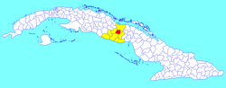 Taguasco municipality (red) within Sancti Spíritus Province (yellow) and Cuba | |
| Coordinates: 22°00′18″N 79°15′54″W / 22.00500°N 79.26500°WCoordinates: 22°00′18″N 79°15′54″W / 22.00500°N 79.26500°W | |
| Country | Cuba |
| Province | Sancti Spíritus |
| Area | |
| • Total | 518 km2 (200 sq mi) |
| Elevation | 100 m (300 ft) |
| Population (2004)[2] | |
| • Total | 36,365 |
| • Density | 70.2/km2 (182/sq mi) |
| Time zone | UTC-5 (EST) |
| Area code(s) | +53-41 |
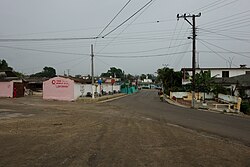
Taguasco (Spanish pronunciation: [taˈɣwasko]) is a municipality and town in the Sancti Spíritus Province of Cuba.
Geography[]
It is located 20 kilometres (12 mi) north-east of Sancti Spiritus, the provincial capital, and is bisected by Carretera Central highway between Cabaiguán and Jatibonico.
Demographics[]
In 2004, the municipality of Taguasco had a population of 36,365.[2] With a total area of 518 km2 (200 sq mi),[1] it has a population density of 70.2/km2 (182/sq mi).
See also[]
References[]
- ^ a b Statoids (July 2003). "Municipios of Cuba". Retrieved 2007-10-07.
- ^ a b Atenas.cu (2004). "2004 Population trends, by Province and Municipality" (in Spanish). Archived from the original on 2006-07-14. Retrieved 2007-10-07.
External links[]
![]() Media related to Taguasco at Wikimedia Commons
Media related to Taguasco at Wikimedia Commons
Places adjacent to Taguasco | ||||||||||||||||
|---|---|---|---|---|---|---|---|---|---|---|---|---|---|---|---|---|
| ||||||||||||||||
This Cuban location article is a stub. You can help Wikipedia by . |
Categories:
- Populated places in Sancti Spíritus Province
- Cuba geography stubs