Guerrero Negro Airport
This article needs additional citations for verification. (May 2021) |
Guerrero Negro Airport Aeropuerto Regional de Guerrero Negro | |||||||||||
|---|---|---|---|---|---|---|---|---|---|---|---|
| Summary | |||||||||||
| Airport type | Public | ||||||||||
| Serves | Guerrero Negro, Baja California Sur, Mexico | ||||||||||
| Location | Ensenada Municipality, Baja California, Mexico | ||||||||||
| Elevation AMSL | 59 ft / 18 m | ||||||||||
| Coordinates | 28°01′33″N 114°01′26″W / 28.02583°N 114.02389°WCoordinates: 28°01′33″N 114°01′26″W / 28.02583°N 114.02389°W | ||||||||||
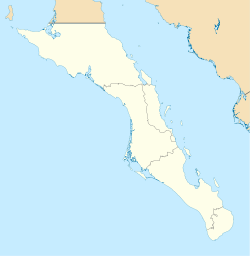
| Map | |||||||||||
 GRN | |||||||||||
| Runways | |||||||||||
| |||||||||||
| Statistics (2020) | |||||||||||
| |||||||||||
Source: Agencia Federal de Aviación Civil | |||||||||||


Guerrero Negro Airport (IATA: GUB, ICAO: MMGR) is an airport located 6 km north of Guerrero Negro in neighboring Ensenada Municipality of southern Baja California state, Mexico.
It handles air traffic for the City of Guerrero Negro, located in Mulegé Municipality of northern Baja California Sur state.
Airlines and destinations[]
This section does not cite any sources. (January 2022) |
| Airlines | Destinations |
|---|---|
| Aéreo Servicio Guerrero | Ensenada, Guaymas, Hermosillo, Isla de Cedros, Nogales, Santa Rosalía |
| Calafia Airlines | Ciudad Obregón, Guaymas, Hermosillo, Isla de Cedros |
Accidents and incidents[]
- On 20 December 1997, Douglas C-47 XA-CUC of crashed near Guerrero Negro on a flight from Guerrero Negro Airport to Isla de Cedros Airport, Cedros, Baja California.[1]
References[]
- ^ "XA-CUC Accident description". Aviation Safety Network. Retrieved 25 June 2010.
External links[]
- Fallingrain.com: MMGR—Guerrero Negro Airport
- MMGR at Elite Jets
- MMGR photo at Our Airports
- MMGR at World Aero Data
This article about a Mexican airport is a stub. You can help Wikipedia by . |
Categories:
- Airports in Baja California
- Airports in Baja California Sur
- Mulegé Municipality
- Transport in Ensenada Municipality
- Mexican airport stubs