Hässelby-Vällingby
Hässelby-Vällingby | |
|---|---|
Borough of Stockholm | |
 View of Hässelby Strand | |
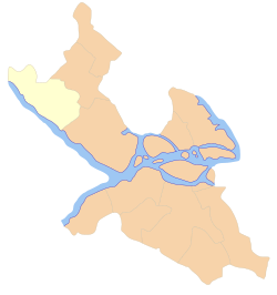 Location of Hässelby-Vällingby within Stockholm Municipality shown in yellow | |
| Coordinates: 59°21′45″N 17°52′20″E / 59.36250°N 17.87222°ECoordinates: 59°21′45″N 17°52′20″E / 59.36250°N 17.87222°E | |
| Country | Sweden |
| Municipality | Stockholm Municipality |
| Municipality subdivision | Västerort |
| Established | 2007 |
| Government | |
| • Type | Municipal assembly |
| • Municipal commissioner | Fredrik Bojerud (C) |
| Area | 19.60 km2 (7.57 sq mi) |
| Population (2014) | 71,042 |
| • Density | 3,600/km2 (9,400/sq mi) |
| Time zone | UTC+1 (CET) |
| • Summer (DST) | UTC+2 (CEST) |
| Postal code | 114 --, 162 --, 163 --, 165 -- |
| Area code | 08 |
| Website | Stockholm.se |

Hässelby-Vällingby is a borough (stadsdelsområde) in the western part of Stockholm, Sweden. It is primarily made up of Hässelby (Gård, Strand, Villastad) and Vällingby. The other districts that make up the borough are , Kälvesta, , Råcksta and . As of 2004, the population is 58,796 in an area of 19.60 km², which gives a density of 2,999.80/km².
The name is taken from Hässelby Castle (Hesselby Slott) which included large areas within the present three districts. The port of Hässelby also includes parts of Vinsta. The castle is located in the present district of Hässelby Gård but in the postcode of Vällingby. [1] [2]
References[]
- ^ "Hässelby-Vällingby stadsdelsförvaltning". Stockholms stad. Retrieved February 1, 2020.
- ^ "Hesselby Slott". hesselbyslott.se. Retrieved February 1, 2020.
External links[]
![]() Media related to Hässelby-Vällingby at Wikimedia Commons
Media related to Hässelby-Vällingby at Wikimedia Commons
| hide Boroughs of Stockholm | |||
|---|---|---|---|
| |||
This article about a location in Stockholm County, Sweden is a stub. You can help Wikipedia by . |
- Boroughs of Stockholm
- Västerort
- Stockholm County geography stubs