Skarpnäck (borough)
Skarpnäck | |
|---|---|
Borough of Stockholm | |
 Aerial view of Skarpnäck in 1980 | |
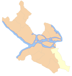 Location within Stockholm | |
| Coordinates: 59°21.45′N 17°52.20′E / 59.35750°N 17.87000°ECoordinates: 59°21.45′N 17°52.20′E / 59.35750°N 17.87000°E | |
| Country | |
| Municipality | Stockholm |
| Municipal part | Söderort |
| Established | 2007 |
| Area | |
| • Total | 15.66 km2 (6.05 sq mi) |
| Population (2014) | |
| • Total | 45,340 |
| • Density | 2,900/km2 (7,500/sq mi) |
| Website | Skarpnäck on stockholm.se |

Skarpnäck is a borough (stadsdelsområde) in the southern part of Stockholm, Sweden.[1]
Overview[]
This area corresponds mostly with the Skarpnäck parish. The districts that make up the borough are Bagarmossen, Björkhagen, Enskededalen, Flaten, Hammarbyhöjden (except the Blåsut subdistrict), Kärrtorp, Orhem, Skarpnäcks Gård, and Skrubba.[1]
The population of Skarpnäck borough is 40,707 as of December 31, 2007 on an area of 15.66 square kilometres (6.05 sq mi), which gives a density of 2,599 inhabitants per square kilometer (6,728 inh per sq mi).[2]
Sports[]
The following sports clubs are located in Skarpnäck:
References[]
- ^ a b "Administrative divisions of the City districts". Stockholms stads utrednings- och statistikkontor AB. 2008-04-14. Retrieved 2008-06-07.
- ^ "Områdesfakta Skarpnäck". Stockholms stads utrednings- och statistikkontor AB. Retrieved 2008-06-07.
External links[]
![]() Media related to Skarpnäck at Wikimedia Commons
Media related to Skarpnäck at Wikimedia Commons
Boroughs of Stockholm | |||
|---|---|---|---|
| |||
This article about a location in Stockholm County, Sweden is a stub. You can help Wikipedia by . |
Categories:
- Boroughs of Stockholm
- Stockholm County geography stubs