Hötensleben
Hötensleben | |
|---|---|
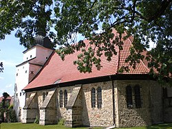 Church of Saint Bartholomew | |
 Coat of arms | |
show Location of Hötensleben within Börde district | |
 Hötensleben | |
| Coordinates: 52°07′0″N 11°1′0″E / 52.11667°N 11.01667°ECoordinates: 52°07′0″N 11°1′0″E / 52.11667°N 11.01667°E | |
| Country | Germany |
| State | Saxony-Anhalt |
| District | Börde |
| Municipal assoc. | Obere Aller |
| Government | |
| • Mayor (2015–22) | Horst Scheibel[1] |
| Area | |
| • Total | 60.75 km2 (23.46 sq mi) |
| Elevation | 99 m (325 ft) |
| Population (2020-12-31)[2] | |
| • Total | 3,549 |
| • Density | 58/km2 (150/sq mi) |
| Time zone | UTC+01:00 (CET) |
| • Summer (DST) | UTC+02:00 (CEST) |
| Postal codes | 39393 |
| Dialling codes | 039401, 039402, 039405 |
| Vehicle registration | BK |


Hötensleben is a municipality in the Börde district in Saxony-Anhalt, Germany.
History[]
The first documented evidence of Hötensleben goes back to 983 AD, when the abbey as a part of the city under the name Holeinaslofu or Hokinasluvu was mentioned. The history goes back to the 16th In this century, but the handwritten documents of the time may not be called reliable.
On 10 January 1016, there is clear documentary evidence of the town. Throughout history, the lords of the town and castle were often changed under ecclesiastical and secular rulers of the day.
Mayor[]
Horst Scheibel was elected mayor in April 2015.[3]
References[]
- ^ Bürgermeisterwahlen in den Gemeinden, Endgültige Ergebnisse, Statistisches Landesamt Sachsen-Anhalt, accessed 8 July 2021.
- ^ "Bevölkerung der Gemeinden – Stand: 31. Dezember 2020" (PDF). Statistisches Landesamt Sachsen-Anhalt (in German). June 2021.
- ^ http://www.radiosaw.de/buergermeisterwahlen-im-saw-land-0
| Wikimedia Commons has media related to Hötensleben. |
| Authority control |
|---|
This Börde location article is a stub. You can help Wikipedia by . |
Categories:
- Municipalities in Saxony-Anhalt
- Börde (district)
- Province of Saxony
- Bezirk Magdeburg
- Börde (district) geography stubs