Hüntwangen
Hüntwangen | |
|---|---|
 | |
 Coat of arms | |
show Location of Hüntwangen | |
 Hüntwangen | |
| Coordinates: 47°36′N 8°30′E / 47.600°N 8.500°ECoordinates: 47°36′N 8°30′E / 47.600°N 8.500°E | |
| Country | Switzerland |
| Canton | Zurich |
| District | Bülach |
| Area | |
| • Total | 4.91 km2 (1.90 sq mi) |
| Elevation | 390 m (1,280 ft) |
| Population (2018-12-31)[2] | |
| • Total | 1,031 |
| • Density | 210/km2 (540/sq mi) |
| Time zone | UTC+01:00 (Central European Time) |
| • Summer (DST) | UTC+02:00 (Central European Summer Time) |
| Postal code(s) | 8194 |
| SFOS number | 0061 |
| Surrounded by | Eglisau, Glattfelden, Hohentengen am Hochrhein (DE-BW), Wasterkingen, Wil |
| Website | www SFSO statistics |


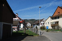
Hüntwangen is a municipality in the district of Bülach in the canton of Zürich in Switzerland.
History[]
Hüntwangen is first mentioned in 1254 as Hiuntwangin.[3]

Geography[]
Hüntwangen has an area of 4.9 km2 (1.9 sq mi). Of this area, 50.9% is used for agricultural purposes, while 32.9% is forested. Of the rest of the land, 13.6% is settled (buildings or roads) and the remainder (2.6%) is non-productive (rivers, glaciers or mountains).[4]
The municipality is located on the western edge of the Rafzerfeld, the region in the district which is north of the Rhine.
Demographics[]
Hüntwangen has a population (as of 31 December 2019) of 1,057.[5] As of 2007, 7.4% of the population was made up of foreign nationals. Over the last 10 years the population has grown at a rate of 22.9%. Most of the population (as of 2000) speaks German (96.8%), with Italian being second most common ( 0.8%) and French being third ( 0.5%).
In the 2007 election the most popular party was the SVP which received 42.8% of the vote. The next three most popular parties were the SPS (17%), the FDP (11.2%) and the Green Party (8.9%).
The age distribution of the population (as of 2000) is children and teenagers (0–19 years old) make up 24.3% of the population, while adults (20–64 years old) make up 63.2% and seniors (over 64 years old) make up 12.5%. In Hüntwangen about 85.5% of the population (between age 25-64) have completed either non-mandatory upper secondary education or additional higher education (either university or a Fachhochschule).
Hüntwangen has an unemployment rate of 1.61%. As of 2005, there were 34 people employed in the primary economic sector and about 13 businesses involved in this sector. 65 people are employed in the secondary sector and there are 8 businesses in this sector. 92 people are employed in the tertiary sector, with 26 businesses in this sector.[4]
The historical population is given in the following table:[3]
| year | population |
|---|---|
| 1640 | 175 |
| 1722 | 456 |
| 1836 | 588 |
| 1850 | 639 |
| 1900 | 538 |
| 1920 | 516 |
| 1950 | 523 |
| 2000 | 782 |
Transport[]
Hüntwangen-Wil railway station is a stop of the Zürich S-Bahn on the lines S5 and S22. It is a 33-minute ride from Zürich Hauptbahnhof.
References[]
- ^ Jump up to: a b "Arealstatistik Standard - Gemeinden nach 4 Hauptbereichen". Federal Statistical Office. Retrieved 13 January 2019.
- ^ "Ständige Wohnbevölkerung nach Staatsangehörigkeitskategorie Geschlecht und Gemeinde; Provisorische Jahresergebnisse; 2018". Federal Statistical Office. 9 April 2019. Retrieved 11 April 2019.
- ^ Jump up to: a b Hüntwangen in German, French and Italian in the online Historical Dictionary of Switzerland.
- ^ Jump up to: a b Swiss Federal Statistical Office Archived 2016-01-05 at the Wayback Machine accessed 29-Jul-2009
- ^ "Ständige und nichtständige Wohnbevölkerung nach institutionellen Gliederungen, Geburtsort und Staatsangehörigkeit". bfs.admin.ch (in German). Swiss Federal Statistical Office - STAT-TAB. 31 December 2019. Retrieved 6 October 2020.
External links[]
| Wikimedia Commons has media related to Hüntwangen. |
- Official website (in German)
- Hüntwangen in German, French and Italian in the online Historical Dictionary of Switzerland.
| show Authority control |
|---|
- Municipalities of the canton of Zürich