Haßfurt
Haßfurt | |
|---|---|
 Market square with the Church of Saint Kilian | |
 Coat of arms | |
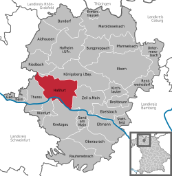
show Location of Haßfurt within Haßberge district | |
 Haßfurt | |
| Coordinates: 50°01′N 10°30′E / 50.017°N 10.500°ECoordinates: 50°01′N 10°30′E / 50.017°N 10.500°E | |
| Country | Germany |
| State | Bavaria |
| Admin. region | Unterfranken |
| District | Haßberge |
| Subdivisions | 9 Stadtteile |
| Government | |
| • Mayor (2020–26) | Günther Werner[1] |
| Area | |
| • Total | 52.77 km2 (20.37 sq mi) |
| Elevation | 220 m (720 ft) |
| Population (2020-12-31)[2] | |
| • Total | 13,593 |
| • Density | 260/km2 (670/sq mi) |
| Time zone | UTC+01:00 (CET) |
| • Summer (DST) | UTC+02:00 (CEST) |
| Postal codes | 97437 |
| Dialling codes | 09521 |
| Vehicle registration | HAS |
| Website | www.hassfurt.de |
Haßfurt (German pronunciation: [ˈhasˌfʊʁt] (![]() listen); English: Hassfurt) is a town in Bavaria, Germany, capital of the Haßberge district. It is situated on the river Main, 20 km east of Schweinfurt and 30 km northwest of Bamberg. In 1852, Ludwig's Western Railway reached the town and between 1892 and 1995, which also had a branch line to Hofheim. The 1867 Hassfurt Bridge, thought to be the first Cantilever bridge built, was also there.
listen); English: Hassfurt) is a town in Bavaria, Germany, capital of the Haßberge district. It is situated on the river Main, 20 km east of Schweinfurt and 30 km northwest of Bamberg. In 1852, Ludwig's Western Railway reached the town and between 1892 and 1995, which also had a branch line to Hofheim. The 1867 Hassfurt Bridge, thought to be the first Cantilever bridge built, was also there.
Notable residents[]
- Fritz Sauckel (1894-1946), Nazi politician, executed for war crimes
- Albert Neuberger FRS, biochemist and professor, was born here in 1908.

The main street in Hassfurt.
References[]
- ^ Liste der ersten Bürgermeister/Oberbürgermeister in kreisangehörigen Gemeinden, Bayerisches Landesamt für Statistik, 15 July 2021.
- ^ "Tabellenblatt "Daten 2", Statistischer Bericht A1200C 202041 Einwohnerzahlen der Gemeinden, Kreise und Regierungsbezirke". Bayerisches Landesamt für Statistik (in German). June 2021.
Categories:
- Towns in Bavaria
- Haßberge (district)
- Shtetls
- Lower Franconia geography stubs


