Knetzgau
Knetzgau | |
|---|---|
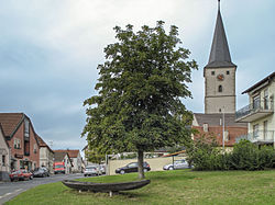 Center of the village | |
 Coat of arms | |
show Location of Knetzgau within Haßberge district | |
 Knetzgau | |
| Coordinates: 49°59′N 10°33′E / 49.983°N 10.550°ECoordinates: 49°59′N 10°33′E / 49.983°N 10.550°E | |
| Country | Germany |
| State | Bavaria |
| Admin. region | Unterfranken |
| District | Haßberge |
| Subdivisions | 8 Ortsteile |
| Government | |
| • Mayor (2020–26) | Stefan Paulus[1] |
| Area | |
| • Total | 43.98 km2 (16.98 sq mi) |
| Elevation | 238 m (781 ft) |
| Population (2020-12-31)[2] | |
| • Total | 6,470 |
| • Density | 150/km2 (380/sq mi) |
| Time zone | UTC+01:00 (CET) |
| • Summer (DST) | UTC+02:00 (CEST) |
| Postal codes | 97478 |
| Dialling codes | 09527 |
| Vehicle registration | HAS |
| Website | www.knetzgau.de |


Knetzgau is a municipality in the district of Haßberge in Bavaria in Germany. It consists of eight villages: Oberschwappach, Unterschwappach, Westheim, Hainert, Eschenau, Neuhaus, Zell am Ebersberg, Wohnau and Zeil.
References[]
- ^ Liste der ersten Bürgermeister/Oberbürgermeister in kreisangehörigen Gemeinden, Bayerisches Landesamt für Statistik, 15 July 2021.
- ^ "Tabellenblatt "Daten 2", Statistischer Bericht A1200C 202041 Einwohnerzahlen der Gemeinden, Kreise und Regierungsbezirke". Bayerisches Landesamt für Statistik (in German). June 2021.
| show Towns and municipalities in Haßberge (district) |
|---|
| show Authority control |
|---|
This Haßberge location article is a stub. You can help Wikipedia by . |
Categories:
- Municipalities in Bavaria
- Haßberge (district)
- Lower Franconia geography stubs