Hamblen Township, Brown County, Indiana
Hamblen Township | |
|---|---|
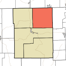 Location of Hamblen Township in Brown County | |
| Coordinates: 39°16′58″N 86°09′34″W / 39.28278°N 86.15944°WCoordinates: 39°16′58″N 86°09′34″W / 39.28278°N 86.15944°W | |
| Country | United States |
| State | Indiana |
| County | Brown |
| Government | |
| • Type | Indiana township |
| Area | |
| • Total | 64.92 sq mi (168.1 km2) |
| • Land | 63.97 sq mi (165.7 km2) |
| • Water | 0.95 sq mi (2.5 km2) |
| Elevation | 840 ft (256 m) |
| Population (2010) | |
| • Total | 4,336 |
| • Density | 67.8/sq mi (26.2/km2) |
| Time zone | UTC-5 (Eastern (EST)) |
| • Summer (DST) | UTC-4 (EDT) |
| Area code(s) | 812 & 930 |
| FIPS code | 18-30528[2] |
| GNIS feature ID | 453363 |

Hamblen Township is one of four townships in Brown County, Indiana.[3] As of the 2010 census, its population was 4,336 and it contained 2,713 housing units.[4]
History[]
Hamblen Township was named for Job Hamblen, a pioneer settler.[5]
Geography[]
According to the 2010 census, the township has a total area of 64.92 square miles (168.1 km2), of which 63.97 square miles (165.7 km2) (or 98.54%) is land and 0.95 square miles (2.5 km2) (or 1.46%) is water.[4]
Unincorporated towns[]
- Cordry Sweetwater Lakes (census-designated place)
- Gatesville
- Peoga (partial)
- Spearsville
- Sprunica, Indiana
- Taggart
(This list is based on USGS data and may include former settlements.)
Adjacent townships[]
- Jackson (west)
- Washington (southwest)
- Camp Atterbury (east)
- Hensley Township, Johnson County (north)
- Nineveh Township, Johnson County (northeast)
Cemeteries[]
The township contains six cemeteries: Anderson, Calvin, Duncan, Mount Moriah, Taylor and Zion Church.
References[]
- "Hamblen Township, Brown County, Indiana". Geographic Names Information System. United States Geological Survey. Retrieved 2009-09-24.
- United States Census Bureau cartographic boundary files
- ^ "US Board on Geographic Names". United States Geological Survey. 2007-10-25. Retrieved 2008-01-31.
- ^ "U.S. Census website". United States Census Bureau. Retrieved 2008-01-31.
- ^ "Hamblen Township, Brown County, Indiana". Geographic Names Information System. United States Geological Survey. Retrieved March 7, 2020.
- ^ Jump up to: a b "Population, Housing Units, Area, and Density: 2010 - County -- County Subdivision and Place -- 2010 Census Summary File 1". United States Census. Archived from the original on 2020-02-12. Retrieved 2013-05-10.
- ^ Blanchard, Charles (1884). Counties of Morgan, Monroe and Brown, Indiana: Historical and Biographical. F.A. Battey & Company. p. 741.
External links[]
| show Municipalities and communities of Brown County, Indiana, United States |
|---|
| show Authority control |
|---|
Categories:
- Townships in Brown County, Indiana
- Townships in Indiana