Harlan, Iowa
Harlan, Iowa | |
|---|---|
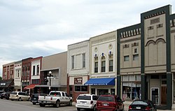 Downtown Harlan | |
 Location of Harlan, Iowa | |
| Coordinates: 41°39′17″N 95°19′19″W / 41.65472°N 95.32194°WCoordinates: 41°39′17″N 95°19′19″W / 41.65472°N 95.32194°W | |
| Country | |
| State | |
| County | Shelby |
| Area | |
| • Total | 4.39 sq mi (11.38 km2) |
| • Land | 4.39 sq mi (11.38 km2) |
| • Water | 0.00 sq mi (0.00 km2) |
| Elevation | 1,253 ft (382 m) |
| Population | |
| • Total | 4,893 |
| • Density | 1,113.6/sq mi (429.96/km2) |
| Time zone | UTC-6 (Central (CST)) |
| • Summer (DST) | UTC-5 (CDT) |
| ZIP codes | 51537, 51593 |
| Area code(s) | 712 |
| FIPS code | 19-34500 |
| GNIS feature ID | 0457259 |
| Website | City of Harlan |

Harlan is a city in Shelby County, Iowa, United States, along the West Nishnabotna River. The population was 4,893 at the time of the 2020 census.[2] It is the county seat of Shelby County.[3]
History[]
Harlan was platted in 1858.[4] It was named for one of Iowa's early U.S. Senators, James Harlan.[5] Harlan was designated county seat in 1859.[6] The town was incorporated on May 2, 1879.
Geography[]
Harlan's longitude and latitude coordinates
in decimal form are 41.654609, -95.322019.[7]
According to the United States Census Bureau, the city has a total area of 4.39 square miles (11.37 km2), all of it land.[8]
Demographics[]
| Year | Pop. | ±% |
|---|---|---|
| 1860 | 47 | — |
| 1870 | 128 | +172.3% |
| 1880 | 1,304 | +918.8% |
| 1890 | 1,765 | +35.4% |
| 1900 | 2,422 | +37.2% |
| 1910 | 2,570 | +6.1% |
| 1920 | 2,831 | +10.2% |
| 1930 | 3,145 | +11.1% |
| 1940 | 3,727 | +18.5% |
| 1950 | 3,915 | +5.0% |
| 1960 | 4,350 | +11.1% |
| 1970 | 5,049 | +16.1% |
| 1980 | 5,357 | +6.1% |
| 1990 | 5,148 | −3.9% |
| 2000 | 5,282 | +2.6% |
| 2010 | 5,106 | −3.3% |
| 2020 | 4,893 | −4.2% |
| Source:"U.S. Census website". United States Census Bureau. Retrieved 2020-03-29. and Iowa Data Center Source: | ||
2010 census[]
At the 2010 census there were 5,106 people, 2,222 households, and 1,341 families living in the city. The population density was 1,163.1 inhabitants per square mile (449.1/km2). There were 2,410 housing units at an average density of 549.0 per square mile (212.0/km2). The racial makup of the city was 97.0% White, 0.5% African American, 0.4% Native American, 0.6% Asian, 0.6% from other races, and 0.9% from two or more races. Hispanic or Latino of any race were 1.9%.[10]
Of the 2,222 households 26.7% had children under the age of 18 living with them, 47.8% were married couples living together, 9.7% had a female householder with no husband present, 2.8% had a male householder with no wife present, and 39.6% were non-families. 34.2% of households were one person and 17.7% were one person aged 65 or older. The average household size was 2.26 and the average family size was 2.88.
The median age was 43.8 years. 23.8% of residents were under the age of 18; 6.1% were between the ages of 18 and 24; 21.4% were from 25 to 44; 27% were from 45 to 64; and 21.8% were 65 or older. The gender makeup of the city was 46.4% male and 53.6% female.
2000 census[]
At the 2000 census there were 5,282 people, 2,204 households, and 1,498 families living in the city. The population density was 1,209.8 people per square mile (466.7/km2). There were 2,306 housing units at an average density of 528.2 per square mile (203.7/km2). The racial makup of the city was 98.30% White, 0.08% African American, 0.30% Native American, 0.47% Asian, 0.17% from other races, and 0.68% from two or more races. Hispanic or Latino of any race were 0.62%.[11]
Of the 2,204 households 31.1% included children under the age of 18; 56.6% were married couples living together, 8.9% consisted of a female householder with no husband present, and 32.0% were non-families. 28.9% of households were one person and 16.3% were one person aged 65 or older. The average household size was 2.35, and the average family size was 2.88.
25.1% are under the age of 18, 6.1% from 18 to 24, 24.2% from 25 to 44, 22.4% from 45 to 64, and 22.3% 65 or older. The median age was 41 years. For every 100 females, there were 90.9 males. For every 100 females age 18 and over, there were 85.4 males.
The median household income was $35,899 and the median family income was $45,888. Males had a median income of $31,365 versus $19,671 for females. The per capita income for the city was $17,514. About 5.3% of families and 7.0% of the population were below the poverty line, including 7.3% of those under age 18 and 9.4% of those age 65 or over.
Economy[]
A major Harlan employer is CDS Global, the Des Moines-based fulfillment house owned by the Hearst media conglomerate. Since this company provides subscription services for hundreds of periodicals, it is common to see a Harlan P.O. box as a magazine's customer service address.[12]
Education[]
The Harlan Community School District operates local public schools.[13] It also serves residents of Jacksonville, Corley, Defiance, Panama, Portsmouth, Earling, and Westphalia.
This section needs expansion. You can help by . (July 2020) |
Notable people[]
- Mary Lincoln Beckwith, great-grandchild of Abraham Lincoln
- Howard Webster Byers, Iowa Attorney General
- Billy Cundiff, NFL kicker, Washington Football Team
- Zach Daeges, baseball player
- George Sabin Gibbs, United States Army General
- Albert Hansen, college football coach
- Kij Johnson, author
- Jerry L. Larson, Iowa Supreme Court justice
- Susan Christensen, Iowa Supreme Court Chief Justice
- Tiny Lund (1929–1975) NASCAR driver and 1963 winner of the Daytona 500[14]
- Raymond Eugene Plummer, lawyer and judge
- Lynn Reynolds, film director
See also[]
Building on the National Register of Historic Places
References[]
- ^ "2019 U.S. Gazetteer Files". United States Census Bureau. Retrieved July 17, 2020.
- ^ Jump up to: a b c "2020 Census State Redistricting Data". census.gov. United states Census Bureau. Retrieved 12 August 2021.
- ^ "Find a County". National Association of Counties. Retrieved 2011-06-07.
- ^ White, Edward Speer (1915). Past and Present of Shelby County, Iowa, Volume 1. B.F. Bowen. p. 226.
- ^ Gannett, Henry (1905). The Origin of Certain Place Names in the United States. Govt. Print. Off. pp. 149.
- ^ Chicago and North Western Railway Company (1908). A History of the Origin of the Place Names Connected with the Chicago & North Western and Chicago, St. Paul, Minneapolis & Omaha Railways. p. 81.
- ^ "US Gazetteer files: 2010, 2000, and 1990". United States Census Bureau. 2011-02-12. Retrieved 2011-04-23.
- ^ "US Gazetteer files 2010". United States Census Bureau. Archived from the original on 2012-07-02. Retrieved 2012-05-11.
- ^ "Census of Population and Housing". Census.gov. Retrieved June 4, 2015.
- ^ "U.S. Census website". United States Census Bureau. Retrieved 2012-05-11.
- ^ "U.S. Census website". United States Census Bureau. Retrieved 2008-01-31.
- ^ "Good Housekeeping Subscription Services". Better Business Bureau. Retrieved 2020-11-05.
- ^ "FY20_HARLAN" (PDF). Iowa Department of Education. Retrieved 2020-07-31.
- ^ "Tiny Lund". International Motorsports Hall of Fame. Archived from the original on 2011-09-27. Retrieved 2011-01-15.
External links[]
| Wikimedia Commons has media related to Harlan, Iowa. |
- Harlan official website
- City-Data Comprehensive Statistical Data and more about Harlan
| show Municipalities and communities of Shelby County, Iowa, United States |
|---|
| show Authority control |
|---|
- Harlan, Iowa
- Cities in Iowa
- Cities in Shelby County, Iowa
- County seats in Iowa