Harrison, Montana
Harrison, Montana | |
|---|---|
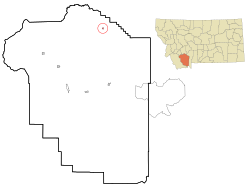 Location of Harrison, Montana | |
| Coordinates: 45°42′9″N 111°47′7″W / 45.70250°N 111.78528°WCoordinates: 45°42′9″N 111°47′7″W / 45.70250°N 111.78528°W | |
| Country | United States |
| State | Montana |
| County | Madison |
| Area | |
| • Total | 0.2 sq mi (0.6 km2) |
| • Land | 0.2 sq mi (0.6 km2) |
| • Water | 0.0 sq mi (0.0 km2) |
| Elevation | 4,918 ft (1,499 m) |
| Population (2010) | |
| • Total | 137 |
| • Density | 614/sq mi (237.2/km2) |
| Time zone | UTC-7 (Mountain (MST)) |
| • Summer (DST) | UTC-6 (MDT) |
| ZIP code | 59735 |
| Area code(s) | 406 |
| FIPS code | 30-34525 |
| GNIS feature ID | 0784573 |

Harrison is an unincorporated community and census-designated place (CDP) in Madison County, Montana, United States. The population was 137 at the 2010 census,[1] down from 162 in 2000.
The town began as Ferguson, a stage stop on the road to Virginia City. The Northern Pacific Railroad constructed a branch line in 1889. Eventually the town was called Harrison after an early settler, Henry C. Harrison.[2]
Geography[]
Harrison is located at 45°42′9″N 111°47′7″W / 45.70250°N 111.78528°W (45.702507, -111.785376).[3] U.S. Route 287 passes through town. is to the east.
According to the United States Census Bureau, the CDP has a total area of 0.2 square miles (0.52 km2), all land.
Demographics[]
As of the census of 2000, there were 162 people, 64 households, and 44 families residing in the CDP. The population density was 704.9 people per square mile (272.0/km2). There were 75 housing units at an average density of 326.3 per square mile (125.9/km2). The racial makeup of the CDP was 96.91% White, 1.85% Native American, 0.62% Asian, and 0.62% from two or more races. Hispanic or Latino of any race were 1.23% of the population.[4]
There were 64 households, out of which 39.1% had children under the age of 18 living with them, 56.3% were married couples living together, 9.4% had a female householder with no husband present, and 29.7% were non-families. 25.0% of all households were made up of individuals, and 17.2% had someone living alone who was 65 years of age or older. The average household size was 2.53 and the average family size was 3.07.
In the CDP, the population was spread out, with 32.7% under the age of 18, 3.7% from 18 to 24, 24.7% from 25 to 44, 21.0% from 45 to 64, and 17.9% who were 65 years of age or older. The median age was 38 years. For every 100 females, there were 107.7 males. For every 100 females age 18 and over, there were 87.9 males.
The median income for a household in the CDP was $36,875, and the median income for a family was $39,167. Males had a median income of $28,750 versus $16,250 for females. The per capita income for the CDP was $13,287. About 5.3% of families and 13.8% of the population were below the poverty line, including 22.7% of those under the age of eighteen and 14.8% of those 65 or over.
The median age for residents in Harrison is 44.7
18.1% of Harrison's residents live in poverty.
Education[]
Harrison Public School educates students from kindergarten through 12th grade.[5] 's team name is the Wildcats.[6]
References[]
- ^ "Geographic Identifiers: 2010 Census Summary File 1 (G001): Harrison CDP, Montana". American Factfinder. U.S. Census Bureau. Archived from the original on February 13, 2020. Retrieved March 14, 2018.
- ^ "Harrison". Montana Place Names Companion. Montana Historical Society. Retrieved 5 April 2021.
- ^ "US Gazetteer files: 2010, 2000, and 1990". United States Census Bureau. 2011-02-12. Retrieved 2011-04-23.
- ^ "Profile of General Population and Housing Characteristics: 2010 Census Summary File 1 (G001): Harrison CDP, Montana". American Factfinder. U.S. Census Bureau. Archived from the original on February 13, 2020. Retrieved March 14, 2018.
- ^ "Harrison Public School". Harrison Public School. Retrieved 20 April 2021.
- ^ "Member Schools". Montana High School Association. Retrieved 19 April 2021.
Municipalities and communities of Madison County, Montana, United States | ||
|---|---|---|
| Towns |  | |
| CDPs | ||
| Other communities | ||
| Ghost towns | ||
| Footnotes | ‡This populated place also has portions in an adjacent county or counties | |
| ||
- Census-designated places in Madison County, Montana
- Census-designated places in Montana