Harrison Township, Blackford County, Indiana
Harrison Township | |
|---|---|
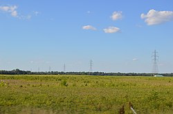 Along State Road 18 west of Montpelier | |
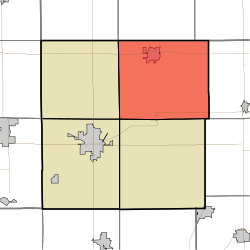 Location of Harrison Township in Blackford County | |
| Coordinates: 40°31′49″N 85°16′07″W / 40.53028°N 85.26861°WCoordinates: 40°31′49″N 85°16′07″W / 40.53028°N 85.26861°W | |
| Country | United States |
| State | Indiana |
| County | Blackford |
| Government | |
| • Type | Indiana township |
| Area | |
| • Total | 42.23 sq mi (109.4 km2) |
| • Land | 42.13 sq mi (109.1 km2) |
| • Water | 0.1 sq mi (0.3 km2) |
| Elevation | 879 ft (268 m) |
| Population (2010) | |
| • Total | 2,640 |
| • Density | 62.7/sq mi (24.2/km2) |
| FIPS code | 18-31630[2] |
| GNIS feature ID | 453378 |

Harrison Township is one of four townships in Blackford County, Indiana. As of the 2010 census, its population was 2,640 and it contained 1,196 housing units.[3] The township was named after William Henry Harrison, hero of the Battle of Tippecanoe, former governor of the Indiana Territory, and ninth President of the United States.[4]
Geography[]
According to the 2010 census, the township has a total area of 42.23 square miles (109.4 km2), of which 42.13 square miles (109.1 km2) (or 99.76%) is land and 0.1 square miles (0.26 km2) (or 0.24%) is water.[3] Lake Blue Water and the Godfrey Reserve are in this township. The Salamonie River runs through the township's northeast corner.

Cities and towns[]
Unincorporated towns[]
Major highways[]
Cemeteries[]
The township contains at least eight cemeteries: Brookside, Independent Order of Odd Fellows, North Twibell, Penrod, Pleasantdale, South Twibell, St Margaret's Roman Catholic, and Woodlawn.
Notes[]
- ^ "US Board on Geographic Names". United States Geological Survey. 2007-10-25. Retrieved 2008-01-31.
- ^ "U.S. Census website". United States Census Bureau. Retrieved 2008-01-31.
- ^ a b "Population, Housing Units, Area, and Density: 2010 - County -- County Subdivision and Place -- 2010 Census Summary File 1". United States Census. Archived from the original on 2020-02-12. Retrieved 2013-05-10.
- ^ See “A History of Blackford County, Indiana…”, page 112.
References[]
- "Harrison Township, Blackford County, Indiana". Geographic Names Information System. United States Geological Survey. Retrieved 2009-09-24.
- A History of Blackford County, Indiana : with historical accounts of the county, 1838-1986 [and] histories of families who have lived in the county. Hartford City, Indiana: Blackford County Historical Society. 1986. p. 302. OCLC 15144953.
- Biographical and historical record of Jay and Blackford Counties, Indiana: Containing ... portraits and biographies of some of the prominent men of the state : engravings of prominent citizens in Jay and Blackford Counties, with personal histories of many of the leading families and a concise history of Jay and Blackford Counties and their cities and villages. Chicago: The Lewis Publishing Company. 1887. p. 901. OCLC 15560416. Archived from the original on 2011-08-07.
- U.S. Board on Geographic Names
- United States Census Bureau cartographic boundary files
External links[]
| Wikimedia Commons has media related to Harrison Township, Blackford County, Indiana. |
Places adjacent to Harrison Township, Blackford County, Indiana | |
|---|---|
Municipalities and communities of Blackford County, Indiana, United States | ||
|---|---|---|
| Cities | ||
| Town | ||
| Townships | ||
| Unincorporated communities | ||
| Ghost town | ||
| Footnotes | ‡This populated place also has portions in an adjacent county or counties | |
| ||
- Townships in Blackford County, Indiana